 |
|
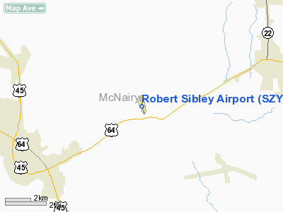
Location & QuickFacts
| FAA Information Effective: | 2008-09-25 |
| Airport Identifier: | SZY |
| Airport Status: | Operational |
| Longitude/Latitude: | 088-29-54.1000W/35-12-10.6000N
-88.498361/35.202944 (Estimated) |
| Elevation: | 610 ft / 185.93 m (Surveyed) |
| Land: | 140 acres |
| From nearest city: | 5 nautical miles NE of Selmer, TN |
| Location: | Mc Nairy County, TN |
| Magnetic Variation: | 01E (1990) |
Owner & Manager
| Ownership: | Publicly owned |
| Owner: | Mc Nairy County |
| Address: | Cty Courthouse; Court Ave
Selmer, TN 38375 |
| Phone number: | 731-645-3472 |
| Manager: | Steve Smith |
| Address: | Route 1, Box 310
Selmer, TN 38375 |
| Phone number: | 731-645-3014 |
Airport Operations and Facilities
| Airport Use: | Open to public |
| Wind indicator: | Yes |
| Segmented Circle: | No |
| Control Tower: | No |
| Lighting Schedule: | DUSK-DAWN
ACTVT MIRL RY 17/35 - CTAF. |
| Beacon Color: | Clear-Green (lighted land airport) |
| Landing fee charge: | No |
| Sectional chart: | Memphis |
| Region: | ASO - Southern |
| Boundary ARTCC: | ZME - Memphis |
| Tie-in FSS: | MKL - Jackson |
| FSS on Airport: | No |
| FSS Toll Free: | 1-800-WX-BRIEF |
| NOTAMs Facility: | MKL (NOTAM-d service avaliable) |
| Federal Agreements: | NGY |
Airport Communications
| CTAF: | 122.700 |
| Unicom: | 122.700 |
Airport Services
| Fuel available: | 100LLA MOGAS |
| Airframe Repair: | MAJOR |
| Power Plant Repair: | MAJOR |
| Bottled Oxygen: | NONE |
| Bulk Oxygen: | NONE |
Runway Information
Runway 17/35
| Dimension: | 5002 x 75 ft / 1524.6 x 22.9 m |
| Surface: | ASPH, Good Condition |
| Weight Limit: | Single wheel: 17000 lbs.
Dual wheel: 23000 lbs. |
| Edge Lights: | Medium |
| |
Runway 17 |
Runway 35 |
| Longitude: | 088-30-01.5944W | 088-29-46.5965W |
| Latitude: | 35-12-34.5797N | 35-11-46.6593N |
| Elevation: | 602.00 ft | 610.00 ft |
| Alignment: | 127 | 127 |
| Traffic Pattern: | Left | Left |
| Markings: | Non-precision instrument, Good Condition | Non-precision instrument, Good Condition |
| Crossing Height: | 20.00 ft | 0.00 ft |
| VASI: | 4-light PAPI on left side | 4-light PAPI on left side |
| Visual Glide Angle: | 3.00° | 0.00° |
| Runway End Identifier: | | Yes |
| Obstruction: | 36 ft trees, 899.0 ft from runway, 245 ft left of centerline, 19:1 slope to clear | 49 ft trees, 963.0 ft from runway, 118 ft left of centerline, 15:1 slope to clear |
|
Radio Navigation Aids
| ID |
Type |
Name |
Ch |
Freq |
Var |
Dist |
| SZY | NDB | Sibley | | 386.00 | 01E | 2.2 nm |
| HHY | NDB | Pinhook | | 346.00 | 01W | 14.8 nm |
| BAV | NDB | Hardeman | | 404.00 | 01E | 26.7 nm |
| FYE | NDB | Somerville | | 255.00 | 00E | 43.9 nm |
| JHG | NDB | Hohenwald | | 257.00 | 01W | 45.3 nm |
| TGC | NDB | Gibson | | 378.00 | 01E | 47.2 nm |
| JKS | VOR/DME | Jacks Creek | 031X | 109.40 | 02E | 24.8 nm |
| MKL | VOR/DME | Mc Kellar | 057X | 112.00 | 02E | 31.4 nm |
Remarks
- RY 17 TRANSITIONAL SFC VIOLATED EAST SIDE BY TREES WITHIN 200 FT OF CNTRLN.
Images and information placed above are from
http://www.airport-data.com/airport/SZY/
We thank them for the data!
| General Info
|
| Country |
United States
|
| State |
TENNESSEE
|
| FAA ID |
SZY
|
| Latitude |
35-12-10.620N
|
| Longitude |
088-29-54.101W
|
| Elevation |
610 feet
|
| Near City |
SELMER
|
We don't guarantee the information is fresh and accurate. The data may
be wrong or outdated.
For more up-to-date information please refer to other sources.
|
|


