 |
|
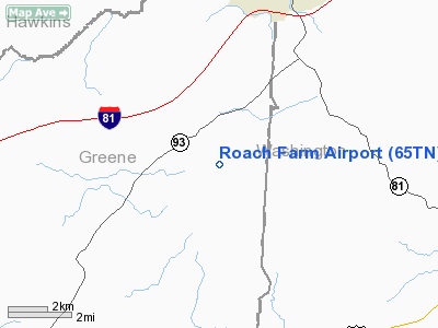
Location & QuickFacts
| FAA Information Effective: | 2008-09-25 |
| Airport Identifier: | 65TN |
| Airport Status: | Operational |
| Longitude/Latitude: | 082-39-42.0000W/36-20-03.0000N
-82.661667/36.334167 (Estimated) |
| Elevation: | 1750 ft / 533.40 m (Estimated) |
| Land: | 10 acres |
| From nearest city: | 5 nautical miles SW of Fall Branch, TN |
| Location: | Greene County, TN |
| Magnetic Variation: | () |
Owner & Manager
| Ownership: | Privately owned |
| Owner: | Roger Roach |
| Address: | 6530 Old Snapps Ferry Road
Limestone, TN 37681 |
| Phone number: | 423-348-7297 |
| Manager: | Roger Roach |
| Address: | 6530 Old Snapps Ferry Road
Limestone, TN 37681 |
| Phone number: | 423-348-7297 |
Airport Operations and Facilities
| Airport Use: | Private |
| Wind indicator: | Yes |
| Segmented Circle: | No |
| Control Tower: | No |
| Sectional chart: | Cincinnati |
| Region: | ASO - Southern |
| Boundary ARTCC: | ZTL - Atlanta |
| Tie-in FSS: | BNA - Nashville |
| FSS Toll Free: | 1-800-WX-BRIEF |
Runway Information
Runway 05/23
| Dimension: | 2200 x 60 ft / 670.6 x 18.3 m |
| Surface: | TURF, |
| |
Runway 05 |
Runway 23 |
| Traffic Pattern: | Left | Left |
|
Radio Navigation Aids
| ID |
Type |
Name |
Ch |
Freq |
Var |
Dist |
| BO | NDB | Booie | | 221.00 | 04W | 8.9 nm |
| RVN | NDB | Rogersville | | 329.00 | 04W | 13.0 nm |
| DYQ | NDB | Dulaney | | 263.00 | 04W | 16.3 nm |
| EZT | NDB | Elizabethton | | 275.00 | 02W | 19.0 nm |
| LQV | NDB | Long Hollow | | 252.00 | 03W | 30.0 nm |
| BAR | NDB | Hemlock | | 320.00 | 02W | 39.4 nm |
| JJO | NDB | Mountain City | | 396.00 | 04W | 40.8 nm |
| JXT | NDB | Jefferson | | 346.00 | 04W | 41.7 nm |
| VJ | NDB | Whine | | 236.00 | 05W | 42.0 nm |
| GZG | VOR/DME | Glade Spring | 039X | 110.20 | 02W | 40.8 nm |
| HMV | VORTAC | Holston Mountain | 093X | 114.60 | 04W | 26.5 nm |
| SOT | VORTAC | Snowbird | 025X | 108.80 | 04W | 37.8 nm |
Remarks
Images and information placed above are from
http://www.airport-data.com/airport/65TN/
We thank them for the data!
|
|


