 |
|
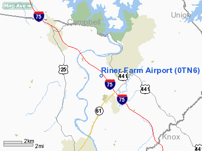
Location & QuickFacts
| FAA Information Effective: | 2008-09-25 |
| Airport Identifier: | 0TN6 |
| Airport Status: | Operational |
| Longitude/Latitude: | 084-05-56.7100W/36-11-00.2830N
-84.099086/36.183412 (Estimated) |
| Elevation: | 1125 ft / 342.90 m (Estimated) |
| Land: | 49 acres |
| From nearest city: | 1 nautical miles SW of Norris, TN |
| Location: | Anderson County, TN |
| Magnetic Variation: | 03W (1985) |
Owner & Manager
| Ownership: | Privately owned |
| Owner: | Gary Riner |
| Address: | Riner Farm, 181 Thurman Lane
Clinton, TN 37716 |
| Phone number: | 865-494-9341 |
| Address: |
|
Airport Operations and Facilities
| Airport Use: | Private |
| Wind indicator: | Yes |
| Segmented Circle: | No |
| Control Tower: | No |
| Sectional chart: | Cincinnati |
| Region: | ASO - Southern |
| Boundary ARTCC: | ZTL - Atlanta |
| Tie-in FSS: | BNA - Nashville |
| FSS on Airport: | No |
| FSS Toll Free: | 1-800-WX-BRIEF |
Runway Information
Runway 08/26
| Dimension: | 1050 x 75 ft / 320.0 x 22.9 m |
| Surface: | TURF, |
| |
Runway 08 |
Runway 26 |
| Traffic Pattern: | Left | Left |
|
Radio Navigation Aids
| ID |
Type |
Name |
Ch |
Freq |
Var |
Dist |
| JAU | NDB | Jacksboro | | 204.00 | 03W | 9.8 nm |
| BPO | NDB | Piney Grove | | 403.00 | 05W | 28.1 nm |
| JXT | NDB | Jefferson | | 346.00 | 04W | 30.6 nm |
| MNV | NDB | Madisonville | | 361.00 | 04W | 40.8 nm |
| VXV | VORTAC | Volunteer | 111X | 116.40 | 03W | 19.5 nm |
| HCH | VORTAC | Hinch Mountain | 123X | 117.60 | 02W | 49.1 nm |
| TYS | VOT | Knoxville | | 112.00 | | 22.9 nm |
Remarks
Images and information placed above are from
http://www.airport-data.com/airport/0TN6/
We thank them for the data!
| General Info
|
| Country |
United States
|
| State |
TENNESSEE
|
| FAA ID |
0TN6
|
| Latitude |
36-11-00.283N
|
| Longitude |
084-05-56.710W
|
| Elevation |
1125 feet
|
| Near City |
NORRIS
|
We don't guarantee the information is fresh and accurate. The data may
be wrong or outdated.
For more up-to-date information please refer to other sources.
|
|


