 |
|
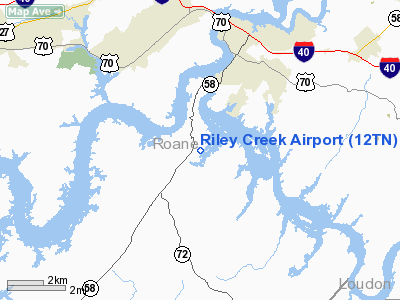
Location & QuickFacts
| FAA Information Effective: | 2008-09-25 |
| Airport Identifier: | 12TN |
| Airport Status: | Operational |
| Longitude/Latitude: | 084-32-19.7620W/35-49-25.2670N
-84.538823/35.823685 (Estimated) |
| Elevation: | 750 ft / 228.60 m (Estimated) |
| Land: | 27 acres |
| From nearest city: | 3 nautical miles SW of Kingston, TN |
| Location: | Roane County, TN |
| Magnetic Variation: | 02W (1985) |
Owner & Manager
| Ownership: | Privately owned |
| Owner: | Walter & Donna Howard |
| Address: | 159 Anglers Cove Road
Kingston, TN 37763 |
| Phone number: | 865-717-3981 |
| Manager: | Walter Howard |
| Address: | 157 Anglers Cove Road
Kingston, TN 37763 |
| Phone number: | 865-717-3981 |
Airport Operations and Facilities
| Airport Use: | Private |
| Wind indicator: | Yes |
| Segmented Circle: | No |
| Control Tower: | No |
| Lighting Schedule: | DUSK-DAWN |
| Landing fee charge: | No |
| Sectional chart: | Atlanta |
| Region: | ASO - Southern |
| Boundary ARTCC: | ZTL - Atlanta |
| Tie-in FSS: | BNA - Nashville |
| FSS on Airport: | No |
| FSS Toll Free: | 1-800-WX-BRIEF |
| NOTAMs Facility: | BNA (NOTAM-d service avaliable) |
Airport Services
| Fuel available: | 100LL |
| Airframe Repair: | MINOR |
| Power Plant Repair: | MINOR |
Runway Information
Runway 05/23
| Dimension: | 2600 x 40 ft / 792.5 x 12.2 m |
| Surface: | ASPH, Good Condition |
| Edge Lights: | Non-standard lighting system
NSTD LIRL DUE TO SPACING. |
| |
Runway 05 |
Runway 23 |
| Traffic Pattern: | Left | Left |
| Markings: | Basic, Fair Condition | Basic, Fair Condition |
| Displaced threshold: | 490.00 ft | 0.00 ft |
| Obstruction: | 68 ft trees, 1002.0 ft from runway, 62 ft left of centerline, 11:1 slope to clear
RY 05 APCH RATIO 21:1 TO DSPLCD THLD. | 45 ft trees, 414.0 ft from runway, 88 ft left of centerline, 4:1 slope to clear |
|
Radio Navigation Aids
| ID |
Type |
Name |
Ch |
Freq |
Var |
Dist |
| MNV | NDB | Madisonville | | 361.00 | 04W | 18.4 nm |
| MMI | NDB | Mc Minn County | | 242.00 | 03W | 25.8 nm |
| DTE | NDB | Mark Anton | | 394.00 | 02W | 28.1 nm |
| JAU | NDB | Jacksboro | | 204.00 | 03W | 35.9 nm |
| BPO | NDB | Piney Grove | | 403.00 | 05W | 43.1 nm |
| HDI | NDB | Hardwick | | 369.00 | 01W | 44.1 nm |
| CQN | NDB | Daisy | | 341.00 | 02W | 49.8 nm |
| HCH | VORTAC | Hinch Mountain | 123X | 117.60 | 02W | 21.6 nm |
| VXV | VORTAC | Volunteer | 111X | 116.40 | 03W | 31.8 nm |
| TYS | VOT | Knoxville | | 112.00 | | 26.6 nm |
Remarks
- TREES & BLDGS IN PRIMARY SFC ON WEST SIDE OF RY.
- HIGH TERRAIN EAST & WEST OF ARPT.
- ARPT CLSD TO FLT TRNG, GLIDERS & AEROBATIC ACTVTY.
- ARPT CLSD TO TRANSIENT ACFT 1700-0800 EXCEPT WITH PPR 865-717-3981.
- VFR ONLY.
Images and information placed above are from
http://www.airport-data.com/airport/12TN/
We thank them for the data!
| General Info
|
| Country |
United States
|
| State |
TENNESSEE
|
| FAA ID |
12TN
|
| Latitude |
35-49-25.267N
|
| Longitude |
084-32-19.762W
|
| Elevation |
750 feet
|
| Near City |
KINGSTON
|
We don't guarantee the information is fresh and accurate. The data may
be wrong or outdated.
For more up-to-date information please refer to other sources.
|
|


