 |
|
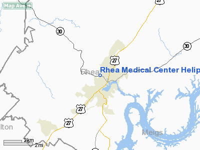
Rhea Medical Center Heliport |
Location & QuickFacts
| FAA Information Effective: | 2008-09-25 |
| Airport Identifier: | TN75 |
| Airport Status: | Operational |
| Longitude/Latitude: | 085-00-59.8330W/35-30-00.2510N
-85.016620/35.500070 (Estimated) |
| Elevation: | 698 ft / 212.75 m (Estimated) |
| Land: | 0 acres |
| From nearest city: | 0 nautical miles N of Dayton, TN |
| Location: | Rhea County, TN |
| Magnetic Variation: | 02W (1990) |
Owner & Manager
| Ownership: | Publicly owned |
| Owner: | Rhea County |
| Address: | 7900 Rhea County Hwy
Dayton, TN 37321 |
| Phone number: | 615-775-8585 |
| Manager: | Ken Croom
ADMINISTRATOR. |
| Address: | 7900 Rhea County Hwy
Dayton, TN 37321 |
| Phone number: | 615-775-1121 |
Airport Operations and Facilities
| Airport Use: | Private
MEDICAL USE. |
| Wind indicator: | Yes |
| Segmented Circle: | No |
| Control Tower: | No |
| Lighting Schedule: | PHONE REQ
FOR PERIMETER LGTS CALL 615-775-1121. |
| Sectional chart: | Atlanta |
| Region: | ASO - Southern |
| Boundary ARTCC: | ZTL - Atlanta |
| Tie-in FSS: | BNA - Nashville |
| FSS on Airport: | No |
| FSS Toll Free: | 1-800-WX-BRIEF |
Runway Information
Helipad H1
| Dimension: | 30 x 30 ft / 9.1 x 9.1 m |
| Surface: | CONC, |
| |
Runway H1 |
Runway |
| Traffic Pattern: | Left | Left |
|
Radio Navigation Aids
| ID |
Type |
Name |
Ch |
Freq |
Var |
Dist |
| DTE | NDB | Mark Anton | | 394.00 | 02W | 4.3 nm |
| CQN | NDB | Daisy | | 341.00 | 02W | 21.2 nm |
| HDI | NDB | Hardwick | | 369.00 | 01W | 21.5 nm |
| MMI | NDB | Mc Minn County | | 242.00 | 03W | 23.2 nm |
| MNV | NDB | Madisonville | | 361.00 | 04W | 31.1 nm |
| APT | NDB | Jasper | | 382.00 | 02W | 38.4 nm |
| RN | NDB | Warri | | 209.00 | 02W | 39.5 nm |
| HEM | NDB | Huchn | | 233.00 | 02W | 40.4 nm |
| UWI | NDB | Whitfield | | 400.00 | 03W | 42.9 nm |
| UOS | NDB | Sewanee | | 275.00 | 02E | 46.6 nm |
| SKN | NDB | Hurricane | | 256.00 | 02W | 48.3 nm |
| HCH | VORTAC | Hinch Mountain | 123X | 117.60 | 02W | 17.0 nm |
| GQO | VORTAC | Choo Choo | 105X | 115.80 | 01E | 33.1 nm |
Remarks
- (E111-1) OUTBOUND WILL BE 320 DEG & 200 DEG; TKOF/LNDG AREA MKD, WIND INDICATOR MAINTAINED, PLINES E OF HWY RTE 27 & N OF WALNUT GROVE RD MKD.
- PRVDD OPNS CONDUCTED IN VFR WX, LMTD TO PVT USE, TREES & LGT FIXTURES REMOVED UNDER APCH/DEP CRS TO EST 8:1 RATIO; MOST SUITABLE CRS WERE DETERMINED TO BE 020 DEG INBOUND FM THE S & 140 DEG INBOUND FM THE NW;
Images and information placed above are from
http://www.airport-data.com/airport/TN75/
We thank them for the data!
| General Info
|
| Country |
United States
|
| State |
TENNESSEE
|
| FAA ID |
TN75
|
| Latitude |
35-30-00.251N
|
| Longitude |
085-00-59.833W
|
| Elevation |
698 feet
|
| Near City |
DAYTON
|
We don't guarantee the information is fresh and accurate. The data may
be wrong or outdated.
For more up-to-date information please refer to other sources.
|
|


