 |
|
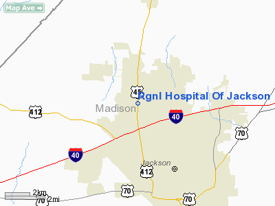
Rgnl Hospital Of Jackson Heliport |
Location & QuickFacts
| FAA Information Effective: | 2008-09-25 |
| Airport Identifier: | 4TN8 |
| Airport Status: | Operational |
| Longitude/Latitude: | 088-51-18.2140W/35-40-56.2560N
-88.855059/35.682293 (Estimated) |
| Elevation: | 444 ft / 135.33 m (Estimated) |
| Land: | 0 acres |
| From nearest city: | 0 nautical miles N of Jackson, TN |
| Location: | Madison County, TN |
| Magnetic Variation: | 01E (1990) |
Owner & Manager
| Ownership: | Privately owned |
| Owner: | Jackson Tenn Hospital Co Llc |
| Address: | 367 Hospital Blvd.
Jackson, TN 38305 |
| Phone number: | 731-661-2185 |
| Manager: | Aaron Sanders
FACILITY DIRECTOR |
| Address: | 367 Hospital Blvd.
Jackson, TN 38305 |
| Phone number: | 731-661-2051 |
Airport Operations and Facilities
| Airport Use: | Private
MEDICAL USE. |
| Wind indicator: | Yes |
| Segmented Circle: | No |
| Control Tower: | No |
| Lighting Schedule: | PHONE REQ
FOR PERIMETER LGTS CALL 901-661-2186. |
| Sectional chart: | Memphis |
| Region: | ASO - Southern |
| Boundary ARTCC: | ZME - Memphis |
| Tie-in FSS: | MKL - Jackson |
| FSS Toll Free: | 1-800-WX-BRIEF |
Runway Information
Helipad H1
| Dimension: | 60 x 60 ft / 18.3 x 18.3 m |
| Surface: | CONC, |
| |
Runway H1 |
Runway |
| Traffic Pattern: | Left | Left |
|
Radio Navigation Aids
| ID |
Type |
Name |
Ch |
Freq |
Var |
Dist |
| TGC | NDB | Gibson | | 378.00 | 01E | 15.1 nm |
| BAV | NDB | Hardeman | | 404.00 | 01E | 29.6 nm |
| HZD | NDB | Huntingdon | | 217.00 | 00E | 30.9 nm |
| SZY | NDB | Sibley | | 386.00 | 01E | 31.5 nm |
| DNT | NDB | Nally Dunston | | 343.00 | 01W | 32.8 nm |
| COO | NDB | Covington | | 326.00 | 02E | 36.2 nm |
| UC | NDB | Obion | | 212.00 | 00E | 37.6 nm |
| FYE | NDB | Somerville | | 255.00 | 00E | 38.9 nm |
| TIQ | NDB | Trainer | | 410.00 | 00E | 40.3 nm |
| HHY | NDB | Pinhook | | 346.00 | 01W | 41.0 nm |
| MKL | VOR/DME | Mc Kellar | 057X | 112.00 | 02E | 5.5 nm |
| JKS | VOR/DME | Jacks Creek | 031X | 109.40 | 02E | 24.7 nm |
| DYR | VORTAC | Dyersburg | 115X | 116.80 | 03E | 30.3 nm |
Remarks
- PRVDD VFR; PVT USE; TKOF/LDG AREA MARKED; WIND INDICATOR IS MAINTAINED; & APCH/DEP RTE OPS FM 135 DEG TO 150 DEG & FM 250 DEG TO 270 DEG.
Images and information placed above are from
http://www.airport-data.com/airport/4TN8/
We thank them for the data!
| General Info
|
| Country |
United States
|
| State |
TENNESSEE
|
| FAA ID |
4TN8
|
| Latitude |
35-40-56.256N
|
| Longitude |
088-51-18.214W
|
| Elevation |
444 feet
|
| Near City |
JACKSON
|
We don't guarantee the information is fresh and accurate. The data may
be wrong or outdated.
For more up-to-date information please refer to other sources.
|
|


