 |
|
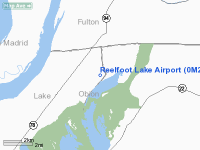
Location & QuickFacts
| FAA Information Effective: | 2008-09-25 |
| Airport Identifier: | 0M2 |
| Airport Status: | Operational |
| Longitude/Latitude: | 089-20-46.2580W/36-28-31.2270N
-89.346183/36.475341 (Estimated) |
| Elevation: | 289 ft / 88.09 m (Estimated) |
| Land: | 98 acres |
| From nearest city: | 9 nautical miles NE of Tiptonville, TN |
| Location: | Lake County, TN |
| Magnetic Variation: | 02E (1985) |
Owner & Manager
| Ownership: | Publicly owned |
| Owner: | Tdot Office Of Aeronautics |
| Address: | Po Box 17326
Nashville, TN 37217 |
| Phone number: | 615-741-3208 |
| Manager: | Paul Perry |
| Address: | Po Box 17326
Nashville, TN 37217
REELFOOT LAKE STATE AIRPARK INN OPEN JAN-OCT; CLSD NOV & DEC. |
| Phone number: | 615-532-5238 |
Airport Operations and Facilities
| Airport Use: | Open to public |
| Wind indicator: | Yes |
| Segmented Circle: | Yes |
| Control Tower: | No |
| Lighting Schedule: | DUSK-DAWN |
| Beacon Color: | Clear-Green (lighted land airport)
OTS INDEFLY. |
| Landing fee charge: | No |
| Sectional chart: | St Louis |
| Region: | ASO - Southern |
| Boundary ARTCC: | ZME - Memphis |
| Tie-in FSS: | MKL - Jackson |
| FSS on Airport: | No |
| FSS Toll Free: | 1-800-WX-BRIEF |
| NOTAMs Facility: | MKL (NOTAM-d service avaliable) |
| Federal Agreements: | Y1 |
Airport Communications
Airport Services
| Airframe Repair: | NONE |
| Power Plant Repair: | NONE |
| Bottled Oxygen: | NONE |
| Bulk Oxygen: | NONE |
Runway Information
Runway 01/19
| Dimension: | 3500 x 75 ft / 1066.8 x 22.9 m |
| Surface: | ASPH, |
| Weight Limit: | Single wheel: 25000 lbs.
Dual wheel: 37000 lbs. |
| |
Runway 01 |
Runway 19 |
| Traffic Pattern: | Left | Right |
| Markings: | Basic, Good Condition | Basic, Good Condition |
| Crossing Height: | 26.00 ft | 31.00 ft |
| VASI: | 2-light PAPI on left side
RY 01 PAPI OTS INDEFLY. | 2-light PAPI on left side |
| Visual Glide Angle: | 4.00° | 4.00° |
| Runway End Identifier: | No | No |
| Obstruction: | 54 ft trees, 1000.0 ft from runway, 190 ft right of centerline, 14:1 slope to clear | 34 ft trees, 650.0 ft from runway, 125 ft left of centerline, 13:1 slope to clear |
|
Radio Navigation Aids
| ID |
Type |
Name |
Ch |
Freq |
Var |
Dist |
| UC | NDB | Obion | | 212.00 | 00E | 20.1 nm |
| CHQ | NDB | Charleston | | 208.00 | 01E | 22.2 nm |
| DNT | NDB | Nally Dunston | | 343.00 | 01W | 29.0 nm |
| DXE | NDB | Dexter | | 423.00 | 00E | 34.3 nm |
| CIR | NDB | Cairo | | 397.00 | 00E | 35.7 nm |
| TKX | NDB | Kennett | | 358.00 | 00E | 36.7 nm |
| GGK | NDB | Mayfield | | 401.00 | 00E | 38.6 nm |
| IUI | NDB | Hicks | | 350.00 | 01E | 40.0 nm |
| TGC | NDB | Gibson | | 378.00 | 01E | 40.4 nm |
| TIQ | NDB | Trainer | | 410.00 | 00E | 47.1 nm |
| HZD | NDB | Huntingdon | | 217.00 | 00E | 48.5 nm |
| FD | NDB | Earli | | 278.00 | 03E | 48.8 nm |
| GOJ | VOR | Gosnell | | 111.80 | 01E | 42.7 nm |
| CGI | VOR/DME | Cape Girardeau | 076X | 112.90 | 01E | 46.5 nm |
| DYR | VORTAC | Dyersburg | 115X | 116.80 | 03E | 27.5 nm |
| MAW | VORTAC | Malden | 049X | 111.20 | 03E | 27.7 nm |
| CNG | VORTAC | Cunningham | 078X | 113.10 | 03E | 40.4 nm |
Remarks
- MAINTAIN 2000 FT OVER LAKE EAST OF ARPT (FEDERAL GAME REFUGE).
Images and information placed above are from
http://www.airport-data.com/airport/0M2/
We thank them for the data!
| General Info
|
| Country |
United States
|
| State |
TENNESSEE
|
| FAA ID |
0M2
|
| Latitude |
36-28-31.227N
|
| Longitude |
089-20-46.258W
|
| Elevation |
289 feet
|
| Near City |
TIPTONVILLE
|
We don't guarantee the information is fresh and accurate. The data may
be wrong or outdated.
For more up-to-date information please refer to other sources.
|
|


