 |
|
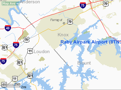
Location & QuickFacts
| FAA Information Effective: | 2008-09-25 |
| Airport Identifier: | 8TN3 |
| Airport Status: | Operational |
| Longitude/Latitude: | 084-10-52.0000W/35-50-30.0000N
-84.181111/35.841667 (Estimated) |
| Elevation: | 830 ft / 252.98 m (Estimated) |
| Land: | 15 acres |
| From nearest city: | 2 nautical miles NE of Farragut, TN |
| Location: | Knox County, TN |
| Magnetic Variation: | 04W (1995) |
Owner & Manager
| Ownership: | Privately owned |
| Owner: | Kenneth & Mary Raby |
| Address: | 1313 Choto Rd.
Knoxville, TN 37922 |
| Phone number: | 865-966-3108 |
| Manager: | Paul Robertson |
| Address: | 1108 Harvey Road
Knoxville, TN 37922 |
| Phone number: | 865-966-1649 |
Airport Operations and Facilities
| Airport Use: | Private |
| Segmented Circle: | No |
| Control Tower: | No |
| Sectional chart: | Atlanta |
| Region: | ASO - Southern |
| Boundary ARTCC: | ZTL - Atlanta |
| Tie-in FSS: | BNA - Nashville |
| FSS on Airport: | No |
| FSS Toll Free: | 1-800-WX-BRIEF |
Runway Information
Runway 05/23
| Dimension: | 1300 x 50 ft / 396.2 x 15.2 m |
| Surface: | TURF, |
| |
Runway 05 |
Runway 23 |
| Traffic Pattern: | Left | Left |
| Obstruction: | 40 ft trees | 40 ft trees |
|
Radio Navigation Aids
| ID |
Type |
Name |
Ch |
Freq |
Var |
Dist |
| MNV | NDB | Madisonville | | 361.00 | 04W | 20.4 nm |
| JAU | NDB | Jacksboro | | 204.00 | 03W | 29.8 nm |
| MMI | NDB | Mc Minn County | | 242.00 | 03W | 32.7 nm |
| JXT | NDB | Jefferson | | 346.00 | 04W | 37.9 nm |
| DTE | NDB | Mark Anton | | 394.00 | 02W | 42.5 nm |
| BPO | NDB | Piney Grove | | 403.00 | 05W | 44.3 nm |
| TTQ | NDB | Tomotla | | 335.00 | 01W | 45.0 nm |
| VXV | VORTAC | Volunteer | 111X | 116.40 | 03W | 14.5 nm |
| HCH | VORTAC | Hinch Mountain | 123X | 117.60 | 02W | 39.0 nm |
| TYS | VOT | Knoxville | | 112.00 | | 9.3 nm |
Remarks
- PRVDD VFR/PVT USE; YOU ARE AWARE OF MIL TFC IN AREA.
Images and information placed above are from
http://www.airport-data.com/airport/8TN3/
We thank them for the data!
| General Info
|
| Country |
United States
|
| State |
TENNESSEE
|
| FAA ID |
8TN3
|
| Latitude |
35-50-30.000N
|
| Longitude |
084-10-52.000W
|
| Elevation |
830 feet
|
| Near City |
FARRAGUT
|
We don't guarantee the information is fresh and accurate. The data may
be wrong or outdated.
For more up-to-date information please refer to other sources.
|
|


