 |
|
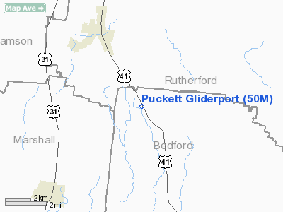
Puckett Gliderport Airport |
Location & QuickFacts
| FAA Information Effective: | 2008-09-25 |
| Airport Identifier: | 50M |
| Airport Status: | Operational |
| Longitude/Latitude: | 086-36-54.0000W/35-41-22.0000N
-86.615000/35.689444 (Estimated) |
| Elevation: | 780 ft / 237.74 m (Estimated) |
| Land: | 15 acres |
| From nearest city: | 4 nautical miles SE of Eagleville, TN |
| Location: | Bedford County, TN |
| Magnetic Variation: | 01W (1985) |
Owner & Manager
| Ownership: | Privately owned |
| Owner: | Russell Puckett |
| Address: | Po Box 36
Eagleville, TN 37060 |
| Phone number: | 931-274-6232 |
| Manager: | Bill Mc Farlane |
| Address: | 124 Beasley Road
Eagleville, TN 37060 |
| Phone number: | 931-294-2280 |
Airport Operations and Facilities
| Airport Use: | Open to public |
| Wind indicator: | Yes |
| Segmented Circle: | No |
| Control Tower: | No |
| Landing fee charge: | No |
| Sectional chart: | Atlanta |
| Region: | ASO - Southern |
| Boundary ARTCC: | ZME - Memphis |
| Tie-in FSS: | BNA - Nashville |
| FSS on Airport: | No |
| FSS Toll Free: | 1-800-WX-BRIEF |
| NOTAMs Facility: | BNA (NOTAM-d service avaliable) |
Airport Communications
Airport Services
| Airframe Repair: | NONE |
| Power Plant Repair: | NONE |
| Bottled Oxygen: | NONE |
| Bulk Oxygen: | NONE |
Runway Information
Runway 14/32
| Dimension: | 2200 x 145 ft / 670.6 x 44.2 m |
| Surface: | TURF, Good Condition |
| |
Runway 14 |
Runway 32 |
| Traffic Pattern: | Right | Left |
| Displaced threshold: | 600.00 ft | 0.00 ft |
| Touchdown Lights: | No | No |
| Obstruction: | 64 ft trees, 862.0 ft from runway, 116 ft right of centerline, 13:1 slope to clear
APCH RATIO 22:1 TO DISPLACED THRESHOLD. | 43 ft trees, 1320.0 ft from runway, 71 ft left of centerline, 30:1 slope to clear |
|
Radio Navigation Aids
| ID |
Type |
Name |
Ch |
Freq |
Var |
Dist |
| SYI | FAN MARKER | Bomar | | | 01W | 14.4 nm |
| LUG | NDB | Verona | | 251.00 | 00W | 14.8 nm |
| SWZ | NDB | Sewart | | 391.00 | 02W | 17.7 nm |
| FQW | NDB | Walter Hill | | 371.00 | 02W | 20.2 nm |
| ULH | NDB | Burwi | | 332.00 | 03W | 22.8 nm |
| PBC | NDB | Maury County | | 365.00 | 01W | 23.8 nm |
| VI | NDB | Opery | | 344.00 | 02W | 31.0 nm |
| TNY | NDB | Kelso | | 358.00 | 01W | 33.6 nm |
| JUE | NDB | Lebanon | | 414.00 | 02W | 33.6 nm |
| GZS | NDB | Giles/dcmsnd | | 375.00 | 00E | 38.9 nm |
| BGF | NDB | Boiling Fork | | 263.00 | 02W | 40.8 nm |
| RN | NDB | Warri | | 209.00 | 02W | 41.7 nm |
| LRT | NDB | Lawrenceburg | | 269.00 | 00E | 41.8 nm |
| SKN | NDB | Hurricane | | 256.00 | 02W | 43.1 nm |
| UOS | NDB | Sewanee | | 275.00 | 02E | 45.7 nm |
| DMZ | NDB | Dickson | | 203.00 | 01W | 47.7 nm |
| ON | NDB | Music | | 279.00 | 03W | 49.2 nm |
| UXM | VOR | Tullahoma Regional | | 109.65 | 03W | 25.9 nm |
| SYI | VOR/DME | Shelbyville | 027X | 109.00 | 01W | 11.5 nm |
| BNA | VORTAC | Nashville | 088X | 114.10 | 02W | 27.1 nm |
| GHM | VORTAC | Graham | 053X | 111.60 | 03E | 41.7 nm |
| MQY | VOT | Smyrna | | 110.20 | | 19.8 nm |
| BNA | VOT | Nashville Metropoln | | 108.60 | | 26.5 nm |
| HSV | VOT | Huntsville | | 111.00 | | 43.2 nm |
Remarks
- GLIDERPORT-POWERED ACFT WELCOME.
- MILITARY ACTIVITY& MANEUVERS PROHIBITED.
- FREQ 123.5 USED FOR GLIDER TRAINING.
- VFR ONLY.
Images and information placed above are from
http://www.airport-data.com/airport/50M/
We thank them for the data!
| General Info
|
| Country |
United States
|
| State |
TENNESSEE
|
| FAA ID |
50M
|
| Latitude |
35-41-22.000N
|
| Longitude |
086-36-54.000W
|
| Elevation |
780 feet
|
| Near City |
EAGLEVILLE
|
We don't guarantee the information is fresh and accurate. The data may
be wrong or outdated.
For more up-to-date information please refer to other sources.
|
|


