 |
|
Location & QuickFacts
| FAA Information Effective: | 2008-09-25 |
| Airport Identifier: | 9A2 |
| Airport Status: | Operational |
| Longitude/Latitude: | 084-00-15.6800W/36-02-40.2890N
-84.004356/36.044525 (Estimated) |
| Elevation: | 992 ft / 302.36 m (Estimated) |
| Land: | 30 acres |
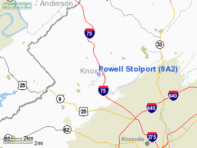
| From nearest city: | 5 nautical miles NW of Knoxville, TN |
| Location: | Knox County, TN |
| Magnetic Variation: | 03W (1985) |
Owner & Manager
| Ownership: | Privately owned |
| Owner: | Norman C. Mayes |
| Address: | 208 Emory Road
Powell, TN 37849 |
| Phone number: | 423-938-2068 |
| Manager: | Norman C. Mayes |
| Address: | 208 Emery Road
Powell, TN 37849 |
| Phone number: | 423-938-2068 |
Airport Operations and Facilities
| Airport Use: | Open to public |
| Wind indicator: | Yes |
| Segmented Circle: | No |
| Control Tower: | No |
| Lighting Schedule: | PHONE REQ
FOR ROTG BCN CALL 865-938-2068. |
| Beacon Color: | Clear-Green (lighted land airport) |
| Landing fee charge: | Yes
|
| Sectional chart: | Cincinnati |
| Region: | ASO - Southern |
| Boundary ARTCC: | ZTL - Atlanta |
| Tie-in FSS: | BNA - Nashville |
| FSS on Airport: | No |
| FSS Toll Free: | 1-800-WX-BRIEF |
| NOTAMs Facility: | BNA (NOTAM-d service avaliable) |
Airport Communications
| CTAF: | 122.800 |
| Unicom: | 122.800 |
Airport Services
Runway Information
Runway 05/23
| Dimension: | 2600 x 50 ft / 792.5 x 15.2 m |
| Surface: | ASPH, Poor Condition
PAVEMENT CRACKING WITH GRASS GROWING IN CRACKS. |
| Edge Lights: | Non-standard lighting system
NSTD LIRL; SYSTEM IN VERY POOR COND; FIXTURES MISSING; MOST LENSES MISSING; DSPLCD THLD NOT LGTD. |
| |
Runway 05 |
Runway 23 |
| Traffic Pattern: | Left | Left |
| Markings: | Nonstandard, Poor Condition
RY 05/23 RY MARKINGS & DSPLCD THLD MARKINGS VERY FADED. | Nonstandard, Poor Condition |
| Displaced threshold: | 524.00 ft | 400.00 ft |
| Obstruction: | 46 ft tree, 537.0 ft from runway, 154 ft left of centerline, 7:1 slope to clear
RY 05 APCH RATIO 5:1 TO DSPLCD THLD.
RY 05 +73 FT TREE 414 FT FROM RY END & 26 FT RIGHT & +40 FT TREES WITHIN 140 FT OF RY END. | 73 ft tree, 414.0 ft from runway, 26 ft left of centerline, 2:1 slope to clear
RY 23 APCH RATIO 11:1 TO DSPLCD THLD.
INTERSTATE HIGHWAY & RAMP WITHIN 100 FT OF PAVEMENT. |
|
Radio Navigation Aids
| ID |
Type |
Name |
Ch |
Freq |
Var |
Dist |
| JAU | NDB | Jacksboro | | 204.00 | 03W | 19.2 nm |
| JXT | NDB | Jefferson | | 346.00 | 04W | 26.0 nm |
| MNV | NDB | Madisonville | | 361.00 | 04W | 35.2 nm |
| BPO | NDB | Piney Grove | | 403.00 | 05W | 37.5 nm |
| MMI | NDB | Mc Minn County | | 242.00 | 03W | 47.6 nm |
| VXV | VORTAC | Volunteer | 111X | 116.40 | 03W | 9.9 nm |
| SOT | VORTAC | Snowbird | 025X | 108.80 | 04W | 48.8 nm |
| HCH | VORTAC | Hinch Mountain | 123X | 117.60 | 02W | 50.0 nm |
| TYS | VOT | Knoxville | | 112.00 | | 14.0 nm |
Remarks
- PAEW WORKING ON OR NEAR RY.
- PROVIDED ALL OPERATIONS ARE CONDUCTED IN VFR WEATHER CONDITIONS.
Images and information placed above are from
http://www.airport-data.com/airport/9A2/
We thank them for the data!
| General Info
|
| Country |
United States
|
| State |
TENNESSEE
|
| FAA ID |
9A2
|
| Latitude |
36-02-40.289N
|
| Longitude |
084-00-15.680W
|
| Elevation |
992 feet
|
| Near City |
KNOXVILLE
|
We don't guarantee the information is fresh and accurate. The data may
be wrong or outdated.
For more up-to-date information please refer to other sources.
|
|


