 |
|
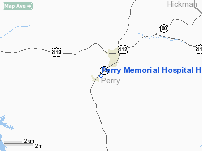
Perry Memorial Hospital Heliport |
Location & QuickFacts
| FAA Information Effective: | 2008-09-25 |
| Airport Identifier: | 5TN8 |
| Airport Status: | Operational |
| Longitude/Latitude: | 087-51-22.0950W/35-35-42.2520N
-87.856137/35.595070 (Estimated) |
| Elevation: | 740 ft / 225.55 m (Estimated) |
| Land: | 0 acres |
| From nearest city: | 0 nautical miles N of Linden, TN |
| Location: | Perry County, TN |
| Magnetic Variation: | 00E (1990) |
Owner & Manager
| Ownership: | Privately owned |
| Owner: | Perry Community Hospital |
| Address: | 2718 Squirrel Hollow Drive
Linden, TN 37096 |
| Phone number: | 931-589-2121 |
| Manager: | John B Avery Iii |
| Address: | 2718 Squirell Hollow Drive
Linden, TN 37096 |
| Phone number: | 931-589-2121 |
Airport Operations and Facilities
| Airport Use: | Private
MEDICAL. |
| Segmented Circle: | No |
| Control Tower: | No |
| Lighting Schedule: | DUSK-DAWN |
| Sectional chart: | Atlanta |
| Region: | ASO - Southern |
| Boundary ARTCC: | ZME - Memphis |
| Tie-in FSS: | MKL - Jackson |
| FSS Toll Free: | 1-800-WX-BRIEF |
Runway Information
Helipad H1
| Dimension: | 40 x 40 ft / 12.2 x 12.2 m |
| Surface: | CONC, |
| |
Runway H1 |
Runway |
| Traffic Pattern: | Left | Left |
|
Radio Navigation Aids
| ID |
Type |
Name |
Ch |
Freq |
Var |
Dist |
| JHG | NDB | Hohenwald | | 257.00 | 01W | 13.6 nm |
| HHY | NDB | Pinhook | | 346.00 | 01W | 26.7 nm |
| AEY | NDB | Waverly | | 329.00 | 00E | 31.8 nm |
| LRT | NDB | Lawrenceburg | | 269.00 | 00E | 36.3 nm |
| PBC | NDB | Maury County | | 365.00 | 01W | 37.4 nm |
| DMZ | NDB | Dickson | | 203.00 | 01W | 38.1 nm |
| SZY | NDB | Sibley | | 386.00 | 01E | 38.8 nm |
| HZD | NDB | Huntingdon | | 217.00 | 00E | 42.0 nm |
| GZS | NDB | Giles/dcmsnd | | 375.00 | 00E | 47.3 nm |
| TIQ | NDB | Trainer | | 410.00 | 00E | 47.8 nm |
| JKS | VOR/DME | Jacks Creek | 031X | 109.40 | 02E | 24.6 nm |
| GHM | VORTAC | Graham | 053X | 111.60 | 03E | 24.4 nm |
Remarks
- PRVDD VFR/PVT USE; ALL APCH/DEP OPERS ARE FM 010 TO 120 AND FM 140 TO 200; AREA APPROPRIATELY MKD; & A WIND IND IS MAINTAINED.
Images and information placed above are from
http://www.airport-data.com/airport/5TN8/
We thank them for the data!
| General Info
|
| Country |
United States
|
| State |
TENNESSEE
|
| FAA ID |
5TN8
|
| Latitude |
35-35-42.252N
|
| Longitude |
087-51-22.095W
|
| Elevation |
740 feet
|
| Near City |
LINDEN
|
We don't guarantee the information is fresh and accurate. The data may
be wrong or outdated.
For more up-to-date information please refer to other sources.
|
|


