|
|
| Perry County Airport |
 |
| IATA: none – ICAO: none – FAA LID: M15 |
| Summary |
| Airport type |
Public |
| Operator |
Perry County |
| Serves |
Linden, Lobelville |
| Location |
Linden, Tennessee |
| Elevation AMSL |
740 ft / 226 m |
| Coordinates |
35°35′45″N 087°52′36″W / 35.59583°N 87.87667°W / 35.59583; -87.87667 |
| Runways |
| Direction |
Length |
Surface |
| ft |
m |
| 18/36 |
3,600 |
1,097 |
Asphalt |
| Statistics (2008) |
| Aircraft operations |
2,184 |
| Based aircraft |
2 |
| Source: Federal Aviation Administration |
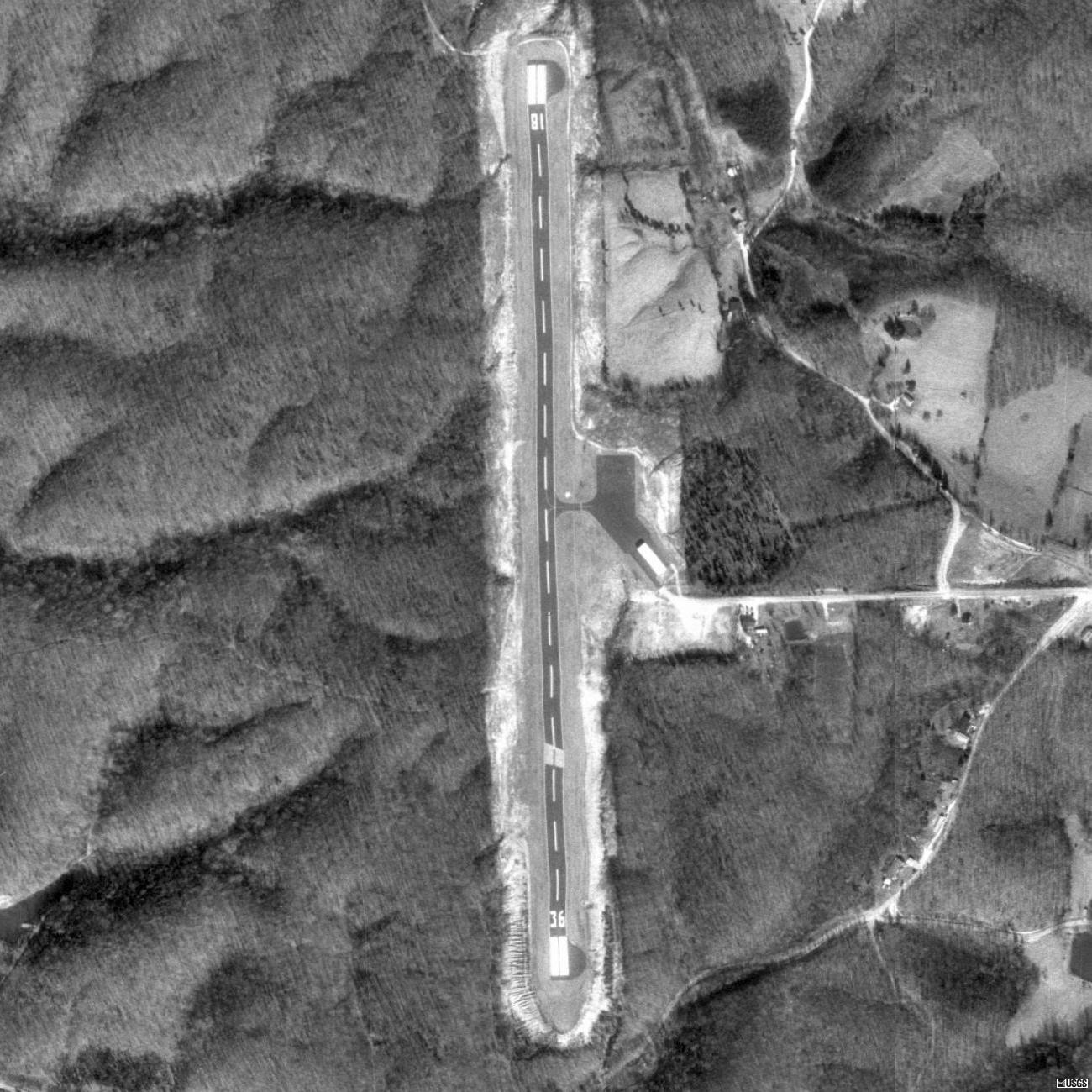
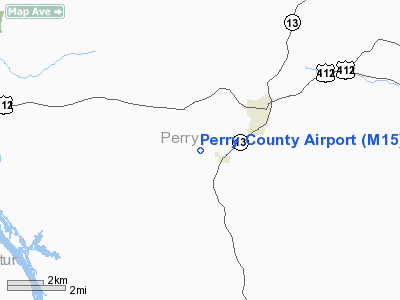
Perry County Airport (FAA LID: M15) is a county-owned, public-use airport located three nautical miles (6 km) southwest of the central business district of Linden, a town in Perry County, Tennessee, United States. M15 is located on the Atlanta sectional chart. Facilities and aircraft
Perry County Airport covers an area of 65 acres (26 ha) at an elevation of 740 feet (226 m) above mean sea level. It has one runway designated 18/36 with a 3,600 by 75 ft (1,097 x 23 m) asphalt surface. For the 12-month period ending June 6, 2008, the airport had 2,195 aircraft operations, an average of 183 per month: 78% general aviation and 22% military.
The airport is unattended and does not have fuel services. It is included under the Jackson FSS. Although it has pilot controlled runway lighting and PAPI on both runways, it is open during daylight hours only. NOTAMs are filed with McKellar-Sipes Regional Airport.
The above content comes from Wikipedia and is published under free licenses – click here to read more.
Location & QuickFacts
| FAA Information Effective: | 2008-09-25 |
| Airport Identifier: | M15 |
| Airport Status: | Operational |
| Longitude/Latitude: | 087-52-36.0970W/35-35-45.2510N
-87.876694/35.595903 (Estimated) |
| Elevation: | 740 ft / 225.55 m (Estimated) |
| Land: | 65 acres |
| From nearest city: | 3 nautical miles SW of Linden, TN |
| Location: | Perry County, TN |
| Magnetic Variation: | 01E (1985) |
Owner & Manager
| Ownership: | Publicly owned |
| Owner: | Perry County |
| Address: | County Courthouse Po Box 16
Linden, TN 37096 |
| Phone number: | 931-589-2216 |
| Manager: | Mayor John Carroll |
| Address: | County Courthouse, P.o. Box 16
Linden, TN 37096
PHYSICAL AIRPORT ADDRESS IS 799 AIRPORT RD., LINDEN, TN 37096 |
| Phone number: | 931-589-2216 |
Airport Operations and Facilities
| Airport Use: | Open to public |
| Wind indicator: | Yes |
| Segmented Circle: | Yes |
| Control Tower: | No |
| Lighting Schedule: | DUSK-DAWN |
| Beacon Color: | Clear-Green (lighted land airport)
ARPT BCN OTS INDEFLY. |
| Landing fee charge: | No |
| Sectional chart: | Atlanta |
| Region: | ASO - Southern |
| Boundary ARTCC: | ZME - Memphis |
| Tie-in FSS: | MKL - Jackson |
| FSS on Airport: | No |
| FSS Toll Free: | 1-800-WX-BRIEF |
| NOTAMs Facility: | MKL (NOTAM-d service avaliable) |
| Federal Agreements: | N |
Airport Communications
Airport Services
| Airframe Repair: | NONE |
| Power Plant Repair: | NONE |
| Bottled Oxygen: | NONE |
| Bulk Oxygen: | NONE |
Runway Information
Runway 18/36
| Dimension: | 3600 x 75 ft / 1097.3 x 22.9 m |
| Surface: | ASPH, Good Condition |
| Weight Limit: | Single wheel: 23000 lbs.
GWT SINGLE WHEEL LIMITED TO 17000 LBS BY AMGR. |
| Edge Lights: | Low |
| |
Runway 18 |
Runway 36 |
| Traffic Pattern: | Left | Left |
| Markings: | Basic, Good Condition | Basic, Good Condition |
| VASI: | 2-light PAPI on left side | 2-light PAPI on left side |
| Runway End Identifier: | Yes
RY 18 REIL OTS INDEFLY. | Yes
RY 36 REIL OTS INDEFLY. |
| Centerline Lights: | No | No |
| Touchdown Lights: | No | No |
| Obstruction: | 43 ft trees, 735.0 ft from runway, 167 ft right of centerline, 12:1 slope to clear | 12 ft trees, 228.0 ft from runway, 35 ft left of centerline, 2:1 slope to clear |
|
Radio Navigation Aids
| ID |
Type |
Name |
Ch |
Freq |
Var |
Dist |
| JHG | NDB | Hohenwald | | 257.00 | 01W | 14.5 nm |
| HHY | NDB | Pinhook | | 346.00 | 01W | 26.1 nm |
| AEY | NDB | Waverly | | 329.00 | 00E | 32.0 nm |
| LRT | NDB | Lawrenceburg | | 269.00 | 00E | 37.1 nm |
| SZY | NDB | Sibley | | 386.00 | 01E | 38.0 nm |
| PBC | NDB | Maury County | | 365.00 | 01W | 38.4 nm |
| DMZ | NDB | Dickson | | 203.00 | 01W | 38.6 nm |
| HZD | NDB | Huntingdon | | 217.00 | 00E | 41.3 nm |
| TIQ | NDB | Trainer | | 410.00 | 00E | 47.2 nm |
| GZS | NDB | Giles/dcmsnd | | 375.00 | 00E | 48.2 nm |
| JKS | VOR/DME | Jacks Creek | 031X | 109.40 | 02E | 23.6 nm |
| GHM | VORTAC | Graham | 053X | 111.60 | 03E | 25.2 nm |
Images and information placed above are from
http://www.airport-data.com/airport/M15/
We thank them for the data!
| General Info
|
| Country |
United States
|
| State |
TENNESSEE
|
| FAA ID |
M15
|
| Latitude |
35-35-45.251N
|
| Longitude |
087-52-36.097W
|
| Elevation |
740 feet
|
| Near City |
LINDEN
|
We don't guarantee the information is fresh and accurate. The data may
be wrong or outdated.
For more up-to-date information please refer to other sources.
|
|