 |
|
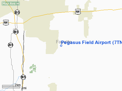
Location & QuickFacts
| FAA Information Effective: | 2008-09-25 |
| Airport Identifier: | 7TN4 |
| Airport Status: | Operational |
| Longitude/Latitude: | 089-33-45.0000W/35-10-22.0000N
-89.562500/35.172778 (Estimated) |
| Elevation: | 380 ft / 115.82 m (Estimated) |
| Land: | 20 acres |
| From nearest city: | 5 nautical miles SW of Oakland, TN |
| Location: | Fayette County, TN |
| Magnetic Variation: | 01E (1995) |
Owner & Manager
| Ownership: | Privately owned |
| Owner: | Larry Wilkinson |
| Address: | 1775 Yancey Road
Rossville, TN 38066 |
| Phone number: | 901-466-0575 |
| Address: |
|
Airport Operations and Facilities
| Airport Use: | Private |
| Segmented Circle: | No |
| Control Tower: | No |
| Sectional chart: | Memphis |
| Region: | ASO - Southern |
| Boundary ARTCC: | ZME - Memphis |
| Tie-in FSS: | MKL - Jackson |
| FSS on Airport: | No |
| FSS Toll Free: | 1-800-WX-BRIEF |
Runway Information
Runway 08/26
| Dimension: | 3000 x 80 ft / 914.4 x 24.4 m |
| Surface: | TURF, |
| |
Runway 08 |
Runway 26 |
| Traffic Pattern: | Left | Left |
| Displaced threshold: | 400.00 ft | 840.00 ft |
| Obstruction: | 45 ft tree, 500.0 ft from runway
08/26 TOWERS E,W,AND SW OF LANDING STRIP. | 64 ft tree, 400.0 ft from runway |
|
Radio Navigation Aids
| ID |
Type |
Name |
Ch |
Freq |
Var |
Dist |
| FYE | NDB | Somerville | | 255.00 | 00E | 8.6 nm |
| OLV | NDB | Olive Branch | | 275.00 | 01E | 16.1 nm |
| MIG | NDB | Millington | | 232.00 | 04E | 19.3 nm |
| SPQ | NDB | Spain | | 414.00 | 04E | 24.1 nm |
| COO | NDB | Covington | | 326.00 | 02E | 25.1 nm |
| BAV | NDB | Hardeman | | 404.00 | 01E | 25.7 nm |
| ME | NDB | Elvis | | 287.00 | 01E | 25.9 nm |
| AWM | NDB | West Memphis | | 362.00 | 01E | 33.0 nm |
| BPW | NDB | Osceola | | 239.00 | 02E | 38.3 nm |
| IUI | NDB | Hicks | | 350.00 | 01E | 47.9 nm |
| MKL | VOR/DME | Mc Kellar | 057X | 112.00 | 02E | 41.1 nm |
| GQE | VOR/DME | Gilmore | 077X | 113.00 | 04E | 46.1 nm |
| MEM | VORTAC | Memphis | 122X | 117.50 | 01E | 22.8 nm |
| HLI | VORTAC | Holly Springs | 071X | 112.40 | 03E | 24.4 nm |
| MEM | VOT | Memphis Metropolitn | | 111.00 | | 21.8 nm |
Remarks
Images and information placed above are from
http://www.airport-data.com/airport/7TN4/
We thank them for the data!
| General Info
|
| Country |
United States
|
| State |
TENNESSEE
|
| FAA ID |
7TN4
|
| Latitude |
35-10-22.000N
|
| Longitude |
089-33-45.000W
|
| Elevation |
380 feet
|
| Near City |
OAKLAND
|
We don't guarantee the information is fresh and accurate. The data may
be wrong or outdated.
For more up-to-date information please refer to other sources.
|
|


