 |
|
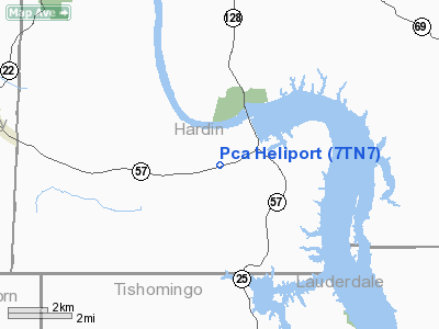
Location & QuickFacts
| FAA Information Effective: | 2008-09-25 |
| Airport Identifier: | 7TN7 |
| Airport Status: | Operational |
| Longitude/Latitude: | 088-15-52.0000W/35-02-42.0000N
-88.264444/35.045000 (Estimated) |
| Elevation: | 480 ft / 146.30 m (Estimated) |
| Land: | 1 acres |
| From nearest city: | 0 nautical miles E of Counce, TN |
| Location: | Hardin County, TN |
| Magnetic Variation: | 00E (1995) |
Owner & Manager
| Ownership: | Privately owned |
| Owner: | Packaging Corp Of America |
| Address: | 6715 Hwy 57, P.o. Box 33
Counce, TN 38326 |
| Phone number: | 731-689-3111 |
| Manager: | Jack Holder |
| Address: | 6715 Hwy 57, P.o. Box 33
Counce, TN 38326 |
| Phone number: | 731-689-1358 |
Airport Operations and Facilities
| Airport Use: | Private |
| Wind indicator: | Yes |
| Segmented Circle: | No |
| Control Tower: | No |
| Sectional chart: | Atlanta |
| Region: | ASO - Southern |
| Boundary ARTCC: | ZME - Memphis |
| Tie-in FSS: | MKL - Jackson |
| FSS on Airport: | No |
| FSS Toll Free: | 1-800-WX-BRIEF |
Runway Information
Helipad H1
| Dimension: | 30 x 30 ft / 9.1 x 9.1 m |
| Surface: | CONC, Good Condition |
| |
Runway H1 |
Runway |
| Traffic Pattern: | Left | Left |
|
Radio Navigation Aids
| ID |
Type |
Name |
Ch |
Freq |
Var |
Dist |
| HHY | NDB | Pinhook | | 346.00 | 01W | 12.9 nm |
| SZY | NDB | Sibley | | 386.00 | 01E | 16.9 nm |
| BAV | NDB | Hardeman | | 404.00 | 01E | 39.6 nm |
| JHG | NDB | Hohenwald | | 257.00 | 01W | 40.0 nm |
| JKS | VOR/DME | Jacks Creek | 031X | 109.40 | 02E | 33.6 nm |
| MKL | VOR/DME | Mc Kellar | 057X | 112.00 | 02E | 46.2 nm |
| MSL | VORTAC | Muscle Shoals | 112X | 116.50 | 01E | 43.2 nm |
Remarks
- VFR; PVT USE. APCH/DEP 253 CLKWS 263 & 086 CLKWS 096; AREA IS MKD; WIND INDICATOR IS MAINTAINED.
Images and information placed above are from
http://www.airport-data.com/airport/7TN7/
We thank them for the data!
| General Info
|
| Country |
United States
|
| State |
TENNESSEE
|
| FAA ID |
7TN7
|
| Latitude |
35-02-42.000N
|
| Longitude |
088-15-52.000W
|
| Elevation |
480 feet
|
| Near City |
COUNCE
|
We don't guarantee the information is fresh and accurate. The data may
be wrong or outdated.
For more up-to-date information please refer to other sources.
|
|


