 |
|
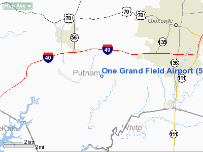
Location & QuickFacts
| FAA Information Effective: | 2008-09-25 |
| Airport Identifier: | 5TN9 |
| Airport Status: | Operational |
| Longitude/Latitude: | 085-35-41.9230W/36-06-50.2210N
-85.594979/36.113950 (Estimated) |
| Elevation: | 1000 ft / 304.80 m (Estimated) |
| Land: | 50 acres |
| From nearest city: | 6 nautical miles SW of Cookeville, TN |
| Location: | Putnam County, TN |
| Magnetic Variation: | 02W (1990) |
Owner & Manager
| Ownership: | Privately owned |
| Owner: | One Grand Field Partnership |
| Address: | Road 5 Box 372
Middletown, NY 10940 |
| Manager: | Unknown |
| Address: | Road 5 Box 372
Middletown, NY 10940 |
Airport Operations and Facilities
| Airport Use: | Private |
| Wind indicator: | Yes |
| Segmented Circle: | No |
| Control Tower: | No |
| Sectional chart: | St Louis |
| Region: | ASO - Southern |
| Boundary ARTCC: | ZME - Memphis |
| Tie-in FSS: | BNA - Nashville |
| FSS on Airport: | No |
| FSS Toll Free: | 1-800-WX-BRIEF |
Runway Information
Runway 09/27
| Dimension: | 2500 x 100 ft / 762.0 x 30.5 m |
| Surface: | TURF, |
| |
Runway 09 |
Runway 27 |
| Traffic Pattern: | Left | Left |
| Obstruction: | | 25 ft pline, 700.0 ft from runway |
|
Radio Navigation Aids
| ID |
Type |
Name |
Ch |
Freq |
Var |
Dist |
| HEM | NDB | Huchn | | 233.00 | 02W | 7.6 nm |
| SKN | NDB | Hurricane | | 256.00 | 02W | 13.0 nm |
| RN | NDB | Warri | | 209.00 | 02W | 23.2 nm |
| LFB | NDB | Lafayette | | 245.00 | 02W | 33.0 nm |
| JUE | NDB | Lebanon | | 414.00 | 02W | 35.2 nm |
| FQW | NDB | Walter Hill | | 371.00 | 02W | 38.8 nm |
| SWZ | NDB | Sewart | | 391.00 | 02W | 43.3 nm |
| DTE | NDB | Mark Anton | | 394.00 | 02W | 49.9 nm |
| LVT | VORTAC | Livingston | 021X | 108.40 | 02W | 35.1 nm |
| HCH | VORTAC | Hinch Mountain | 123X | 117.60 | 02W | 36.1 nm |
| MQY | VOT | Smyrna | | 110.20 | | 44.8 nm |
Remarks
Images and information placed above are from
http://www.airport-data.com/airport/5TN9/
We thank them for the data!
| General Info
|
| Country |
United States
|
| State |
TENNESSEE
|
| FAA ID |
5TN9
|
| Latitude |
36-06-50.221N
|
| Longitude |
085-35-41.923W
|
| Elevation |
1000 feet
|
| Near City |
COOKEVILLE
|
We don't guarantee the information is fresh and accurate. The data may
be wrong or outdated.
For more up-to-date information please refer to other sources.
|
|


