 |
|
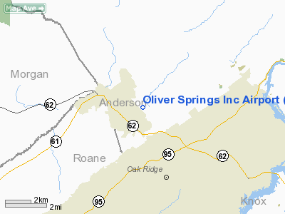
Oliver Springs Inc Airport |
Location & QuickFacts
| FAA Information Effective: | 2008-09-25 |
| Airport Identifier: | TN08 |
| Airport Status: | Operational |
| Longitude/Latitude: | 084-18-24.7310W/36-02-15.2810N
-84.306870/36.037578 (Estimated) |
| Elevation: | 790 ft / 240.79 m (Estimated) |
| Land: | 49 acres |
| From nearest city: | 2 nautical miles E of Oliver Springs, TN |
| Location: | Anderson County, TN |
| Magnetic Variation: | 03W (1985) |
Owner & Manager
| Ownership: | Privately owned |
| Owner: | Oliver Springs Airport Inc. |
| Address: | 140 Baltimore Drive
Oliver Springs, TN 37830 |
| Phone number: | 865-483-0938 |
| Manager: | Steve Hamel |
| Address: | 13 Windhaven Lane
Oak Ridge, TN 37830 |
| Phone number: | 865-483-3453
NIGHT MGR PHONE865-483-0938. |
Airport Operations and Facilities
| Airport Use: | Private |
| Wind indicator: | Yes |
| Segmented Circle: | No |
| Control Tower: | No |
| Landing fee charge: | No |
| Sectional chart: | Cincinnati |
| Region: | ASO - Southern |
| Boundary ARTCC: | ZTL - Atlanta |
| Tie-in FSS: | BNA - Nashville |
| FSS on Airport: | No |
| FSS Toll Free: | 1-800-WX-BRIEF |
Airport Services
| Fuel available: | 100LL |
| Airframe Repair: | NONE |
| Power Plant Repair: | NONE |
| Bottled Oxygen: | NONE |
| Bulk Oxygen: | NONE |
Runway Information
Runway 15/33
| Dimension: | 2800 x 200 ft / 853.4 x 61.0 m |
| Surface: | TURF, |
| |
Runway 15 |
Runway 33 |
| Traffic Pattern: | Left | Left |
| Runway End Identifier: | No | No |
| Centerline Lights: | No | No |
| Touchdown Lights: | No | No |
|
Radio Navigation Aids
| ID |
Type |
Name |
Ch |
Freq |
Var |
Dist |
| JAU | NDB | Jacksboro | | 204.00 | 03W | 19.4 nm |
| MNV | NDB | Madisonville | | 361.00 | 04W | 29.8 nm |
| BPO | NDB | Piney Grove | | 403.00 | 05W | 31.3 nm |
| MMI | NDB | Mc Minn County | | 242.00 | 03W | 40.6 nm |
| JXT | NDB | Jefferson | | 346.00 | 04W | 40.6 nm |
| DTE | NDB | Mark Anton | | 394.00 | 02W | 45.2 nm |
| VXV | VORTAC | Volunteer | 111X | 116.40 | 03W | 21.6 nm |
| HCH | VORTAC | Hinch Mountain | 123X | 117.60 | 02W | 36.1 nm |
| TYS | VOT | Knoxville | | 112.00 | | 20.4 nm |
Remarks
- NUMEROUS PLINES IN AREA.
- 1200 FT POWER LINES PARALLEL TO RY 15/33. FOR OBSTN AVOIDANCE CTC AMGR 423-483-3453.
- USE IN VFR CONDITIONS ONLY.
Images and information placed above are from
http://www.airport-data.com/airport/TN08/
We thank them for the data!
| General Info
|
| Country |
United States
|
| State |
TENNESSEE
|
| FAA ID |
TN08
|
| Latitude |
36-02-15.281N
|
| Longitude |
084-18-24.731W
|
| Elevation |
790 feet
|
| Near City |
OLIVER SPRINGS
|
We don't guarantee the information is fresh and accurate. The data may
be wrong or outdated.
For more up-to-date information please refer to other sources.
|
|


