 |
|
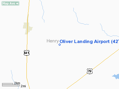
Location & QuickFacts
| FAA Information Effective: | 2008-09-25 |
| Airport Identifier: | 42TN |
| Airport Status: | Operational |
| Longitude/Latitude: | 088-15-56.0000W/36-24-43.0000N
-88.265556/36.411944 (Estimated) |
| Elevation: | 475 ft / 144.78 m (Estimated) |
| Land: | 60 acres |
| From nearest city: | 8 nautical miles NE of Paris, TN |
| Location: | Henry County, TN |
| Magnetic Variation: | () |
Owner & Manager
| Ownership: | Privately owned |
| Owner: | George Joseph Oliver |
| Address: | 11271 Southington Place
Jacksonville, FL 32257 |
| Phone number: | 904-945-3178 |
| Manager: | George Joseph Oliver |
| Address: | 11271 Southington Place
Jacksonville, FL 32257 |
| Phone number: | 904-945-3178 |
Airport Operations and Facilities
| Airport Use: | Private |
| Wind indicator: | Yes |
| Control Tower: | No |
| Sectional chart: | St Louis |
| Region: | ASO - Southern |
| Boundary ARTCC: | ZME - Memphis |
| Tie-in FSS: | MKL - Jackson |
| FSS Toll Free: | 1-800-WX-BRIEF |
Airport Communications
Runway Information
Runway 10/28
| Dimension: | 2800 x 100 ft / 853.4 x 30.5 m |
| Surface: | TURF, |
| |
Runway 10 |
Runway 28 |
| Traffic Pattern: | Right | Left |
|
Radio Navigation Aids
| ID |
Type |
Name |
Ch |
Freq |
Var |
Dist |
| TIQ | NDB | Trainer | | 410.00 | 00E | 12.2 nm |
| HZD | NDB | Huntingdon | | 217.00 | 00E | 21.8 nm |
| GGK | NDB | Mayfield | | 401.00 | 00E | 23.0 nm |
| AEY | NDB | Waverly | | 329.00 | 00E | 31.0 nm |
| UC | NDB | Obion | | 212.00 | 00E | 36.0 nm |
| TGC | NDB | Gibson | | 378.00 | 01E | 40.4 nm |
| DMZ | NDB | Dickson | | 203.00 | 01W | 43.9 nm |
| FK | NDB | Airbe | | 273.00 | 01W | 45.5 nm |
| BDD | NDB | Bellgrade | | 254.00 | 00E | 48.2 nm |
| HXW | TACAN | Screaming Eagle | 096X | | 01W | 40.4 nm |
| CKV | VOR/DME | Clarksville | 043X | 110.60 | 01W | 43.1 nm |
| JKS | VOR/DME | Jacks Creek | 031X | 109.40 | 02E | 49.1 nm |
| CNG | VORTAC | Cunningham | 078X | 113.10 | 03E | 45.2 nm |
Remarks
- PRVDD VFR OPNS, PVT USE, R TFC RY 10, THIS ARPT MAY BE NEAR A MIL TRNG RTE OR MIL TRNG AREA.
Images and information placed above are from
http://www.airport-data.com/airport/42TN/
We thank them for the data!
|
|


