 |
|
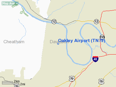
Location & QuickFacts
| FAA Information Effective: | 2008-09-25 |
| Airport Identifier: | TN79 |
| Airport Status: | Operational |
| Longitude/Latitude: | 086-57-35.0060W/36-10-20.2050N
-86.959724/36.172279 (Estimated) |
| Elevation: | 400 ft / 121.92 m (Estimated) |
| Land: | 0 acres |
| From nearest city: | 1 nautical miles NW of Nashville, TN |
| Location: | Davidson County, TN |
| Magnetic Variation: | 00W (1985) |
Owner & Manager
| Ownership: | Privately owned |
| Owner: | Willard Oakley & Alan Oakley |
| Address: | 707 42nd Ave N
Nashville, TN 37209 |
| Phone number: | 615-321-3644 |
| Address: |
|
Airport Operations and Facilities
| Airport Use: | Private |
| Wind indicator: | Yes |
| Segmented Circle: | No |
| Control Tower: | No |
| Landing fee charge: | Yes |
| Sectional chart: | St Louis |
| Region: | ASO - Southern |
| Boundary ARTCC: | ZME - Memphis |
| Tie-in FSS: | BNA - Nashville |
| FSS on Airport: | No |
| FSS Toll Free: | 1-800-WX-BRIEF |
Runway Information
Runway 16/34
| Dimension: | 1800 x 100 ft / 548.6 x 30.5 m |
| Surface: | TURF, |
| |
Runway 16 |
Runway 34 |
| Traffic Pattern: | Left | Left |
|
Helipad H1
| Dimension: | 150 x 150 ft / 45.7 x 45.7 m |
| Surface: | TURF, |
| |
Runway H1 |
Runway |
| Traffic Pattern: | Left | Left |
|
Radio Navigation Aids
| ID |
Type |
Name |
Ch |
Freq |
Var |
Dist |
| SYI | FAN MARKER | Bomar | | | 01W | 47.9 nm |
| VI | NDB | Opery | | 344.00 | 02W | 15.0 nm |
| ON | NDB | Music | | 279.00 | 03W | 16.7 nm |
| PED | NDB | Needmore | | 221.00 | 01W | 22.0 nm |
| DMZ | NDB | Dickson | | 203.00 | 01W | 23.1 nm |
| SWZ | NDB | Sewart | | 391.00 | 02W | 27.4 nm |
| FQW | NDB | Walter Hill | | 371.00 | 02W | 31.3 nm |
| JUE | NDB | Lebanon | | 414.00 | 02W | 31.4 nm |
| PBC | NDB | Maury County | | 365.00 | 01W | 34.5 nm |
| AEY | NDB | Waverly | | 329.00 | 00E | 38.1 nm |
| FK | NDB | Airbe | | 273.00 | 01W | 40.4 nm |
| LUG | NDB | Verona | | 251.00 | 00W | 41.0 nm |
| HIX | NDB | Honey Grove | | 356.00 | 01W | 46.3 nm |
| LFB | NDB | Lafayette | | 245.00 | 02W | 48.1 nm |
| HXW | TACAN | Screaming Eagle | 096X | | 01W | 39.8 nm |
| CKV | VOR/DME | Clarksville | 043X | 110.60 | 01W | 34.8 nm |
| SYI | VOR/DME | Shelbyville | 027X | 109.00 | 01W | 44.6 nm |
| BNA | VORTAC | Nashville | 088X | 114.10 | 02W | 13.5 nm |
| GHM | VORTAC | Graham | 053X | 111.60 | 03E | 31.4 nm |
| BNA | VOT | Nashville Metropoln | | 108.60 | | 13.8 nm |
| MQY | VOT | Smyrna | | 110.20 | | 24.1 nm |
Remarks
- VFR USE; TFC PAT ESTABD SW OF RWY WHEN COCKRILL BEND ARPT IS CONSTD.
Images and information placed above are from
http://www.airport-data.com/airport/TN79/
We thank them for the data!
| General Info
|
| Country |
United States
|
| State |
TENNESSEE
|
| FAA ID |
TN79
|
| Latitude |
36-10-20.205N
|
| Longitude |
086-57-35.006W
|
| Elevation |
400 feet
|
| Near City |
NASHVILLE
|
We don't guarantee the information is fresh and accurate. The data may
be wrong or outdated.
For more up-to-date information please refer to other sources.
|
|


