 |
|
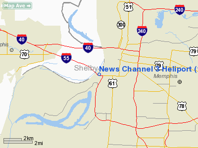
Location & QuickFacts
| FAA Information Effective: | 2008-09-25 |
| Airport Identifier: | 14TN |
| Airport Status: | Operational |
| Longitude/Latitude: | 090-04-17.0000W/35-07-35.0000N
-90.071389/35.126389 (Estimated) |
| Elevation: | 300 ft / 91.44 m (Estimated) |
| Land: | 0 acres |
| From nearest city: | 0 nautical miles N of Memphis, TN |
| Location: | Shelby County, TN |
| Magnetic Variation: | 01E (2000) |
Owner & Manager
| Ownership: | Privately owned |
| Owner: | Wreg-tv |
| Address: | 803 Channel 3 Dr
Memphis, TN 38103 |
| Phone number: | 901-543-2100 |
| Manager: | Wreg-tv |
| Address: | 803 Channel 3 Dr
Memphis, TN 38103 |
| Phone number: | 901-543-2100 |
Airport Operations and Facilities
| Airport Use: | Private
MEDICAL USE. |
| Wind indicator: | Yes |
| Segmented Circle: | No |
| Control Tower: | No |
| Sectional chart: | Memphis |
| Region: | ASO - Southern |
| Boundary ARTCC: | ZME - Memphis |
| Tie-in FSS: | MKL - Jackson |
| FSS Toll Free: | 1-800-WX-BRIEF |
Runway Information
Helipad H1
| Dimension: | 150 x 150 ft / 45.7 x 45.7 m |
| Surface: | TURF, |
| |
Runway H1 |
Runway |
| Traffic Pattern: | Left | Left |
|
Radio Navigation Aids
| ID |
Type |
Name |
Ch |
Freq |
Var |
Dist |
| ME | NDB | Elvis | | 287.00 | 01E | 3.9 nm |
| SPQ | NDB | Spain | | 414.00 | 04E | 4.6 nm |
| AWM | NDB | West Memphis | | 362.00 | 01E | 8.0 nm |
| MIG | NDB | Millington | | 232.00 | 04E | 11.4 nm |
| OLV | NDB | Olive Branch | | 275.00 | 01E | 16.5 nm |
| FYE | NDB | Somerville | | 255.00 | 00E | 33.7 nm |
| BPW | NDB | Osceola | | 239.00 | 02E | 34.2 nm |
| FCY | NDB | Forrest City | | 332.00 | 01E | 36.3 nm |
| COO | NDB | Covington | | 326.00 | 02E | 36.6 nm |
| HEE | NDB | Thompson-robbins | | 251.00 | 01E | 44.8 nm |
| MXA | NDB | Manila | | 282.00 | 01E | 46.2 nm |
| GOJ | VOR | Gosnell | | 111.80 | 01E | 50.0 nm |
| GQE | VOR/DME | Gilmore | 077X | 113.00 | 04E | 24.0 nm |
| UJM | VOR/DME | Marvell | 033X | 109.60 | 01E | 44.5 nm |
| MEM | VORTAC | Memphis | 122X | 117.50 | 01E | 8.0 nm |
| HLI | VORTAC | Holly Springs | 071X | 112.40 | 03E | 35.5 nm |
| MEM | VOT | Memphis Metropolitn | | 111.00 | | 6.5 nm |
Remarks
- OWNER REQUESTS CHARTING.
- PRVDD LANDING AREA IS APPROPRIATELY MARKED; WIND INDICATOR IS MAINTAINED; AND NO NIGHT HELO OPNS UNLESS A LIGHTED WIND INDICATOR AND A HELIPORT BEACON ARE INSTALLED.
Images and information placed above are from
http://www.airport-data.com/airport/14TN/
We thank them for the data!
| General Info
|
| Country |
United States
|
| State |
TENNESSEE
|
| FAA ID |
14TN
|
| Latitude |
35-07-35.000N
|
| Longitude |
090-04-17.000W
|
| Elevation |
300 feet
|
| Near City |
MEMPHIS
|
We don't guarantee the information is fresh and accurate. The data may
be wrong or outdated.
For more up-to-date information please refer to other sources.
|
|


