 |
|
Location & QuickFacts
| FAA Information Effective: | 2008-09-25 |
| Airport Identifier: | TN47 |
| Airport Status: | Operational |
| Longitude/Latitude: | 089-44-28.2960W/35-17-20.3110N
-89.741193/35.288975 (Estimated) |
| Elevation: | 289 ft / 88.09 m (Estimated) |
| Land: | 3 acres |
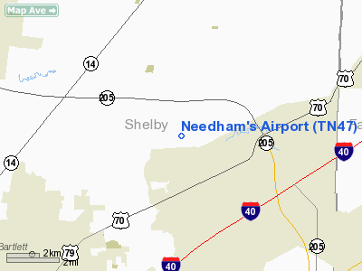
| From nearest city: | 4 nautical miles W of Arlington, TN |
| Location: | Shelby County, TN |
| Magnetic Variation: | 02E (1985) |
Owner & Manager
| Ownership: | Privately owned |
| Owner: | L. & M. Needham |
| Address: | 9596 Stewart Rd
Arlington, TN 38002-9536 |
| Phone number: | 901-829-4928 |
| Manager: | L. & M. Needham |
| Address: | 9596 Stewart Rd
Arlington, TN 38002-9536 |
| Phone number: | 901-829-4928 |
Airport Operations and Facilities
| Airport Use: | Private |
| Wind indicator: | Yes |
| Segmented Circle: | No |
| Control Tower: | No |
| Landing fee charge: | No |
| Sectional chart: | Memphis |
| Region: | ASO - Southern |
| Boundary ARTCC: | ZME - Memphis |
| Tie-in FSS: | MKL - Jackson |
| FSS on Airport: | No |
| FSS Toll Free: | 1-800-WX-BRIEF |
Runway Information
Runway 18/36
| Dimension: | 2500 x 50 ft / 762.0 x 15.2 m |
| Surface: | TURF, |
| |
Runway 18 |
Runway 36 |
| Traffic Pattern: | Left | Left |
|
Radio Navigation Aids
| ID |
Type |
Name |
Ch |
Freq |
Var |
Dist |
| MIG | NDB | Millington | | 232.00 | 04E | 9.4 nm |
| SPQ | NDB | Spain | | 414.00 | 04E | 16.1 nm |
| FYE | NDB | Somerville | | 255.00 | 00E | 17.8 nm |
| OLV | NDB | Olive Branch | | 275.00 | 01E | 18.7 nm |
| COO | NDB | Covington | | 326.00 | 02E | 19.6 nm |
| ME | NDB | Elvis | | 287.00 | 01E | 21.2 nm |
| AWM | NDB | West Memphis | | 362.00 | 01E | 25.8 nm |
| BPW | NDB | Osceola | | 239.00 | 02E | 27.7 nm |
| BAV | NDB | Hardeman | | 404.00 | 01E | 34.6 nm |
| IUI | NDB | Hicks | | 350.00 | 01E | 39.3 nm |
| MXA | NDB | Manila | | 282.00 | 01E | 41.5 nm |
| DNT | NDB | Nally Dunston | | 343.00 | 01W | 45.5 nm |
| GOJ | VOR | Gosnell | | 111.80 | 01E | 41.0 nm |
| GQE | VOR/DME | Gilmore | 077X | 113.00 | 04E | 36.3 nm |
| MKL | VOR/DME | Mc Kellar | 057X | 112.00 | 02E | 44.9 nm |
| MEM | VORTAC | Memphis | 122X | 117.50 | 01E | 20.3 nm |
| HLI | VORTAC | Holly Springs | 071X | 112.40 | 03E | 33.4 nm |
| DYR | VORTAC | Dyersburg | 115X | 116.80 | 03E | 48.5 nm |
| MEM | VOT | Memphis Metropolitn | | 111.00 | | 18.5 nm |
Remarks
- VFR OPERATIONS/PRIVATE USE
Images and information placed above are from
http://www.airport-data.com/airport/TN47/
We thank them for the data!
| General Info
|
| Country |
United States
|
| State |
TENNESSEE
|
| FAA ID |
TN47
|
| Latitude |
35-17-20.311N
|
| Longitude |
089-44-28.296W
|
| Elevation |
289 feet
|
| Near City |
ARLINGTON
|
We don't guarantee the information is fresh and accurate. The data may
be wrong or outdated.
For more up-to-date information please refer to other sources.
|
|


