 |
|
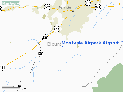
Location & QuickFacts
| FAA Information Effective: | 2008-09-25 |
| Airport Identifier: | TN87 |
| Airport Status: | Operational |
| Longitude/Latitude: | 083-59-55.6560W/35-41-33.2970N
-83.998793/35.692583 (Estimated) |
| Elevation: | 1030 ft / 313.94 m (Estimated) |
| Land: | 0 acres |
| From nearest city: | 1 nautical miles S of Maryville, TN |
| Location: | Blount County, TN |
| Magnetic Variation: | 03W (1984) |
Owner & Manager
| Ownership: | Privately owned |
| Owner: | Montvale Airpark Inc |
| Address: | 2432 Montvale Air Park Rd
Maryville, TN 37803 |
| Phone number: | 865-980-3343 |
| Manager: | Andy Mckevitz |
| Address: | 2432 Montvale Air Park Rd
Maryville, TN 37803 |
| Phone number: | 865-980-3343 |
Airport Operations and Facilities
| Airport Use: | Private |
| Wind indicator: | Yes |
| Segmented Circle: | No |
| Control Tower: | No |
| Lighting Schedule: | PHONE REQ
FOR ROTG BCN CALL 865-977-0526. |
| Beacon Color: | Clear (unlighted land airport) |
| Landing fee charge: | No |
| Sectional chart: | Atlanta |
| Region: | ASO - Southern |
| Boundary ARTCC: | ZTL - Atlanta |
| Tie-in FSS: | BNA - Nashville |
| FSS on Airport: | No |
| FSS Toll Free: | 1-800-WX-BRIEF |
Runway Information
Runway 03/21
| Dimension: | 2700 x 35 ft / 823.0 x 10.7 m |
| Surface: | ASPH, |
| Edge Lights: | Low |
| |
Runway 03 |
Runway 21 |
| Traffic Pattern: | Left | Left |
|
Radio Navigation Aids
| ID |
Type |
Name |
Ch |
Freq |
Var |
Dist |
| MNV | NDB | Madisonville | | 361.00 | 04W | 20.8 nm |
| MMI | NDB | Mc Minn County | | 242.00 | 03W | 32.8 nm |
| TTQ | NDB | Tomotla | | 335.00 | 01W | 34.7 nm |
| JXT | NDB | Jefferson | | 346.00 | 04W | 35.8 nm |
| JAU | NDB | Jacksboro | | 204.00 | 03W | 39.6 nm |
| DTE | NDB | Mark Anton | | 394.00 | 02W | 47.3 nm |
| VXV | VORTAC | Volunteer | 111X | 116.40 | 03W | 13.7 nm |
| HRS | VORTAC | Harris | 035X | 109.80 | 00E | 45.2 nm |
| SOT | VORTAC | Snowbird | 025X | 108.80 | 04W | 46.5 nm |
| HCH | VORTAC | Hinch Mountain | 123X | 117.60 | 02W | 48.1 nm |
| TYS | VOT | Knoxville | | 112.00 | | 7.2 nm |
Remarks
Images and information placed above are from
http://www.airport-data.com/airport/TN87/
We thank them for the data!
| General Info
|
| Country |
United States
|
| State |
TENNESSEE
|
| FAA ID |
TN87
|
| Latitude |
35-41-33.297N
|
| Longitude |
083-59-55.656W
|
| Elevation |
1030 feet
|
| Near City |
MARYVILLE
|
We don't guarantee the information is fresh and accurate. The data may
be wrong or outdated.
For more up-to-date information please refer to other sources.
|
|


