 |
|
| Monroe County Airport |
| IATA: none – ICAO: KMNV – FAA LID: MNV |
| Summary |
| Airport type |
Public |
| Owner |
Monroe County |
| Serves |
Madisonville, Tennessee |
| Elevation AMSL |
1,031 ft / 314 m |
| Coordinates |
35°32′43″N 084°22′49″W / 35.54528°N 84.38028°W / 35.54528; -84.38028 |
| Runways |
| Direction |
Length |
Surface |
| ft |
m |
| 5/23 |
3,641 |
1,110 |
Asphalt |
| Statistics (2009) |
| Aircraft operations |
10,800 |
| Based aircraft |
19 |
| Source: Federal Aviation Administration |
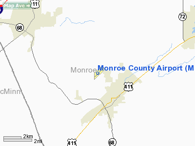
Monroe County Airport (ICAO: KMNV, FAA LID: MNV) is a county-owned, public-use airport located two nautical miles (3.7 km) northwest of the central business district of Madisonville, a town in Monroe County, Tennessee, United States.
Although most U.S. airports use the same three-letter location identifier for the FAA and IATA, Monroe County Airport is assigned MNV by the FAA but has no designation from the IATA.
Facilities and aircraft
Monroe County Airport covers an area of 56 acres (23 ha) at an elevation of 1,031 feet (314 m) above mean sea level. It has one runway designated 5/23 with an asphalt surface measuring 3,641 by 75 feet (1,110 x 23 m).
For the 12-month period ending November 12, 2009, the airport had 10,800 aircraft operations, an average of 29 per day: 97% general aviation, 2% air taxi, and 1% military. At that time there were 19 aircraft based at this airport: 79% single-engine and 21% multi-engine.
The above content comes from Wikipedia and is published under free licenses – click here to read more.
Location & QuickFacts
| FAA Information Effective: | 2008-09-25 |
| Airport Identifier: | MNV |
| Airport Status: | Operational |
| Longitude/Latitude: | 084-22-49.4350W/35-32-42.8450N
-84.380399/35.545235 (Estimated) |
| Elevation: | 1031 ft / 314.25 m (Surveyed) |
| Land: | 56 acres |
| From nearest city: | 2 nautical miles NW of Madisonville, TN |
| Location: | Monroe County, TN |
| Magnetic Variation: | 04W (2005) |
Owner & Manager
| Ownership: | Publicly owned |
| Owner: | Monroe County |
| Address: | Monroe Co Courthouse, 105 College Street, Suite 1
Madisonville, TN 37354 |
| Phone number: | 423-442-3981 |
| Manager: | Larry Hamilton |
| Address: | 350 Airport Road
Madisonville, TN 37354 |
| Phone number: | 423-442-4506 |
Airport Operations and Facilities
| Airport Use: | Open to public |
| Wind indicator: | Yes |
| Segmented Circle: | Yes |
| Control Tower: | No |
| Lighting Schedule: | DUSK-DAWN |
| Beacon Color: | Clear-Green (lighted land airport) |
| Landing fee charge: | No |
| Sectional chart: | Atlanta |
| Region: | ASO - Southern |
| Boundary ARTCC: | ZTL - Atlanta |
| Tie-in FSS: | BNA - Nashville |
| FSS on Airport: | No |
| FSS Toll Free: | 1-800-WX-BRIEF |
| NOTAMs Facility: | BNA (NOTAM-d service avaliable) |
| Federal Agreements: | NGY |
Airport Communications
| CTAF: | 123.000 |
| Unicom: | 123.000 |
Airport Services
| Fuel available: | 100LLA1+ |
| Airframe Repair: | MAJOR |
| Power Plant Repair: | MAJOR |
| Bottled Oxygen: | NONE |
| Bulk Oxygen: | NONE |
Runway Information
Runway 05/23
| Dimension: | 3641 x 75 ft / 1109.8 x 22.9 m
RY 5/23 EXTDD 140 FT SOUTH END. |
| Surface: | ASPH, |
| Weight Limit: | Single wheel: 22000 lbs.
Dual wheel: 35000 lbs. |
| Edge Lights: | Medium |
| |
Runway 05 |
Runway 23 |
| Longitude: | 084-23-04.6800W | 084-22-34.1900W |
| Latitude: | 35-32-29.8500N | 35-32-55.8400N |
| Elevation: | 1030.00 ft | 1002.00 ft |
| Alignment: | 44 | 127 |
| Traffic Pattern: | Left | Left |
| Markings: | Non-precision instrument, Good Condition | Non-precision instrument, Good Condition |
| Crossing Height: | 20.00 ft | 20.00 ft |
| Displaced threshold: | 0.00 ft | 140.00 ft |
| VASI: | 2-light PAPI on left side | 2-light PAPI on left side |
| Visual Glide Angle: | 3.00° | 3.00° |
| Runway End Identifier: | Yes
RY 05 REIL OTS INDEFLY. | Yes
RY 23 REIL OTS INDEFLY. |
| Obstruction: | 44 ft tree, 1202.0 ft from runway, 68 ft left of centerline, 23:1 slope to clear | 12 ft tree, 246.0 ft from runway, 68 ft left of centerline, 4:1 slope to clear
APCH RATIO 32:1 TO DSPLCD THLD. |
|
Radio Navigation Aids
| ID |
Type |
Name |
Ch |
Freq |
Var |
Dist |
| MNV | NDB | Madisonville | | 361.00 | 04W | 0.1 nm |
| MMI | NDB | Mc Minn County | | 242.00 | 03W | 12.7 nm |
| DTE | NDB | Mark Anton | | 394.00 | 02W | 27.2 nm |
| TTQ | NDB | Tomotla | | 335.00 | 01W | 33.1 nm |
| HDI | NDB | Hardwick | | 369.00 | 01W | 34.9 nm |
| CQN | NDB | Daisy | | 341.00 | 02W | 44.4 nm |
| JAU | NDB | Jacksboro | | 204.00 | 03W | 48.8 nm |
| VXV | VORTAC | Volunteer | 111X | 116.40 | 03W | 32.1 nm |
| HCH | VORTAC | Hinch Mountain | 123X | 117.60 | 02W | 32.5 nm |
| HRS | VORTAC | Harris | 035X | 109.80 | 00E | 42.8 nm |
| TYS | VOT | Knoxville | | 112.00 | | 24.8 nm |
Images and information placed above are from
http://www.airport-data.com/airport/MNV/
We thank them for the data!
| General Info
|
| Country |
United States
|
| State |
TENNESSEE
|
| FAA ID |
MNV
|
| Latitude |
35-32-43.340N
|
| Longitude |
084-22-48.846W
|
| Elevation |
1031 feet
|
| Near City |
MADISONVILLE
|
We don't guarantee the information is fresh and accurate. The data may
be wrong or outdated.
For more up-to-date information please refer to other sources.
|
|


