 |
|
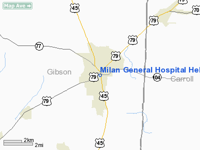
Milan General Hospital Heliport |
Location & QuickFacts
| FAA Information Effective: | 2008-09-25 |
| Airport Identifier: | 6TN6 |
| Airport Status: | Operational |
| Longitude/Latitude: | 088-45-13.0000W/35-54-46.0000N
-88.753611/35.912778 (Estimated) |
| Elevation: | 424 ft / 129.24 m (Estimated) |
| Land: | 0 acres |
| From nearest city: | 1 nautical miles N of Milan, TN |
| Location: | Gibson County, TN |
| Magnetic Variation: | 01E (1990) |
Owner & Manager
| Ownership: | Privately owned |
| Owner: | Milan General Hospital |
| Address: | 4039 South Highland
Milan, TN 38358 |
| Phone number: | 731-686-1591 |
| Manager: | Matt Copous |
| Address: | 4039 South Highland
Milan, TN 38358 |
| Phone number: | 731-686-1591 |
Airport Operations and Facilities
| Airport Use: | Private
MEDICAL USE. |
| Segmented Circle: | No |
| Control Tower: | No |
| Sectional chart: | Memphis |
| Region: | ASO - Southern |
| Boundary ARTCC: | ZME - Memphis |
| Tie-in FSS: | MKL - Jackson |
| FSS on Airport: | No |
| FSS Toll Free: | 1-800-WX-BRIEF |
Runway Information
Helipad H1
| Dimension: | 40 x 40 ft / 12.2 x 12.2 m |
| Surface: | ASPH, |
| |
Runway H1 |
Runway |
| Traffic Pattern: | Left | Left |
|
Radio Navigation Aids
| ID |
Type |
Name |
Ch |
Freq |
Var |
Dist |
| TGC | NDB | Gibson | | 378.00 | 01E | 4.9 nm |
| HZD | NDB | Huntingdon | | 217.00 | 00E | 17.5 nm |
| UC | NDB | Obion | | 212.00 | 00E | 25.9 nm |
| TIQ | NDB | Trainer | | 410.00 | 00E | 26.1 nm |
| DNT | NDB | Nally Dunston | | 343.00 | 01W | 32.1 nm |
| SZY | NDB | Sibley | | 386.00 | 01E | 42.3 nm |
| BAV | NDB | Hardeman | | 404.00 | 01E | 44.3 nm |
| COO | NDB | Covington | | 326.00 | 02E | 45.1 nm |
| GGK | NDB | Mayfield | | 401.00 | 00E | 47.4 nm |
| HHY | NDB | Pinhook | | 346.00 | 01W | 47.8 nm |
| MKL | VOR/DME | Mc Kellar | 057X | 112.00 | 02E | 20.1 nm |
| JKS | VOR/DME | Jacks Creek | 031X | 109.40 | 02E | 27.0 nm |
| DYR | VORTAC | Dyersburg | 115X | 116.80 | 03E | 28.2 nm |
Remarks
- VFR; PRIVATE USE; OPNS CONDUCTED FROM 135 DEGS TO 155 DEGS & FROM 225 DEGS TO 245 DEGS; AREA IS MARKED; WIND INDICATOR IS MAINTAINED.
Images and information placed above are from
http://www.airport-data.com/airport/6TN6/
We thank them for the data!
| General Info
|
| Country |
United States
|
| State |
TENNESSEE
|
| FAA ID |
6TN6
|
| Latitude |
35-54-46.000N
|
| Longitude |
088-45-13.000W
|
| Elevation |
424 feet
|
| Near City |
MILAN
|
We don't guarantee the information is fresh and accurate. The data may
be wrong or outdated.
For more up-to-date information please refer to other sources.
|
|


