 |
|
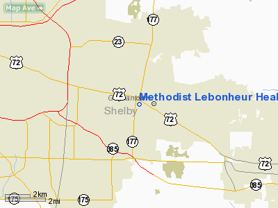
Methodist Lebonheur Healthcare Heliport |
Location & QuickFacts
| FAA Information Effective: | 2008-09-25 |
| Airport Identifier: | TN69 |
| Airport Status: | Operational |
| Longitude/Latitude: | 089-48-26.0000W/35-05-21.0000N
-89.807222/35.089167 (Estimated) |
| Elevation: | 285 ft / 86.87 m (Estimated) |
| Land: | 0 acres |
| From nearest city: | 0 nautical miles N of Germantown, TN |
| Location: | Shelby County, TN |
| Magnetic Variation: | 00E (2000) |
Owner & Manager
| Ownership: | Privately owned |
| Owner: | Methodist Lebonheur Healthcare |
| Address: | Germantown Hospital, 7961 Poplar Avenue
Germantown, TN 38138 |
| Phone number: | 901-516-6967 |
| Manager: | Jerry Ferguson |
| Address: | 7691 Poplar Avenue
Germantown, TN 38138 |
| Phone number: | 901-516-6967 |
Airport Operations and Facilities
| Airport Use: | Private
MEDICAL USE. |
| Wind indicator: | Yes |
| Segmented Circle: | No |
| Control Tower: | No |
| Lighting Schedule: | PHONE REQ
FOR PERIMETER LGTS CALL 901-757-6967. |
| Sectional chart: | Memphis |
| Region: | ASO - Southern |
| Boundary ARTCC: | ZME - Memphis |
| Tie-in FSS: | MKL - Jackson |
| FSS Toll Free: | 1-800-WX-BRIEF |
Runway Information
Helipad H1
| Dimension: | 24 x 24 ft / 7.3 x 7.3 m |
| Surface: | ASPH, |
| |
Runway H1 |
Runway |
| Traffic Pattern: | Left | Left |
|
Radio Navigation Aids
| ID |
Type |
Name |
Ch |
Freq |
Var |
Dist |
| OLV | NDB | Olive Branch | | 275.00 | 01E | 6.6 nm |
| MIG | NDB | Millington | | 232.00 | 04E | 13.0 nm |
| ME | NDB | Elvis | | 287.00 | 01E | 13.1 nm |
| SPQ | NDB | Spain | | 414.00 | 04E | 13.8 nm |
| AWM | NDB | West Memphis | | 362.00 | 01E | 21.1 nm |
| FYE | NDB | Somerville | | 255.00 | 00E | 21.6 nm |
| COO | NDB | Covington | | 326.00 | 02E | 32.0 nm |
| BPW | NDB | Osceola | | 239.00 | 02E | 37.7 nm |
| BAV | NDB | Hardeman | | 404.00 | 01E | 38.3 nm |
| FCY | NDB | Forrest City | | 332.00 | 01E | 48.4 nm |
| GQE | VOR/DME | Gilmore | 077X | 113.00 | 04E | 36.4 nm |
| MEM | VORTAC | Memphis | 122X | 117.50 | 01E | 9.7 nm |
| HLI | VORTAC | Holly Springs | 071X | 112.40 | 03E | 24.5 nm |
| MEM | VOT | Memphis Metropolitn | | 111.00 | | 8.8 nm |
Remarks
- 41 FT BLDG 214 FT SOUTH OF HELIPAD.
- PRVDD VFR OPNS, PVT USE.
Images and information placed above are from
http://www.airport-data.com/airport/TN69/
We thank them for the data!
| General Info
|
| Country |
United States
|
| State |
TENNESSEE
|
| FAA ID |
TN69
|
| Latitude |
35-05-21.000N
|
| Longitude |
089-48-26.000W
|
| Elevation |
285 feet
|
| Near City |
GERMANTOWN
|
We don't guarantee the information is fresh and accurate. The data may
be wrong or outdated.
For more up-to-date information please refer to other sources.
|
|


