 |
|
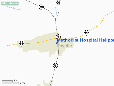
Methodist Hospital Heliport |
Location & QuickFacts
| FAA Information Effective: | 2008-09-25 |
| Airport Identifier: | TN27 |
| Airport Status: | Operational |
| Longitude/Latitude: | 089-21-09.2570W/35-14-07.3090N
-89.352571/35.235364 (Estimated) |
| Elevation: | 400 ft / 121.92 m (Estimated) |
| Land: | 0 acres |
| From nearest city: | 0 nautical miles N of Somerville, TN |
| Location: | Fayette County, TN |
| Magnetic Variation: | 02E (1985) |
Owner & Manager
| Ownership: | Privately owned |
| Owner: | Methodist Hosp Of Fayette |
| Address: | 214 Lakeview Drive
Somerville, TN 38068 |
| Phone number: | 901-516-4000 |
| Manager: | David Crislip, Admin |
| Address: | 214 Lakeview Drive
Somerville, TN 38068 |
| Phone number: | 901-516-4000 |
Airport Operations and Facilities
| Airport Use: | Private
MEDICAL USE. |
| Wind indicator: | Yes |
| Segmented Circle: | No |
| Control Tower: | No |
| Lighting Schedule: | DUSK-DAWN |
| Sectional chart: | New Orleans |
| Region: | ASO - Southern |
| Boundary ARTCC: | ZME - Memphis |
| Tie-in FSS: | MKL - Jackson |
| FSS Toll Free: | 1-800-WX-BRIEF |
Runway Information
Helipad H1
| Dimension: | 30 x 30 ft / 9.1 x 9.1 m |
| Surface: | CONC, |
| |
Runway H1 |
Runway |
| Traffic Pattern: | Left | Left |
|
Radio Navigation Aids
| ID |
Type |
Name |
Ch |
Freq |
Var |
Dist |
| FYE | NDB | Somerville | | 255.00 | 00E | 2.6 nm |
| BAV | NDB | Hardeman | | 404.00 | 01E | 15.3 nm |
| COO | NDB | Covington | | 326.00 | 02E | 24.2 nm |
| OLV | NDB | Olive Branch | | 275.00 | 01E | 26.4 nm |
| MIG | NDB | Millington | | 232.00 | 04E | 28.6 nm |
| SPQ | NDB | Spain | | 414.00 | 04E | 34.4 nm |
| ME | NDB | Elvis | | 287.00 | 01E | 36.9 nm |
| SZY | NDB | Sibley | | 386.00 | 01E | 41.1 nm |
| BPW | NDB | Osceola | | 239.00 | 02E | 42.4 nm |
| AWM | NDB | West Memphis | | 362.00 | 01E | 43.6 nm |
| DNT | NDB | Nally Dunston | | 343.00 | 01W | 45.7 nm |
| IUI | NDB | Hicks | | 350.00 | 01E | 48.3 nm |
| TGC | NDB | Gibson | | 378.00 | 01E | 48.6 nm |
| MKL | VOR/DME | Mc Kellar | 057X | 112.00 | 02E | 31.0 nm |
| HLI | VORTAC | Holly Springs | 071X | 112.40 | 03E | 28.8 nm |
| MEM | VORTAC | Memphis | 122X | 117.50 | 01E | 33.7 nm |
| DYR | VORTAC | Dyersburg | 115X | 116.80 | 03E | 47.1 nm |
| MEM | VOT | Memphis Metropolitn | | 111.00 | | 32.7 nm |
Remarks
- VFR PVT USE; APP/DEP OPERATIONS ARE FROM 150 TO 300 DEGS; AREA IS MARKED; WIND INDIC IS MAINTAINED.
Images and information placed above are from
http://www.airport-data.com/airport/TN27/
We thank them for the data!
| General Info
|
| Country |
United States
|
| State |
TENNESSEE
|
| FAA ID |
TN27
|
| Latitude |
35-14-07.309N
|
| Longitude |
089-21-09.257W
|
| Elevation |
400 feet
|
| Near City |
SOMERVILLE
|
We don't guarantee the information is fresh and accurate. The data may
be wrong or outdated.
For more up-to-date information please refer to other sources.
|
|


