 |
|
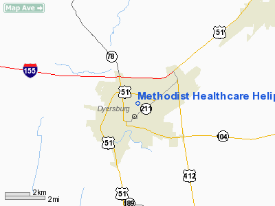
Methodist Healthcare Heliport |
Location & QuickFacts
| FAA Information Effective: | 2008-09-25 |
| Airport Identifier: | 1TN4 |
| Airport Status: | Operational |
| Longitude/Latitude: | 089-22-48.0000W/36-02-58.0000N
-89.380000/36.049444 (Estimated) |
| Elevation: | 312 ft / 95.10 m (Estimated) |
| Land: | 11 acres |
| From nearest city: | 1 nautical miles N of Dyersburg, TN |
| Location: | Dyer County, TN |
| Magnetic Variation: | () |
Owner & Manager
| Ownership: | Privately owned |
| Owner: | Methodist Healthcare |
| Address: | 400 Tickle Street East
Dyersburg, TN 38024 |
| Phone number: | 731-288-4781 |
| Manager: | Wanda Browning
CONTACT: DAN FOWLKES 731-288-4781 |
| Address: | 400 Tickle Street East
Dyersburg, TN 38002 |
| Phone number: | 731-288-4781 |
Airport Operations and Facilities
| Airport Use: | Private |
| Wind indicator: | Yes |
| Segmented Circle: | No |
| Control Tower: | No |
| Lighting Schedule: | DUSK-DAWN |
| Beacon Color: | Clear-Green-Yellow (heliport) |
| Sectional chart: | St Louis |
| Region: | ASO - Southern |
| Boundary ARTCC: | ZME - Memphis |
| Tie-in FSS: | MKL - Jackson |
| FSS Toll Free: | 1-800-WX-BRIEF |
Runway Information
Helipad H1
| Dimension: | 50 x 50 ft / 15.2 x 15.2 m |
| Surface: | CONC, |
| |
Runway H1 |
Runway |
| Traffic Pattern: | Left | Left |
|
Radio Navigation Aids
| ID |
Type |
Name |
Ch |
Freq |
Var |
Dist |
| DNT | NDB | Nally Dunston | | 343.00 | 01W | 3.5 nm |
| IUI | NDB | Hicks | | 350.00 | 01E | 23.1 nm |
| UC | NDB | Obion | | 212.00 | 00E | 23.9 nm |
| TGC | NDB | Gibson | | 378.00 | 01E | 26.6 nm |
| COO | NDB | Covington | | 326.00 | 02E | 29.4 nm |
| TKX | NDB | Kennett | | 358.00 | 00E | 33.8 nm |
| BPW | NDB | Osceola | | 239.00 | 02E | 37.6 nm |
| MXA | NDB | Manila | | 282.00 | 01E | 39.0 nm |
| HZD | NDB | Huntingdon | | 217.00 | 00E | 44.4 nm |
| CHQ | NDB | Charleston | | 208.00 | 01E | 47.8 nm |
| TIQ | NDB | Trainer | | 410.00 | 00E | 48.3 nm |
| GOJ | VOR | Gosnell | | 111.80 | 01E | 27.9 nm |
| MKL | VOR/DME | Mc Kellar | 057X | 112.00 | 02E | 35.2 nm |
| DYR | VORTAC | Dyersburg | 115X | 116.80 | 03E | 3.6 nm |
| MAW | VORTAC | Malden | 049X | 111.20 | 03E | 39.8 nm |
Remarks
- PRVDD VFR PVT APCH/DEP ROUTE OPERATIONS FROM 010-110 AND 250-320 AND 190-290 AND 070-140 ARE IS MKD AND WIND INDICATOR IS MAINTAINED.
Images and information placed above are from
http://www.airport-data.com/airport/1TN4/
We thank them for the data!
|
|


