|
|
Coordinates: 35°02′33″N 089°58′36″W / 35.0425°N 89.97667°W / 35.0425; -89.97667
| Memphis International Airport |
 |
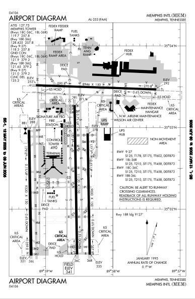
| FAA airport diagram |
| IATA: MEM – ICAO: KMEM – FAA LID: MEM
Location of the Memphis International Airport
|
| Summary |
| Airport type |
Public |
| Owner/Operator |
Memphis - Shelby County Airport Authority |
| Serves |
Memphis, Tennessee |
| Hub for |
- Delta Air Lines
- FedEx Express
- SeaPort Airlines
|
| Elevation AMSL |
341 ft / 104 m |
| Website |
www.mscaa.com |
| Runways |
| Direction |
Length |
Surface |
| ft |
m |
| 18C/36C |
11,120 |
3,389 |
Concrete |
| 18L/36R |
9,000 |
2,743 |
Concrete |
| 18R/36L |
9,320 |
2,841 |
Concrete |
| 9/27 |
8,946 |
2,727 |
Asphalt |
| Statistics (2009) |
| Aircraft operations |
349,448 |
| Based aircraft |
64 |
| Sources: FAA & airport website |
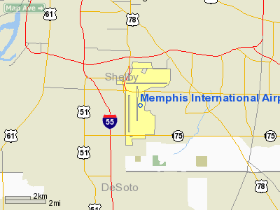
Memphis International Airport (IATA: MEM, ICAO: KMEM, FAA LID: MEM) is a joint civil-military public airport located three miles (5 km) south of the central business district of Memphis, a city in Shelby County, Tennessee, United States. It is owned and operated by the Memphis - Shelby County Airport Authority.
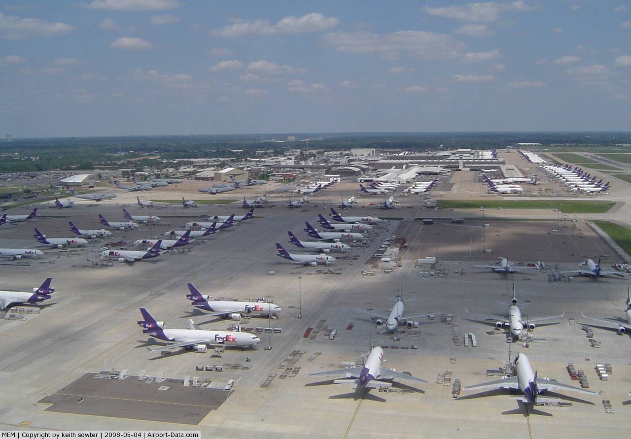
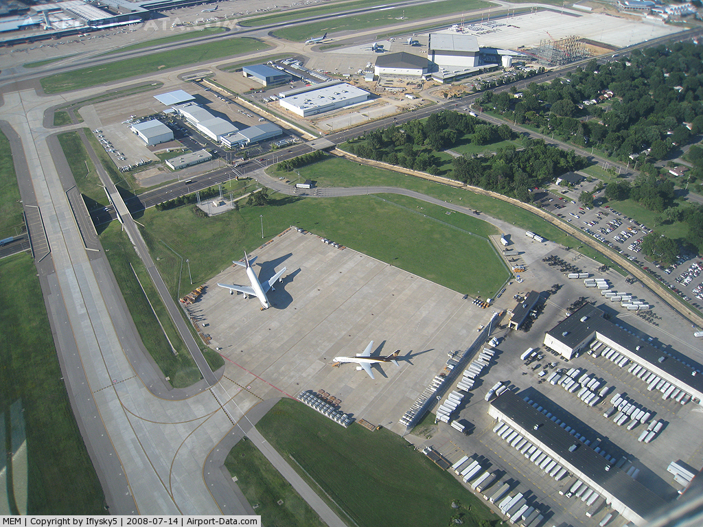
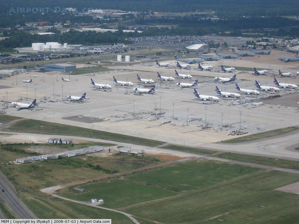
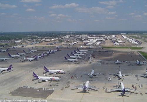
Memphis International Airport is home to the main FedEx Express global "SuperHub", which processes a significant portion of the freight carrier's packages. Nonstop FedEx destinations from Memphis include scores of cities across the continental U.S., plus Anchorage and Honolulu, as well as numerous Canadian, Mexican, and Caribbean cities. Intercontinental nonstops include Paris, London, Frankfurt, Sao Paulo, Shanghai, and Tokyo.
Because of the FedEx Express "SuperHub", Memphis since 1993 has had the largest cargo operations by volume of any airport worldwide.
Memphis serves as a hub for Delta Air Lines, with routes to destinations throughout North America, as well as a daily nonstop flight to Amsterdam. History
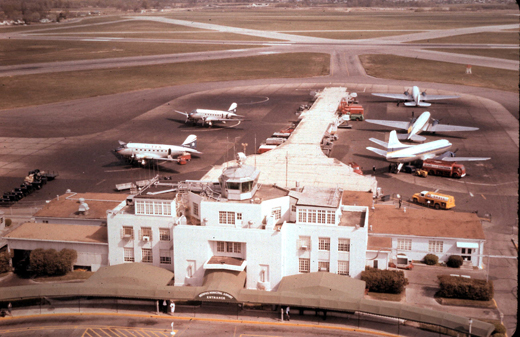 | |
Memphis Municipal Airport, 1962, photographed from the then-new control tower. |
Memphis Municipal Airport opened on a 200 acre (0.8 km²) plot of farmland just over seven miles (10 km) from downtown Memphis. During its early years, the airport consisted of three hangars and an unpaved runway. Passenger and air mail service was provided by American Airlines and Chicago and Southern Air Lines. In 1939, four new carriers won route awards to serve Memphis: Braniff Airways, Capital Airlines, Eastern Air Lines, and Southern Airways.
During World War II the airfield was used by the United States Army Air Force Air Transport Command 4th Ferrying Group for movement of new aircraft from the United States to overseas locations.
The current terminal opened on June 7, 1963 and Memphis Municipal changed its name to Memphis International in 1969. However, the airport had no non-stop international routes until 1995, when KLM began service to Amsterdam. Currently, service to Amsterdam is operated by Delta.
FedEx Express established its freight hub in Memphis in 1973, and Republic Airlines established a passenger hub in 1985, which was absorbed into Northwest in 1986. In 2008, Delta Air Lines bought Northwest Airlines and rebranded the entire Memphis operation. Memphis now serves as a hub for Delta Air Lines. Prior to the Delta/Northwest merger, Memphis had been a hub for Delta many years after its acquisition of Chicago and Southern Air Lines. The original Delta hub ceased operations in the late 1970s and resumed on December 31, 2009.
Since 2009, the airport has also been a hub for small regional airline, SeaPort Airlines which provides single engine plane service to a number of communities in Arkansas through the Essential Air Service program. SeaPort Airlines is based out of the private aviation terminal not the main passenger terminal.
Facilities and aircraft
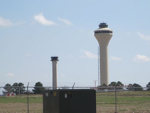 | |
Old (left) and new (right) control tower at Memphis International Airport |
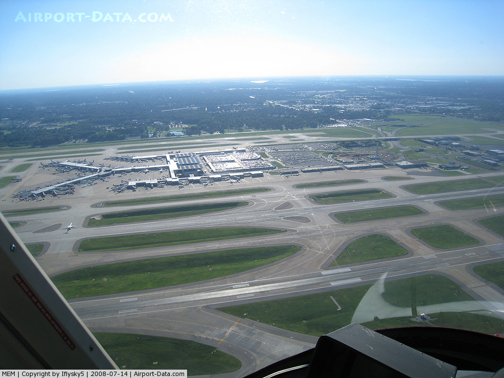
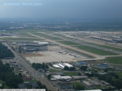
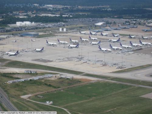
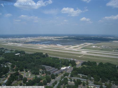
Memphis International Airport covers an area of 3,900 acres (1,600 ha) which contains four paved runways:
- Runway 18C/36C: 11,120 ft × 150 ft (3,389 m × 46 m), Surface: Concrete
- Runway 18L/36R: 9,000 ft × 150 ft (2,743 m × 46 m), Surface: Concrete
- Runway 18R/36L: 9,320 ft × 150 ft (2,841 m × 46 m), Surface: Concrete
- Runway 9/27: 8,946 ft × 150 ft (2,727 m × 46 m), Surface: Asphalt.
Note: Runway 9/27 has reopened for traffic, 30 November 2009, after nine months resurfacing. The new runway has a more durable concrete surface, and opened in time for the peak of the FedEx shipping season.
For the 12-month period ending December 31, 2006, the airport had 392,883 aircraft operations, an average of 1,076 per day: 57% scheduled commercial, 34% air taxi, 9% general aviation, and <1% military. There are 110 aircraft based at this airport: 46% jet, 26% multi-engine, 19% single-engine, and 8% military.
The Memphis Air Route Traffic Control Center (ARTCC) is located on the airport grounds at 3229 Democrat Road, TN 38118.
Terminals, airlines, and destinations
- Terminal A contains 23 gates: A1-A12, A14, A16, A18-A21, A25, A27, A29, A31 and A33.
- Terminal B contains 42 gates: B1-B43 (B21 doesn't exist). Terminal B serves all international arrivals and requires travelers to pass through a TSA security checkpoint after clearing customs. This is required because the customs hall exits into the concourse instead of the main lobby.
- Terminal C contains 18 gates: C1-C5, C7-C11, C12A/C12B, C14A/C14B, C16, C18, C20 and C22.
| Airlines |
Destinations |
Terminal |
| Air Canada Jazz |
Toronto-Pearson |
C |
| AirTran Airways |
Atlanta |
A |
| American Airlines |
Dallas/Fort Worth |
C |
| American Eagle |
Chicago-O'Hare, Miami |
C |
| Continental Express operated by ExpressJet Airlines |
Houston-Intercontinental, Newark |
C |
| Delta Air Lines |
Amsterdam, Atlanta, Boston, Cancún, Chicago-O'Hare, Detroit, Fort Lauderdale, Kansas City, Las Vegas, Little Rock, Los Angeles, Miami, Minneapolis/St. Paul, Montego Bay, New Orleans, New York-LaGuardia, Orlando, Phoenix, Salt Lake City, San Francisco, Tampa, Washington-Reagan
Seasonal: Cozumel, Fort Myers, San Diego, Seattle/Tacoma, Vancouver, West Palm Beach |
B |
| Delta Connection operated by Atlantic Southeast Airlines |
Alexandria, Baton Rouge, Birmingham (AL), Chattanooga, Chicago-O'Hare, Fort Walton Beach, Gulfport/Biloxi, Huntsville, Jackson, Lafayette (LA), Lexington, Little Rock, Monroe, Montgomery, Nashville, Panama City, Raleigh/Durham, Shreveport, St. Louis, Tallahassee, Toronto-Pearson |
A, B, C |
| Delta Connection operated by Chautauqua Airlines |
Cincinnati/Northern Kentucky, Columbus (OH), Louisville, St. Louis |
A, B |
| Delta Connection operated by Comair |
Baltimore, Birmingham (AL), Charlotte, Dallas/Fort Worth, Jackson, Lexington, New York-JFK, Omaha, Philadelphia, St. Louis |
A, B |
| Delta Connection operated by Compass Airlines |
Boston, Charlotte, Minneapolis/St. Paul, Newark |
A, B |
| Delta Connection operated by Mesaba Airlines |
Austin, Boston, Columbus (MS), Dallas/Fort Worth, Denver, Detroit, Fort Smith, Greenville (MS), Hattiesburg/Laurel, Lexington, Minneapolis/St. Paul, Philadelphia, Phoenix, Salt Lake City, Tampa [seasonal], Toronto-Pearson, Tupelo |
A, B |
| Delta Connection operated by Pinnacle Airlines |
Amarillo, Atlanta, Austin, Baltimore, Baton Rouge, Birmingham (AL), Charlotte, Chattanooga, Cleveland, Columbia (MO), Columbus (MS), Columbus (OH), Dallas/Fort Worth, Dallas-Love, Des Moines, Evansville, Fayetteville/Springdale (AR), Fort Smith, Fort Walton Beach, Grand Rapids, Greensboro/High Point/Winston-Salem, Gulfport/Biloxi, Houston-Intercontinental, Huntsville, Indianapolis, Jacksonville, Kansas City, Knoxville, Lafayette (LA), Lexington, Little Rock, Louisville, Lubbock, Madison, McAllen, Milwaukee, Mobile, Moline/Quad Cities, Nashville, Oklahoma City, Omaha, Panama City (FL), Pensacola, Philadelphia, Pittsburgh, Raleigh/Durham, St. Louis, Salt Lake City, San Antonio, Springfield (MO), Tallahassee, Tulsa, Wichita |
A, B, C |
| Delta Connection operated by Shuttle America |
Atlanta, Columbus (OH), Gulfport/Biloxi, Jackson, Tallahassee |
B |
| Delta Connection operated by SkyWest Airlines |
Milwaukee, Salt Lake City, Wichita |
B |
| United Express operated by SkyWest Airlines |
Chicago-O'Hare, Denver |
C |
| United Express operated by Mesa Airlines |
Chicago-O'Hare |
C |
| US Airways |
Charlotte |
C |
| US Airways Express operated by Mesa Airlines |
Charlotte, Phoenix |
C |
| US Airways Express operated by Republic Airlines |
Charlotte |
C |
Private Terminal
SeaPort Airlines is based out of the Signature Air FBO.
| Airlines |
Destinations |
| SeaPort Airlines |
El Dorado, Harrison, Hot Springs, Jonesboro, Kansas City |
Cargo
Memphis is home to the FedEx Express "SuperHub".
| Airlines |
Destinations |
| FedEx Express |
Many variable destinations across the United States and around the world |
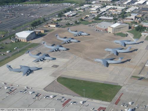
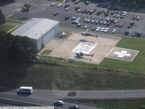
MilitaryThe 164th Airlift Wing of the Tennessee Air National Guard is based at Memphis International Airport, operating the large C-5A transport aircraft.
Accidents and incidents
- On 11 August 1984, Douglas C-47 N70003 of Aviation Enterprises crashed shortly after take-off from Memphis International Airport on a domestic non-scheduled passenger flight to O'Hare International Airport, Chicago. All three people on board were killed. A missing spark plug on the port engine caused a loss of power. Maintenance involving the removal of the spark plugs had been performed the previous day.
The above content comes from Wikipedia and is published under free licenses – click here to read more.
 |
(Click on the photo to enlarge) |
 |
(Click on the photo to enlarge) |
 |
(Click on the photo to enlarge) |
 |
(Click on the photo to enlarge) |
 |
(Click on the photo to enlarge) |
 |
(Click on the photo to enlarge) |
 |
(Click on the photo to enlarge) |
 |
(Click on the photo to enlarge) |
Location & QuickFacts
| FAA Information Effective: | 2008-09-25 |
| Airport Identifier: | MEM |
| Airport Status: | Operational |
| Longitude/Latitude: | 089-58-36.0000W/35-02-32.7000N
-89.976667/35.042417 (Estimated) |
| Elevation: | 341 ft / 103.94 m (Surveyed) |
| Land: | 3900 acres |
| From nearest city: | 3 nautical miles S of Memphis, TN |
| Location: | Shelby County, TN |
| Magnetic Variation: | 01E (2000) |
Owner & Manager
| Ownership: | Publicly owned |
| Owner: | Memphis Shelby Cnty Arpt Auth |
| Address: | 2491 Winchester Rd.
Memphis, TN 38116-3856 |
| Phone number: | 901-922-8000 |
| Manager: | Larry D Cox |
| Address: | 2491 Winchester Rd.
Memphis, TN 38116-3856 |
| Phone number: | 901-922-8000 |
Airport Operations and Facilities
| Airport Use: | Open to public |
| Wind indicator: | Yes |
| Segmented Circle: | No |
| Control Tower: | Yes |
| Lighting Schedule: | DUSK-DAWN |
| Beacon Color: | Clear-Green (lighted land airport) |
| Landing fee charge: | No |
| Sectional chart: | Memphis |
| Region: | ASO - Southern |
| Boundary ARTCC: | ZME - Memphis |
| Tie-in FSS: | MKL - Jackson |
| FSS on Airport: | No |
| FSS Toll Free: | 1-800-WX-BRIEF |
| NOTAMs Facility: | MEM (NOTAM-d service avaliable) |
| Certification type/date: | I C S 02/2005
INDEX D ARFF EQUIPMENT AVAILABLE 24 HOURS PER DAY, 7 DAYS PER WEEK. |
| Federal Agreements: | NGPY3 |
Airport Communications
Airport Services
| Fuel available: | 100LLA |
| Airframe Repair: | MAJOR |
| Power Plant Repair: | MAJOR |
| Bottled Oxygen: | NONE |
| Bulk Oxygen: | HIGH/LOW |
Runway Information
Runway 09/27
| Dimension: | 8946 x 150 ft / 2726.7 x 45.7 m |
| Surface: | ASPH, Good Condition |
| Surface Treatment: | Saw-cut or plastic Grooved |
| Weight Limit: | Single wheel: 125000 lbs.
Dual wheel: 178000 lbs.
Dual tandem wheel: 602000 lbs.
Dual dual tandem wheel: 870000 lbs.
SINGLE-BELLY TWIN TANDEM LANDING GEAR - 621.
SINGLE-BELLY TWIN TANDEM LANDING GEAR - 621.
SINGLE-BELLY TWIN TANDEM LANDING GEAR - 621. |
| Edge Lights: | High |
| |
Runway 09 |
Runway 27 |
| Longitude: | 089-59-08.6301W | 089-57-21.0834W |
| Latitude: | 35-03-31.0441N | 35-03-28.0125N |
| Elevation: | 253.00 ft | 292.00 ft |
| Alignment: | 92 | 127 |
| ILS Type: | ILS
| ILS
|
| Traffic Pattern: | Left | Left |
| Markings: | Precision instrument, Good Condition | Precision instrument, Good Condition |
| Crossing Height: | 0.00 ft | 65.00 ft |
| VASI: | | 4-light PAPI on left side |
| Visual Glide Angle: | 0.00° | 3.00° |
| RVR Equipment: | touchdown, rollout | touchdown, rollout |
| Approach lights: | MALSR | MALSR |
| Obstruction: | 28 ft pole, 1300.0 ft from runway, 600 ft left of centerline, 37:1 slope to clear | 33 ft pole, 1450.0 ft from runway, 300 ft right of centerline, 37:1 slope to clear |
|
Runway 18C/36C
| Dimension: | 11120 x 150 ft / 3389.4 x 45.7 m |
| Surface: | CONC, Good Condition |
| Surface Treatment: | Saw-cut or plastic Grooved |
| Weight Limit: | Single wheel: 125000 lbs.
Dual wheel: 210000 lbs.
Dual tandem wheel: 458000 lbs.
Dual dual tandem wheel: 873000 lbs.
SINGLE-BELLY TWIN TANDEM LANDING GEAR - 621.
SINGLE-BELLY TWIN TANDEM LANDING GEAR - 621.
SINGLE-BELLY TWIN TANDEM LANDING GEAR - 621. |
| Edge Lights: | High |
| |
Runway 18C |
Runway 36C |
| Longitude: | 089-58-34.2145W | 089-58-31.8952W |
| Latitude: | 35-03-16.5393N | 35-01-26.5805N |
| Elevation: | 271.00 ft | 341.00 ft |
| Alignment: | 127 | 127 |
| ILS Type: | ILS
| ILS/DME
|
| Traffic Pattern: | Left | Right |
| Markings: | Precision instrument, Good Condition | Precision instrument, Good Condition |
| RVR Equipment: | touchdown, midfield, rollout | touchdown, midfield, rollout |
| Approach lights: | MALSR | ALSF2 |
| Centerline Lights: | Yes | Yes |
| Touchdown Lights: | Yes | Yes |
| Obstruction: | 65 ft pole, 2595.0 ft from runway, 803 ft right of centerline, 37:1 slope to clear | 12 ft ant, 750.0 ft from runway, 500 ft left of centerline, 47:1 slope to clear |
|
Runway 18L/36R
| Dimension: | 9000 x 150 ft / 2743.2 x 45.7 m |
| Surface: | CONC, Good Condition |
| Surface Treatment: | Saw-cut or plastic Grooved |
| Weight Limit: | Single wheel: 125000 lbs.
Dual wheel: 210000 lbs.
Dual tandem wheel: 458000 lbs.
Dual dual tandem wheel: 873000 lbs.
SINGLE-BELLY TWIN TANDEM LANDING GEAR - 621.
SINGLE-BELLY TWIN TANDEM LANDING GEAR - 621.
SINGLE-BELLY TWIN TANDEM LANDING GEAR - 621. |
| Edge Lights: | High |
| |
Runway 18L |
Runway 36R |
| Longitude: | 089-58-22.6251W | 089-58-20.7538W |
| Latitude: | 35-02-55.7386N | 35-01-26.7372N |
| Elevation: | 278.00 ft | 335.00 ft |
| Alignment: | 127 | 127 |
| ILS Type: | ILS/DME
| ILS/DME
|
| Traffic Pattern: | Left | Left |
| Markings: | Precision instrument, Good Condition | Precision instrument, Good Condition |
| RVR Equipment: | touchdown, midfield, rollout | touchdown, midfield, rollout |
| Approach lights: | MALSR | ALSF2
ALSF2 UNMONITORED. |
| Centerline Lights: | Yes | Yes |
| Touchdown Lights: | Yes | Yes |
| Obstruction: | , 50:1 slope to clear | 18 ft ant, 750.0 ft from runway, 400 ft left of centerline, 31:1 slope to clear |
|
Runway 18R/36L
| Dimension: | 9320 x 150 ft / 2840.7 x 45.7 m |
| Surface: | CONC, Good Condition |
| Surface Treatment: | Saw-cut or plastic Grooved |
| Weight Limit: | Single wheel: 125000 lbs.
Dual wheel: 210000 lbs.
Dual tandem wheel: 458000 lbs.
Dual dual tandem wheel: 873000 lbs.
SINGLE-BELLY TWIN TANDEM LANDING GEAR - 621.
SINGLE-BELLY TWIN TANDEM LANDING GEAR - 621.
SINGLE-BELLY TWIN TANDEM LANDING GEAR - 621. |
| Edge Lights: | High |
| |
Runway 18R |
Runway 36L |
| Longitude: | 089-59-14.7937W | 089-59-12.8137W |
| Latitude: | 35-02-58.1603N | 35-01-25.9845N |
| Elevation: | 288.00 ft | 321.00 ft |
| Alignment: | 127 | 127 |
| ILS Type: | ILS
| ILS/DME
|
| Traffic Pattern: | Right | Left |
| Markings: | Precision instrument, Good Condition | Precision instrument, Good Condition |
| VASI: | | 4-light PAPI on left side |
| RVR Equipment: | touchdown, midfield, rollout | touchdown, midfield, rollout |
| Approach lights: | MALSR | ALSF2 |
| Centerline Lights: | Yes | Yes |
| Touchdown Lights: | Yes | Yes |
| Obstruction: | , 50:1 slope to clear | 21 ft road, 1020.0 ft from runway, 600 ft right of centerline, 39:1 slope to clear |
| Decleard distances: | Take off run available 9320.00 ft
Take off distance available 9320.00 ft
Actual stop distance available 9320.00 ft
Landing distance available 9127.00 ft
| Take off run available 9320.00 ft
Take off distance available 9320.00 ft
Actual stop distance available 9320.00 ft
Landing distance available 9320.00 ft
|
|
Radio Navigation Aids
| ID |
Type |
Name |
Ch |
Freq |
Var |
Dist |
| ME | NDB | Elvis | | 287.00 | 01E | 4.8 nm |
| OLV | NDB | Olive Branch | | 275.00 | 01E | 10.0 nm |
| SPQ | NDB | Spain | | 414.00 | 04E | 10.2 nm |
| AWM | NDB | West Memphis | | 362.00 | 01E | 13.9 nm |
| MIG | NDB | Millington | | 232.00 | 04E | 14.4 nm |
| FYE | NDB | Somerville | | 255.00 | 00E | 30.4 nm |
| COO | NDB | Covington | | 326.00 | 02E | 38.0 nm |
| BPW | NDB | Osceola | | 239.00 | 02E | 39.1 nm |
| FCY | NDB | Forrest City | | 332.00 | 01E | 39.7 nm |
| HEE | NDB | Thompson-robbins | | 251.00 | 01E | 44.6 nm |
| BAV | NDB | Hardeman | | 404.00 | 01E | 47.1 nm |
| GQE | VOR/DME | Gilmore | 077X | 113.00 | 04E | 30.7 nm |
| UJM | VOR/DME | Marvell | 033X | 109.60 | 01E | 44.4 nm |
| MEM | VORTAC | Memphis | 122X | 117.50 | 01E | 1.7 nm |
| HLI | VORTAC | Holly Springs | 071X | 112.40 | 03E | 28.8 nm |
| MEM | VOT | Memphis Metropolitn | | 111.00 | | 0.5 nm |
Remarks
- PORTIONS OF TWY A EAST OF TWY A1 NOT VISIBLE FM ATCT.
- BOEING 727 MODEL ACFT PROHIBITED FM TAXIING SOUTHBOUND ON TWY B BTN TWY V & RY 27 WHEN RY 27 IS ACTV.
- TWY N NORTH OF TWY V, TWY C NORTH OF TWY V AND TWY S NORTH OF TWY V DESIGNATED AS NON-MOVEMENT AREAS.
- LARGE & HEAVY EASTBOUND ACFT ON TWY V FOR RY 27 HOLD SHORT AT MINIMUM THRUST AREA SIGN.
- PPR FOR TAXI CLNC ON TWY 'N' NORTH OF TWY 'V', TWY 'S' NORTH TWY 'V', AND TWY 'C' NORTH OF TWY 'V' CTC FEDEX RAMP ATCT ON FREQ 131.5.
- IF POSSIBLE ALL ACFT CONDUCT GROUND OPNS WITH TRANSPONDERS ON.
- TWY V BETWEEN TWY B AND AER 27 RESTRICTED TO ACFT WITH WINGSPANS OF 171 FT 6 INCHES OR LESS.
- TWY V BTN TWY S TWY Y RESTRICTED TO ACFT WITH TAIL HEIGHTS LESS THAN 65 FT 10 INCHES.
- ANG-PPR DSN 726-7131, C901-291-7131. OPER 1245-2215Z MON - FRI AND CLSD ALT MON & HOL DUE TO ALTERNATE WORK SKED. TSNT ACFT MAINT NOT AVBL. REFUEL SVC FOR OTR THAN C5 ACFT RQR QUALIFIED CREW CHIEF OR CREWMEMBERS. NON-C5 ACFT SUPPORT PRVDD BY CONTRACT FBO ON FLD.
- CTC RAMP CONTROL ON 121.8 FOR ENTRY ON TO ANG RAMP. ANG FREQS 138.95 341.75. AFTER HRS CTC COMMAND POST AT DSN 726-7148 OR SECURITY FORCES AT DSN 726-7101.
- READ BACK ALL HOLD SHORT INSTRUCTIONS REQURED.
- MILITARY ACFT WITH WINGSPANS GREATER THAN 171 FT SHOULD NOT TAXI ON TWY N BTWN TWY M7 AND TWY T NOR ON TWY J NORTH OF TWY C3.
- ARPT CLSD TO C5 AND LARGER EXC PPR ARPT MGR 901-922-8117.
- CTC FED EX RAMP AT 121.8 AT SPOT 10 FOR ENTRY ON TO ANG RAMP.
- ANG: BASH PHASE TWO PERIOD ACTIVE FROM SEPTEMBER THROUGH MARCH.
- ALL TRANSIENT ACFT RQR -FOLLOW ME- ASSIST ENTERING ANG RAMP. USE OF ANG RAMP RQRS PPR V966-8131 -FOR OFFICIAL BUSINESS ONLY-.
- HELICOPTER OPERATIONS PROHIBITED TO/FROM TERMINAL BUILDING.
- LARGE FLOCKS OF BIRDS INVOF ARPT.
Images and information placed above are from
http://www.airport-data.com/airport/MEM/
We thank them for the data!
| General Info
|
| Country |
United States
|
| State |
TENNESSEE
|
| FAA ID |
MEM
|
| Latitude |
35-02-32.700N
|
| Longitude |
089-58-36.000W
|
| Elevation |
341 feet
|
| Near City |
MEMPHIS
|
We don't guarantee the information is fresh and accurate. The data may
be wrong or outdated.
For more up-to-date information please refer to other sources.
|
|