 |
|
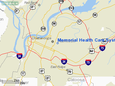
Memorial Health Care System Heliport |
Location & QuickFacts
| FAA Information Effective: | 2008-09-25 |
| Airport Identifier: | TN03 |
| Airport Status: | Operational |
| Longitude/Latitude: | 085-15-30.0000W/35-02-39.0000N
-85.258333/35.044167 (Estimated) |
| Elevation: | 770 ft / 234.70 m (Estimated) |
| Land: | 0 acres |
| From nearest city: | 0 nautical miles E of Chattanooga, TN |
| Location: | Hamilton County, TN |
| Magnetic Variation: | () |
Owner & Manager
| Ownership: | Privately owned |
| Owner: | Memorial Health Care System |
| Address: | 2525 De Sales Ave
Chattanooga, TN 37404 |
| Phone number: | 423-495-4664 |
| Manager: | Winston Shields
SAFETY OFFICER. |
| Address: | 2525 De Sales Ave
Chattanooga, TN 37404 |
| Phone number: | 423-495-4664 |
Airport Operations and Facilities
| Airport Use: | Private
MEDICAL USE. |
| Control Tower: | No |
| Sectional chart: | Atlanta |
| Region: | ASO - Southern |
| Boundary ARTCC: | ZTL - Atlanta |
| Tie-in FSS: | BNA - Nashville |
| FSS Toll Free: | 1-800-WX-BRIEF |
Runway Information
Helipad H1
| Dimension: | 40 x 40 ft / 12.2 x 12.2 m |
| Surface: | CONC, |
| |
Runway H1 |
Runway |
| Traffic Pattern: | Left | Left |
|
Radio Navigation Aids
| ID |
Type |
Name |
Ch |
Freq |
Var |
Dist |
| CQN | NDB | Daisy | | 341.00 | 02W | 8.9 nm |
| APT | NDB | Jasper | | 382.00 | 02W | 16.0 nm |
| HDI | NDB | Hardwick | | 369.00 | 01W | 18.5 nm |
| UWI | NDB | Whitfield | | 400.00 | 03W | 21.7 nm |
| DTE | NDB | Mark Anton | | 394.00 | 02W | 30.8 nm |
| UOS | NDB | Sewanee | | 275.00 | 02E | 32.8 nm |
| FTP | NDB | Fort Payne | | 426.00 | 01W | 37.5 nm |
| MMI | NDB | Mc Minn County | | 242.00 | 03W | 40.2 nm |
| BGF | NDB | Boiling Fork | | 263.00 | 02W | 40.6 nm |
| OUK | NDB | Calhoun | | 323.00 | 02W | 42.0 nm |
| OYD | NDB | Floyd | | 388.00 | 02W | 45.0 nm |
| RN | NDB | Warri | | 209.00 | 02W | 49.3 nm |
| GQO | VORTAC | Choo Choo | 105X | 115.80 | 01E | 7.2 nm |
| HCH | VORTAC | Hinch Mountain | 123X | 117.60 | 02W | 46.4 nm |
Remarks
- PRVDD VFR OPNS, PVT USE, AREA IS MARKED, AND APCH/DEP USING 050/170/230/350 RADIALS.
Images and information placed above are from
http://www.airport-data.com/airport/TN03/
We thank them for the data!
| General Info
|
| Country |
United States
|
| State |
TENNESSEE
|
| FAA ID |
TN03
|
| Latitude |
36-11-46.383N
|
| Longitude |
082-29-13.517W
|
| Elevation |
1505 feet
|
| Near City |
JONESBORO
|
We don't guarantee the information is fresh and accurate. The data may
be wrong or outdated.
For more up-to-date information please refer to other sources.
|
|


