 |
|
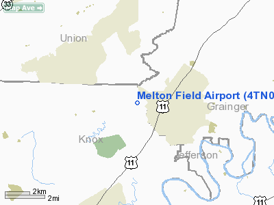
Location & QuickFacts
| FAA Information Effective: | 2008-09-25 |
| Airport Identifier: | 4TN0 |
| Airport Status: | Operational |
| Longitude/Latitude: | 083-43-58.0000W/36-09-07.0000N
-83.732778/36.151944 (Estimated) |
| Elevation: | 1060 ft / 323.09 m (Estimated) |
| Land: | 15 acres |
| From nearest city: | 2 nautical miles W of Blaine, TN |
| Location: | Knox County, TN |
| Magnetic Variation: | 03W (1990) |
Owner & Manager
| Ownership: | Privately owned |
| Owner: | R. Neal Melton |
| Address: | 10612 Emory Road
Luttrell, TN 37779 |
| Phone number: | 615-689-1007 |
| Manager: | R. Neal Melton |
| Address: | 10612 Emory Road
Luttrell, TN 37779 |
| Phone number: | 615-689-1007 |
Airport Operations and Facilities
| Airport Use: | Private
PERSONAL USE. |
| Wind indicator: | Yes |
| Segmented Circle: | No |
| Control Tower: | No |
| Sectional chart: | Cincinnati |
| Region: | ASO - Southern |
| Boundary ARTCC: | ZTL - Atlanta |
| Tie-in FSS: | BNA - Nashville |
| FSS on Airport: | No |
| FSS Toll Free: | 1-800-WX-BRIEF |
Runway Information
Runway 18/36
| Dimension: | 1200 x 50 ft / 365.8 x 15.2 m |
| Surface: | TURF, |
| |
Runway 18 |
Runway 36 |
| Traffic Pattern: | Left | Left |
| Displaced threshold: | 400.00 ft | 0.00 ft |
| Obstruction: | 70 ft pline, 1000.0 ft from runway | 1751 ft ant, 6000.0 ft from runway |
|
Radio Navigation Aids
| ID |
Type |
Name |
Ch |
Freq |
Var |
Dist |
| JXT | NDB | Jefferson | | 346.00 | 04W | 12.7 nm |
| JAU | NDB | Jacksboro | | 204.00 | 03W | 23.6 nm |
| DYQ | NDB | Dulaney | | 263.00 | 04W | 40.9 nm |
| BPO | NDB | Piney Grove | | 403.00 | 05W | 42.9 nm |
| RVN | NDB | Rogersville | | 329.00 | 04W | 45.0 nm |
| LQV | NDB | Long Hollow | | 252.00 | 03W | 46.1 nm |
| MNV | NDB | Madisonville | | 361.00 | 04W | 48.3 nm |
| VXV | VORTAC | Volunteer | 111X | 116.40 | 03W | 16.8 nm |
| SOT | VORTAC | Snowbird | 025X | 108.80 | 04W | 39.6 nm |
| TYS | VOT | Knoxville | | 112.00 | | 24.0 nm |
Remarks
Images and information placed above are from
http://www.airport-data.com/airport/4TN0/
We thank them for the data!
| General Info
|
| Country |
United States
|
| State |
TENNESSEE
|
| FAA ID |
4TN0
|
| Latitude |
36-09-07.000N
|
| Longitude |
083-43-58.000W
|
| Elevation |
1060 feet
|
| Near City |
BLAINE
|
We don't guarantee the information is fresh and accurate. The data may
be wrong or outdated.
For more up-to-date information please refer to other sources.
|
|


