 |
|
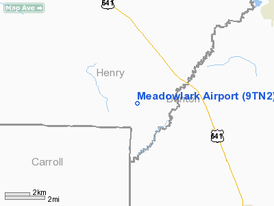
Location & QuickFacts
| FAA Information Effective: | 2008-09-25 |
| Airport Identifier: | 9TN2 |
| Airport Status: | Operational |
| Longitude/Latitude: | 088-12-19.0000W/36-09-50.0000N
-88.205278/36.163889 (Estimated) |
| Elevation: | 460 ft / 140.21 m (Estimated) |
| Land: | 2 acres |
| From nearest city: | 9 nautical miles NW of Camden, TN |
| Location: | Henry County, TN |
| Magnetic Variation: | 00W (1995) |
Owner & Manager
| Ownership: | Privately owned |
| Owner: | William J. Miller, Jr |
| Address: | 1375 Porter Norwood Road
Mansfield, TN 38236 |
| Phone number: | 731-644-0258
731-676-2219 CELL |
| Manager: | William J. Miller, Jr. |
| Address: | 1375 Porter Norwood Road
Mansfield, TN 38236 |
| Phone number: | 731-644-0258 |
Airport Operations and Facilities
| Airport Use: | Private |
| Wind indicator: | Yes |
| Segmented Circle: | No |
| Control Tower: | No |
| Sectional chart: | St Louis |
| Region: | ASO - Southern |
| Boundary ARTCC: | ZME - Memphis |
| Tie-in FSS: | MKL - Jackson |
| FSS Toll Free: | 1-800-WX-BRIEF |
Runway Information
Runway 01/19
| Dimension: | 1900 x 50 ft / 579.1 x 15.2 m |
| Surface: | TURF, |
| |
Runway 01 |
Runway 19 |
| Traffic Pattern: | Left | Left |
| Obstruction: | 50 ft trees, 1000.0 ft from runway | |
|
Radio Navigation Aids
| ID |
Type |
Name |
Ch |
Freq |
Var |
Dist |
| TIQ | NDB | Trainer | | 410.00 | 00E | 11.4 nm |
| HZD | NDB | Huntingdon | | 217.00 | 00E | 13.5 nm |
| AEY | NDB | Waverly | | 329.00 | 00E | 22.7 nm |
| TGC | NDB | Gibson | | 378.00 | 01E | 34.3 nm |
| GGK | NDB | Mayfield | | 401.00 | 00E | 36.8 nm |
| DMZ | NDB | Dickson | | 203.00 | 01W | 37.6 nm |
| UC | NDB | Obion | | 212.00 | 00E | 39.1 nm |
| HXW | TACAN | Screaming Eagle | 096X | | 01W | 46.1 nm |
| JKS | VOR/DME | Jacks Creek | 031X | 109.40 | 02E | 34.8 nm |
| CKV | VOR/DME | Clarksville | 043X | 110.60 | 01W | 47.2 nm |
| MKL | VOR/DME | Mc Kellar | 057X | 112.00 | 02E | 48.1 nm |
| GHM | VORTAC | Graham | 053X | 111.60 | 03E | 41.7 nm |
Remarks
- PRVDD CLEAR 20:1 APCH, WE POINT OUT THAT ROADS ARE A FAR77 OBSTN.
Images and information placed above are from
http://www.airport-data.com/airport/9TN2/
We thank them for the data!
| General Info
|
| Country |
United States
|
| State |
TENNESSEE
|
| FAA ID |
9TN2
|
| Latitude |
36-09-50.000N
|
| Longitude |
088-12-19.000W
|
| Elevation |
460 feet
|
| Near City |
CAMDEN
|
We don't guarantee the information is fresh and accurate. The data may
be wrong or outdated.
For more up-to-date information please refer to other sources.
|
|


