 |
|
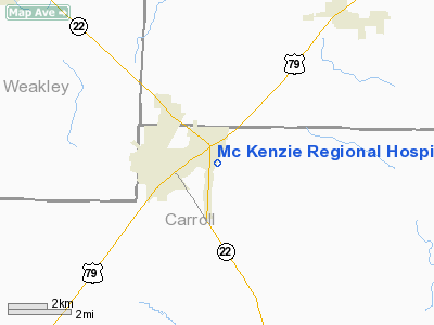
Mc Kenzie Rgnl Hospital Heliport |
Location & QuickFacts
| FAA Information Effective: | 2008-09-25 |
| Airport Identifier: | 5TN1 |
| Airport Status: | Operational |
| Longitude/Latitude: | 088-29-08.1850W/36-08-00.2210N
-88.485607/36.133395 (Estimated) |
| Elevation: | 100 ft / 30.48 m (Estimated) |
| Land: | 0 acres |
| From nearest city: | 0 nautical miles N of Mc Kenzie, TN |
| Location: | Carroll County, TN |
| Magnetic Variation: | 00E (1990) |
Owner & Manager
| Ownership: | Privately owned |
| Owner: | Mc Kenzie Hospital Corp |
| Address: | 161 Hospital Drive
Mc Kenzie, TN 38201 |
| Phone number: | 731-352-5344 |
| Manager: | David D Rasmussen |
| Address: | Mc Kenzie Rgnl Hospital, 161 Hospital Dr
Mc Kenzie, TN 38201 |
| Phone number: | 731-352-5344 |
Airport Operations and Facilities
| Airport Use: | Private
MEDICAL USE. |
| Segmented Circle: | No |
| Control Tower: | No |
| Sectional chart: | St Louis |
| Region: | ASO - Southern |
| Boundary ARTCC: | ZME - Memphis |
| Tie-in FSS: | MKL - Jackson |
| FSS Toll Free: | 1-800-WX-BRIEF |
Runway Information
Helipad H1
| Dimension: | 60 x 50 ft / 18.3 x 15.2 m |
| Surface: | ASPH, |
| |
Runway H1 |
Runway |
| Traffic Pattern: | Left | Left |
|
Radio Navigation Aids
| ID |
Type |
Name |
Ch |
Freq |
Var |
Dist |
| HZD | NDB | Huntingdon | | 217.00 | 00E | 2.8 nm |
| TIQ | NDB | Trainer | | 410.00 | 00E | 7.8 nm |
| TGC | NDB | Gibson | | 378.00 | 01E | 21.4 nm |
| UC | NDB | Obion | | 212.00 | 00E | 26.6 nm |
| GGK | NDB | Mayfield | | 401.00 | 00E | 33.9 nm |
| AEY | NDB | Waverly | | 329.00 | 00E | 36.2 nm |
| DNT | NDB | Nally Dunston | | 343.00 | 01W | 45.5 nm |
| JKS | VOR/DME | Jacks Creek | 031X | 109.40 | 02E | 32.7 nm |
| MKL | VOR/DME | Mc Kellar | 057X | 112.00 | 02E | 38.0 nm |
| DYR | VORTAC | Dyersburg | 115X | 116.80 | 03E | 41.0 nm |
Remarks
- PRVDD VFR; PVT USE; TKF/LDG AREA MKD; WIND IND IS MAINTAINED; APCH/DEP RTE OPS FM 340 DEG TO 010 DEG; & AFTER THE TREE LINE IS REMOVED APCH/DEP RTE FM 060 DEG TO 110.
Images and information placed above are from
http://www.airport-data.com/airport/5TN1/
We thank them for the data!
| General Info
|
| Country |
United States
|
| State |
TENNESSEE
|
| FAA ID |
5TN1
|
| Latitude |
36-08-00.221N
|
| Longitude |
088-29-08.185W
|
| Elevation |
100 feet
|
| Near City |
MC KENZIE
|
We don't guarantee the information is fresh and accurate. The data may
be wrong or outdated.
For more up-to-date information please refer to other sources.
|
|


