 |
|
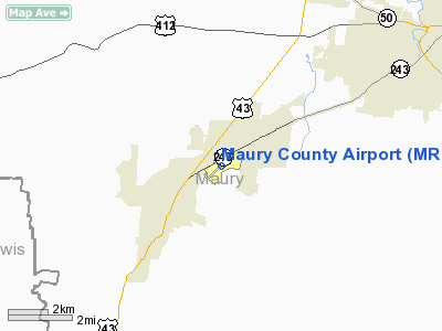
Location & QuickFacts
| FAA Information Effective: | 2008-09-25 |
| Airport Identifier: | MRC |
| Airport Status: | Operational |
| Longitude/Latitude: | 087-10-44.1000W/35-33-14.9000N
-87.178917/35.554139 (Estimated) |
| Elevation: | 681 ft / 207.57 m (Surveyed) |
| Land: | 188 acres |
| From nearest city: | 2 nautical miles NE of Columbia/mount Pleasant, TN |
| Location: | Maury County, TN |
| Magnetic Variation: | 01W (1990) |
Owner & Manager
| Ownership: | Publicly owned |
| Owner: | Maury Co Reg Arpt Auth |
| Address: | 1200 N Main St
Mt Pleasant, TN 38474 |
| Phone number: | 931-379-5511 |
| Manager: | Trev Echols |
| Address: | 1200 North Main St
Mt Pleasant, TN 38474 |
| Phone number: | 931-379-5511 |
Airport Operations and Facilities
| Airport Use: | Open to public |
| Wind indicator: | Yes |
| Segmented Circle: | Yes |
| Control Tower: | No |
| Lighting Schedule: | DUSK-DAWN
ACTVT ODALS RY 24 - CTAF. |
| Beacon Color: | Clear-Green (lighted land airport) |
| Landing fee charge: | No |
| Sectional chart: | Atlanta |
| Region: | ASO - Southern |
| Boundary ARTCC: | ZME - Memphis |
| Tie-in FSS: | MKL - Jackson |
| FSS on Airport: | No |
| FSS Toll Free: | 1-800-WX-BRIEF |
| NOTAMs Facility: | MKL (NOTAM-d service avaliable) |
| Federal Agreements: | NGY |
Airport Communications
| CTAF: | 122.800 |
| Unicom: | 122.800 |
Airport Services
| Fuel available: | 100LLA |
| Airframe Repair: | MAJOR |
| Power Plant Repair: | MAJOR |
Runway Information
Runway 06/24
| Dimension: | 6003 x 100 ft / 1829.7 x 30.5 m |
| Surface: | ASPH, Good Condition |
| Weight Limit: | Single wheel: 28000 lbs.
Dual wheel: 43000 lbs.
Dual tandem wheel: 70000 lbs. |
| Edge Lights: | Medium |
| |
Runway 06 |
Runway 24 |
| Longitude: | 087-11-13.6790W | 087-10-15.1280W |
| Latitude: | 35-33-01.1270N | 35-33-36.2730N |
| Elevation: | 664.00 ft | 681.00 ft |
| Alignment: | 54 | 127 |
| ILS Type: | | SDF
|
| Traffic Pattern: | Left | Left |
| Markings: | Non-precision instrument, Good Condition | Non-precision instrument, Good Condition |
| VASI: | 4-light PAPI on right side | 4-light PAPI on left side |
| Approach lights: | | ODALS |
| Runway End Identifier: | Yes | Yes |
| Obstruction: | 54 ft trees, 1245.0 ft from runway, 54 ft left of centerline, 19:1 slope to clear | 44 ft trees, 2460.0 ft from runway, 74 ft left of centerline, 50:1 slope to clear |
|
Runway 17/35
| Dimension: | 2000 x 200 ft / 609.6 x 61.0 m |
| Surface: | TURF, Good Condition |
| |
Runway 17 |
Runway 35 |
| Traffic Pattern: | Left | Left |
| Obstruction: | 52 ft trees, 1195.0 ft from runway, 104 ft right of centerline, 22:1 slope to clear | 59 ft trees, 1269.0 ft from runway, 80 ft right of centerline, 21:1 slope to clear |
|
Radio Navigation Aids
| ID |
Type |
Name |
Ch |
Freq |
Var |
Dist |
| SYI | FAN MARKER | Bomar | | | 01W | 35.2 nm |
| PBC | NDB | Maury County | | 365.00 | 01W | 5.4 nm |
| LUG | NDB | Verona | | 251.00 | 00W | 18.3 nm |
| LRT | NDB | Lawrenceburg | | 269.00 | 00E | 19.6 nm |
| JHG | NDB | Hohenwald | | 257.00 | 01W | 22.8 nm |
| GZS | NDB | Giles/dcmsnd | | 375.00 | 00E | 24.9 nm |
| DMZ | NDB | Dickson | | 203.00 | 01W | 36.6 nm |
| TNY | NDB | Kelso | | 358.00 | 01W | 40.2 nm |
| SWZ | NDB | Sewart | | 391.00 | 02W | 42.5 nm |
| AEY | NDB | Waverly | | 329.00 | 00E | 43.5 nm |
| ULH | NDB | Burwi | | 332.00 | 03W | 46.2 nm |
| FQW | NDB | Walter Hill | | 371.00 | 02W | 46.4 nm |
| VI | NDB | Opery | | 344.00 | 02W | 46.7 nm |
| UXM | VOR | Tullahoma Regional | | 109.65 | 03W | 46.9 nm |
| SYI | VOR/DME | Shelbyville | 027X | 109.00 | 01W | 36.2 nm |
| GHM | VORTAC | Graham | 053X | 111.60 | 03E | 21.5 nm |
| BNA | VORTAC | Nashville | 088X | 114.10 | 02W | 42.5 nm |
| HSV | VOT | Huntsville | | 111.00 | | 39.8 nm |
| BNA | VOT | Nashville Metropoln | | 108.60 | | 42.1 nm |
| MQY | VOT | Smyrna | | 110.20 | | 42.5 nm |
Remarks
- LGTD ANT 1.9 NM SW OF ARPT 1060' MSL APPROX 330' AGL.
- PAEW INVOF RYS 0700-1700.
Images and information placed above are from
http://www.airport-data.com/airport/MRC/
We thank them for the data!
| General Info
|
| Country |
United States
|
| State |
TENNESSEE
|
| FAA ID |
MRC
|
| Latitude |
35-33-14.900N
|
| Longitude |
087-10-44.100W
|
| Elevation |
681 feet
|
| Near City |
COLUMBIA/MOUNT PLEASANT
|
We don't guarantee the information is fresh and accurate. The data may
be wrong or outdated.
For more up-to-date information please refer to other sources.
|
|


