 |
|
Location & QuickFacts
| FAA Information Effective: | 2008-09-25 |
| Airport Identifier: | TN89 |
| Airport Status: | Operational |
| Longitude/Latitude: | 085-27-09.8720W/35-15-30.2580N
-85.452742/35.258405 (Estimated) |
| Elevation: | 700 ft / 213.36 m (Estimated) |
| Land: | 70 acres |
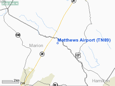
| From nearest city: | 6 nautical miles NE of Whitwell, TN |
| Location: | Marion County, TN |
| Magnetic Variation: | 02W (1984) |
Owner & Manager
| Ownership: | Privately owned |
| Owner: | John Lawton |
| Address: | 306 Condra Road
Whitwell, TN 37397 |
| Phone number: | 423-240-0064 |
| Address: |
|
Airport Operations and Facilities
| Airport Use: | Private |
| Wind indicator: | Yes |
| Segmented Circle: | No |
| Control Tower: | No |
| Landing fee charge: | No |
| Sectional chart: | Atlanta |
| Region: | ASO - Southern |
| Boundary ARTCC: | ZME - Memphis |
| Tie-in FSS: | BNA - Nashville |
| FSS on Airport: | No |
| FSS Toll Free: | 1-800-WX-BRIEF |
Runway Information
Runway 05/23
| Dimension: | 2200 x 60 ft / 670.6 x 18.3 m |
| Surface: | TURF, |
| |
Runway 05 |
Runway 23 |
| Traffic Pattern: | Left | Left |
|
Radio Navigation Aids
| ID |
Type |
Name |
Ch |
Freq |
Var |
Dist |
| APT | NDB | Jasper | | 382.00 | 02W | 13.6 nm |
| CQN | NDB | Daisy | | 341.00 | 02W | 15.5 nm |
| UOS | NDB | Sewanee | | 275.00 | 02E | 22.0 nm |
| HDI | NDB | Hardwick | | 369.00 | 01W | 27.6 nm |
| DTE | NDB | Mark Anton | | 394.00 | 02W | 28.9 nm |
| BGF | NDB | Boiling Fork | | 263.00 | 02W | 30.6 nm |
| RN | NDB | Warri | | 209.00 | 02W | 33.4 nm |
| UWI | NDB | Whitfield | | 400.00 | 03W | 37.6 nm |
| ULH | NDB | Burwi | | 332.00 | 03W | 40.6 nm |
| HEM | NDB | Huchn | | 233.00 | 02W | 44.3 nm |
| MMI | NDB | Mc Minn County | | 242.00 | 03W | 44.5 nm |
| FTP | NDB | Fort Payne | | 426.00 | 01W | 45.6 nm |
| SKN | NDB | Hurricane | | 256.00 | 02W | 46.9 nm |
| UXM | VOR | Tullahoma Regional | | 109.65 | 03W | 39.6 nm |
| GQO | VORTAC | Choo Choo | 105X | 115.80 | 01E | 23.1 nm |
| HCH | VORTAC | Hinch Mountain | 123X | 117.60 | 02W | 39.1 nm |
Remarks
- MULTICOM 123.5 & 123.3 SECONDARY.
- VFR, PRIVATE USE ONLY.
Images and information placed above are from
http://www.airport-data.com/airport/TN89/
We thank them for the data!
| General Info
|
| Country |
United States
|
| State |
TENNESSEE
|
| FAA ID |
TN89
|
| Latitude |
35-15-30.258N
|
| Longitude |
085-27-09.872W
|
| Elevation |
700 feet
|
| Near City |
WHITWELL
|
We don't guarantee the information is fresh and accurate. The data may
be wrong or outdated.
For more up-to-date information please refer to other sources.
|
|


