 |
|
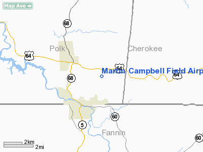
Martin Campbell Field Airport |
Location & QuickFacts
| FAA Information Effective: | 2008-09-25 |
| Airport Identifier: | 1A3 |
| Airport Status: | Operational |
| Longitude/Latitude: | 084-20-46.7190W/35-00-58.2880N
-84.346311/35.016191 (Estimated) |
| Elevation: | 1793 ft / 546.51 m (Estimated) |
| Land: | 59 acres |
| From nearest city: | 3 nautical miles NE of Copperhill, TN |
| Location: | Polk County, TN |
| Magnetic Variation: | 02W (1985) |
Owner & Manager
| Ownership: | Publicly owned |
| Owner: | Polk County |
| Address: | County Courthouse
Benton, TN 37307 |
| Phone number: | 423-338-4527 |
| Manager: | John Rutkosky |
| Address: | 971 Airport Road
Copperhill, TN 37317 |
| Phone number: | 423-338-4527
PHONE NR AT ARPT 423-496-3761. |
Airport Operations and Facilities
| Airport Use: | Open to public |
| Wind indicator: | Yes |
| Segmented Circle: | Yes |
| Control Tower: | No |
| Lighting Schedule: | DUSK-DAWN |
| Beacon Color: | Clear-Green (lighted land airport) |
| Landing fee charge: | No |
| Sectional chart: | Atlanta |
| Region: | ASO - Southern |
| Boundary ARTCC: | ZTL - Atlanta |
| Tie-in FSS: | BNA - Nashville |
| FSS on Airport: | No |
| FSS Toll Free: | 1-800-WX-BRIEF |
| NOTAMs Facility: | BNA (NOTAM-d service avaliable) |
| Federal Agreements: | NY1 |
Airport Communications
Airport Services
| Bottled Oxygen: | NONE |
| Bulk Oxygen: | NONE |
Runway Information
Runway 02/20
| Dimension: | 3500 x 75 ft / 1066.8 x 22.9 m |
| Surface: | ASPH, Good Condition |
| Weight Limit: | Single wheel: 30000 lbs.
Dual wheel: 45000 lbs. |
| Edge Lights: | Low
RY 02/20 LIRL OTS INDEFLY. |
| |
Runway 02 |
Runway 20 |
| Traffic Pattern: | Left | Left |
| Markings: | Basic, Good Condition | Basic, Good Condition |
| Crossing Height: | 24.00 ft | 28.00 ft |
| VASI: | 2-box SAVASI on left side
RY 02 VASI OTS INDEFLY. | 2-box SAVASI on left side
RY 20 VASI OTS INDEFLY. |
| Visual Glide Angle: | 3.00° | 3.50° |
| Runway End Identifier: | Yes
& 20 REIL OTS INDEFLY. | Yes |
| Centerline Lights: | No | No |
| Touchdown Lights: | No | No |
| Obstruction: | 18 ft tree, 500.0 ft from runway, 14 ft left of centerline, 16:1 slope to clear | 52 ft tree, 2200.0 ft from runway, 22 ft right of centerline, 38:1 slope to clear
+5 FT BUSHES 170 FT FM RY END. |
|
Radio Navigation Aids
| ID |
Type |
Name |
Ch |
Freq |
Var |
Dist |
| TTQ | NDB | Tomotla | | 335.00 | 01W | 20.1 nm |
| MMI | NDB | Mc Minn County | | 242.00 | 03W | 25.1 nm |
| HDI | NDB | Hardwick | | 369.00 | 01W | 28.7 nm |
| MNV | NDB | Madisonville | | 361.00 | 04W | 31.8 nm |
| UWI | NDB | Whitfield | | 400.00 | 03W | 32.6 nm |
| JZP | NDB | Pickens County | | 285.00 | 04W | 34.1 nm |
| DTE | NDB | Mark Anton | | 394.00 | 02W | 40.1 nm |
| CQN | NDB | Daisy | | 341.00 | 02W | 40.9 nm |
| DJD | NDB | Canton | | 415.00 | 04W | 46.4 nm |
| OUK | NDB | Calhoun | | 323.00 | 02W | 46.8 nm |
| HRS | VORTAC | Harris | 035X | 109.80 | 00E | 21.7 nm |
| GQO | VORTAC | Choo Choo | 105X | 115.80 | 01E | 39.9 nm |
Remarks
Images and information placed above are from
http://www.airport-data.com/airport/1A3/
We thank them for the data!
| General Info
|
| Country |
United States
|
| State |
TENNESSEE
|
| FAA ID |
1A3
|
| Latitude |
35-00-58.288N
|
| Longitude |
084-20-46.719W
|
| Elevation |
1793 feet
|
| Near City |
COPPERHILL
|
We don't guarantee the information is fresh and accurate. The data may
be wrong or outdated.
For more up-to-date information please refer to other sources.
|
|


