 |
|
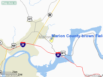
Marion County-brown Field Airport |
Location & QuickFacts
| FAA Information Effective: | 2008-09-25 |
| Airport Identifier: | APT |
| Airport Status: | Operational |
| Longitude/Latitude: | 085-35-07.1400W/35-03-38.4400N
-85.585317/35.060678 (Estimated) |
| Elevation: | 641 ft / 195.38 m (Estimated) |
| Land: | 86 acres |
| From nearest city: | 4 nautical miles SE of Jasper, TN |
| Location: | Marion County, TN |
| Magnetic Variation: | 02W (1990) |
Owner & Manager
| Ownership: | Publicly owned |
| Owner: | Marion County |
| Address: | 31 Courthouse Square
Jasper, TN 37347 |
| Phone number: | 423-942-2552 |
| Manager: | Beth Gudger |
| Address: | 300 Airport Rd
Jasper, TN 37347 |
| Phone number: | 423-942-5234 |
Airport Operations and Facilities
| Airport Use: | Open to public |
| Wind indicator: | Yes |
| Segmented Circle: | Yes |
| Control Tower: | No |
| Lighting Schedule: | DUSK-DAWN |
| Beacon Color: | Clear-Green (lighted land airport) |
| Landing fee charge: | No |
| Sectional chart: | Atlanta |
| Region: | ASO - Southern |
| Boundary ARTCC: | ZME - Memphis |
| Responsible ARTCC: | ZTL - Atlanta |
| Tie-in FSS: | BNA - Nashville |
| FSS on Airport: | No |
| FSS Toll Free: | 1-800-WX-BRIEF |
| NOTAMs Facility: | BNA (NOTAM-d service avaliable) |
| Federal Agreements: | NY1 |
Airport Communications
| CTAF: | 122.800 |
| Unicom: | 122.800 |
Airport Services
| Fuel available: | 100LLA |
| Bottled Oxygen: | NONE |
| Bulk Oxygen: | NONE |
Runway Information
Runway 04/22
| Dimension: | 3500 x 75 ft / 1066.8 x 22.9 m |
| Surface: | ASPH, Good Condition |
| Weight Limit: | Single wheel: 30000 lbs. |
| Edge Lights: | Medium |
| |
Runway 04 |
Runway 22 |
| Longitude: | 085-35-20.1060W | 085-34-54.1770W |
| Latitude: | 35-03-24.8050N | 35-03-52.0760N |
| Elevation: | 641.00 ft | 641.00 ft |
| Alignment: | 38 | 127 |
| Traffic Pattern: | Left | Right |
| Markings: | Non-precision instrument, Good Condition | Non-precision instrument, Good Condition |
| Crossing Height: | 26.00 ft | 22.00 ft |
| VASI: | 2-box SAVASI on left side | 2-box SAVASI on left side |
| Visual Glide Angle: | 3.50° | 3.50° |
| Runway End Identifier: | Yes | Yes |
| Obstruction: | 60 ft tree, 840.0 ft from runway, 153 ft right of centerline, 10:1 slope to clear | 80 ft tree, 860.0 ft from runway, 258 ft right of centerline, 8:1 slope to clear |
|
Radio Navigation Aids
| ID |
Type |
Name |
Ch |
Freq |
Var |
Dist |
| UOS | NDB | Sewanee | | 275.00 | 02E | 17.5 nm |
| CQN | NDB | Daisy | | 341.00 | 02W | 22.0 nm |
| BGF | NDB | Boiling Fork | | 263.00 | 02W | 24.8 nm |
| FTP | NDB | Fort Payne | | 426.00 | 01W | 32.7 nm |
| HDI | NDB | Hardwick | | 369.00 | 01W | 33.9 nm |
| UWI | NDB | Whitfield | | 400.00 | 03W | 35.5 nm |
| ULH | NDB | Burwi | | 332.00 | 03W | 40.2 nm |
| DTE | NDB | Mark Anton | | 394.00 | 02W | 40.9 nm |
| RN | NDB | Warri | | 209.00 | 02W | 42.5 nm |
| TNY | NDB | Kelso | | 358.00 | 01W | 47.3 nm |
| UXM | VOR | Tullahoma Regional | | 109.65 | 03W | 37.7 nm |
| GQO | VORTAC | Choo Choo | 105X | 115.80 | 01E | 22.1 nm |
Remarks
- ULTRALIGHT ACTIVITY ON AND IN VICINITY OF ARPT.
- DEER ON & INVOF ARPT.
- PAEW ON & INVOF RY 04/22.
Images and information placed above are from
http://www.airport-data.com/airport/APT/
We thank them for the data!
| General Info
|
| Country |
United States
|
| State |
TENNESSEE
|
| FAA ID |
APT
|
| Latitude |
35-03-38.440N
|
| Longitude |
085-35-07.140W
|
| Elevation |
641 feet
|
| Near City |
JASPER
|
We don't guarantee the information is fresh and accurate. The data may
be wrong or outdated.
For more up-to-date information please refer to other sources.
|
|


