|
|
Chattanooga Metropolitan Airport
Lovell Field |
 |
| IATA: CHA – ICAO: KCHA – FAA LID: CHA |
| Summary |
| Airport type |
Public |
| Owner/Operator |
Chattanooga Metropolitan Airport Authority |
| Serves |
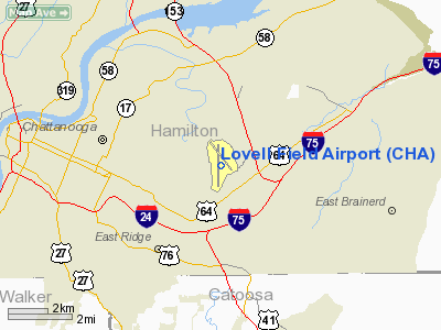
Chattanooga, Tennessee |
| Location |
35°02′07″N 085°12′14″W / 35.03528°N 85.20389°W / 35.03528; -85.20389 |
| Elevation AMSL |
683 ft / 208 m |
| Runways |
| Direction |
Length |
Surface |
| ft |
m |
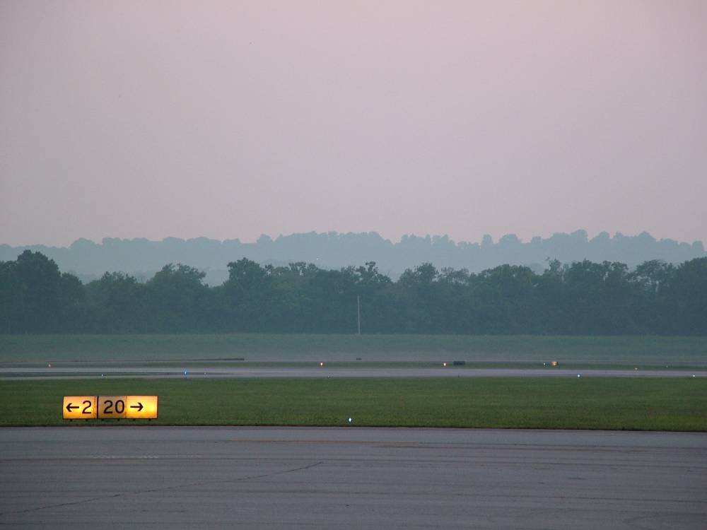
| 2/20 |
7,400 |
2,256 |
Asphalt |
| 15/33 |
5,575 |
1,699 |
Asphalt |
| Statistics (2008) |
| Aircraft operations |
79,354 |
| Source: Federal Aviation Administration |
FAA airport diagram Chattanooga Metropolitan Airport (IATA: CHA, ICAO: KCHA, FAA LID: CHA), also known as Lovell Field, is a public airport located five miles (8 km) east of the central business district of Chattanooga, a city in Hamilton County, Tennessee, United States. The airport is owned and operated by the Chattanooga Metropolitan Airport Authority. It is a Class C airport serviced by Chattanooga Approach.
Chattanooga Metropolitan Airport has a single concourse. Commercial service is provided by connection carriers for several major airlines. General aviation is serviced by TAC Air FBO. The general aviation ramp is split into two locations, with one on the South side of the main terminal, and the other to the North. The locations are respectively referred to as "TAC Air North" and "TAC Air South." General aviation can find service at either location, although business jets are preferred at North, and military and other miscellaneous traffic is preferred at South.
Currently, a flight from Chattanooga to Atlanta can take 17 minutes (from wheels up to wheels down) flying on a Canadair Regional Jet (operated by Delta Connection). When flight operations in Atlanta are interrupted, Chattanooga is one of the first airports to receive diversions.
It has been proposed that a new high-speed rail line be constructed from the airport to MARTA in metro Atlanta, so that it could easily serve as Atlanta's second airport. Facilities and aircraft
Lovell Field covers an area of 950 acres (384 ha) which contains two asphalt paved runways: 2/20 measuring 7,400 x 150 ft (2,256 x 46 m) and 15/33 measuring 5,575 x 150 ft (1,699 x 46 m).
For the 12-month period ending December 31, 2006, the airport had 77,361 aircraft operations, an average of 211 per day: 57% general aviation, 24% air taxi, 14% military and 5% scheduled commercial. There are 115 aircraft based at this airport: 53% jet, 31% single-engine, 14% multi-engine and 2% helicopter.
Airlines and destinations
| Airlines |
Destinations |
| Allegiant Air |
Orlando-Sanford, St. Petersburg/Clearwater |
| American Eagle |
Chicago-O'Hare, Dallas/Fort Worth |
Delta Connection operated by
Atlantic Southeast Airlines |
Atlanta, Detroit [ends December 11] |
Delta Connection operated by
Comair |
Atlanta [resumes October 1], Detroit [ends December 17] |
Delta Connection operated by
Mesaba Airlines |
Atlanta |
Delta Connection operated by
Pinnacle Airlines |
Detroit [begins December 18] |
US Airways Express operated by
Air Wisconsin |
Charlotte |
US Airways Express operated by
Piedmont Airlines |
Charlotte |
US Airways Express operated by
PSA Airlines |
Charlotte, Washington-Reagan |
Cargo
 | |
Runway 2-20 |
| Airlines |
Destinations |
| FedEx Feeder operated by Baron Aviation Services |
Memphis |
| FedEx Feeder operated by Mountain Air Cargo |
Memphis |
Accidents and incidents
On November 27, 1973, Delta Air Lines Flight 516 a McDonnell Douglas DC-9 crashed short of the runway on approach to the airport. None of the 79 passengers and crew were killed in the accident but the aircraft was damaged beyond repair.
On September 19, 2007 A Small Twin turboprop plane ran out of fuel and crashed into a the Brainerd Village mall parking lot only 2000ft from the runway. The plane skidded into a telephone pole, into two parked cars then hit a car traveling on a small highway, Brainerd Rd that runs parrallel to Lovell Field. All three passengers including the pilot sustained major injuries but no one was killed. The person in the car traveling on Brainerd Rd. sustained no injuries.
The above content comes from Wikipedia and is published under free licenses – click here to read more.
Location & QuickFacts
| FAA Information Effective: | 2008-09-25 |
| Airport Identifier: | CHA |
| Airport Status: | Operational |
| Longitude/Latitude: | 085-12-12.7958W/35-02-06.6982N
-85.203554/35.035194 (Estimated) |
| Elevation: | 683 ft / 208.18 m (Surveyed) |
| Land: | 950 acres |
| From nearest city: | 5 nautical miles E of Chattanooga, TN |
| Location: | Hamilton County, TN |
| Magnetic Variation: | 02W (1985) |
Owner & Manager
| Ownership: | Publicly owned |
| Owner: | Chattanooga Metro Arpt Auth |
| Address: | 1001 Airport Road, Suite 14
Chattanooga, TN 37421 |
| Phone number: | 423-855-2200 |
| Manager: | Mike Landguth |
| Address: | 1001 Airport Road, Suite 14
Chattanooga, TN 37421 |
| Phone number: | 423-855-2200 |
Airport Operations and Facilities
| Airport Use: | Open to public |
| Wind indicator: | Yes |
| Segmented Circle: | Yes |
| Control Tower: | Yes |
| Lighting Schedule: | DUSK-DAWN
ACTVT HIRL RY 02/20, CNTRLN LGTS RY 02/20, TDZL RY 20, MALSR RY 02 - CTAF. MIRL RY 15/33 UNAVBL WHEN ATCT CLSD. |
| Beacon Color: | Clear-Green (lighted land airport) |
| Landing fee charge: | No |
| Sectional chart: | Atlanta |
| Region: | ASO - Southern |
| Boundary ARTCC: | ZTL - Atlanta |
| Tie-in FSS: | BNA - Nashville |
| FSS on Airport: | No |
| FSS Toll Free: | 1-800-WX-BRIEF |
| NOTAMs Facility: | CHA (NOTAM-d service avaliable) |
| Certification type/date: | I B S 03/2005 |
| Federal Agreements: | NGVY |
Airport Communications
| CTAF: | 118.300 |
| Unicom: | 122.950 |
Airport Services
| Fuel available: | 100LLA |
| Airframe Repair: | MAJOR |
| Power Plant Repair: | MAJOR |
| Bottled Oxygen: | HIGH |
| Bulk Oxygen: | HIGH |
Runway Information
Runway 02/20
| Dimension: | 7400 x 150 ft / 2255.5 x 45.7 m |
| Surface: | ASPH, Good Condition |
| Surface Treatment: | Saw-cut or plastic Grooved |
| Weight Limit: | Single wheel: 120000 lbs.
Dual wheel: 160000 lbs.
Dual tandem wheel: 265000 lbs. |
| Edge Lights: | High |
| |
Runway 02 |
Runway 20 |
| Longitude: | 085-12-27.0143W | 085-12-01.4374W |
| Latitude: | 35-01-21.5459N | 35-02-31.6451N |
| Elevation: | 681.00 ft | 667.00 ft |
| Alignment: | 17 | 127 |
| ILS Type: | ILS
| ILS
|
| Traffic Pattern: | Left | Left |
| Markings: | Precision instrument, Good Condition | Precision instrument, Good Condition |
| Crossing Height: | 56.00 ft | 0.00 ft |
| VASI: | 4-box on right side | |
| Visual Glide Angle: | 3.00° | 0.00° |
| RVR Equipment: | touchdown, rollout | touchdown, rollout |
| Approach lights: | MALSR | ALSF2
ALSF2 RY 20 OPERS MED INTST WHEN ATCT CLSD. |
| Centerline Lights: | Yes | Yes |
| Touchdown Lights: | No | Yes |
| Obstruction: | , 50:1 slope to clear | 28 ft rr, 850.0 ft from runway, 600 ft left of centerline, 23:1 slope to clear |
| Decleard distances: | Take off run available 7400.00 ft
Take off distance available 7400.00 ft
Actual stop distance available 7201.00 ft
Landing distance available 7201.00 ft
| Take off run available 7400.00 ft
Take off distance available 7400.00 ft
Actual stop distance available 7400.00 ft
Landing distance available 7400.00 ft
|
|
Runway 15/33
| Dimension: | 5575 x 150 ft / 1699.3 x 45.7 m |
| Surface: | ASPH, Fair Condition |
| Weight Limit: | Single wheel: 120000 lbs.
Dual wheel: 160000 lbs.
Dual tandem wheel: 265000 lbs. |
| Edge Lights: | Medium |
| |
Runway 15 |
Runway 33 |
| Longitude: | 085-12-29.8945W | 085-11-51.9007W |
| Latitude: | 35-02-42.8228N | 35-01-57.3945N |
| Elevation: | 670.00 ft | 671.00 ft |
| Alignment: | 127 | 127 |
| Traffic Pattern: | Left | Left |
| Markings: | Non-precision instrument, Fair Condition | Non-precision instrument, Fair Condition |
| Crossing Height: | 45.00 ft | 47.00 ft |
| Displaced threshold: | 105.00 ft | 575.00 ft |
| VASI: | 4-light PAPI on left side | 4-light PAPI on left side |
| Visual Glide Angle: | 3.00° | 3.00° |
| Obstruction: | 3 ft trees, 1000.0 ft from runway, 100 ft left of centerline, 17:1 slope to clear | 44 ft trees, 1000.0 ft from runway, 325 ft left of centerline, 18:1 slope to clear |
| Decleard distances: | Take off run available 5575.00 ft
Take off distance available 5575.00 ft
Actual stop distance available 5575.00 ft
Landing distance available 5470.00 ft
| Take off run available 5470.00 ft
Take off distance available 5470.00 ft
Actual stop distance available 5470.00 ft
Landing distance available 5000.00 ft
|
|
Radio Navigation Aids
| ID |
Type |
Name |
Ch |
Freq |
Var |
Dist |
| CQN | NDB | Daisy | | 341.00 | 02W | 8.2 nm |
| HDI | NDB | Hardwick | | 369.00 | 01W | 16.3 nm |
| APT | NDB | Jasper | | 382.00 | 02W | 18.8 nm |
| UWI | NDB | Whitfield | | 400.00 | 03W | 19.5 nm |
| DTE | NDB | Mark Anton | | 394.00 | 02W | 30.0 nm |
| UOS | NDB | Sewanee | | 275.00 | 02E | 35.5 nm |
| MMI | NDB | Mc Minn County | | 242.00 | 03W | 38.2 nm |
| FTP | NDB | Fort Payne | | 426.00 | 01W | 38.6 nm |
| OUK | NDB | Calhoun | | 323.00 | 02W | 40.5 nm |
| BGF | NDB | Boiling Fork | | 263.00 | 02W | 43.4 nm |
| OYD | NDB | Floyd | | 388.00 | 02W | 44.3 nm |
| GQO | VORTAC | Choo Choo | 105X | 115.80 | 01E | 5.1 nm |
| HCH | VORTAC | Hinch Mountain | 123X | 117.60 | 02W | 46.2 nm |
Remarks
- TRANSIENT ACFT AVOID SECURITY ZONE WITHIN 300 FT OF TERMINAL BUILDING.
- LARGE FLOCKS OF BIRDS IN VICINITY OF AIRPORT.
- READ BACK ALL HOLD SHORT INSTRUCTIONS REQURED.
Images and information placed above are from
http://www.airport-data.com/airport/CHA/
We thank them for the data!
| General Info
|
| Country |
United States
|
| State |
TENNESSEE
|
| FAA ID |
CHA
|
| Latitude |
35-02-06.966N
|
| Longitude |
085-12-13.636W
|
| Elevation |
682 feet
|
| Near City |
CHATTANOOGA
|
We don't guarantee the information is fresh and accurate. The data may
be wrong or outdated.
For more up-to-date information please refer to other sources.
|
|