 |
|
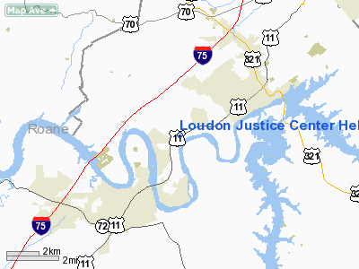
Loudon Justice Center Heliport |
Location & QuickFacts
| FAA Information Effective: | 2008-09-25 |
| Airport Identifier: | TN32 |
| Airport Status: | Operational |
| Longitude/Latitude: | 084-18-47.0000W/35-46-15.0000N
-84.313056/35.770833 (Estimated) |
| Elevation: | 904 ft / 275.54 m (Estimated) |
| Land: | 0 acres |
| From nearest city: | 2 nautical miles N of Loudon, TN |
| Location: | Loudon County, TN |
| Magnetic Variation: | 04W (2000) |
Owner & Manager
| Ownership: | Publicly owned |
| Owner: | Loudon County |
| Address: | 100 River Rd
Loudon, TN 37774 |
| Phone number: | 865-458-4664 |
| Manager: | John Paris
LOUDON COUNTY EMERGENCY MGMT AGENCY. |
| Address: | 12680 Hwy 11 West, Suite 5
Lenoir City, TN 37771 |
| Phone number: | 865-988-0175 |
Airport Operations and Facilities
| Airport Use: | Private |
| Wind indicator: | Yes |
| Segmented Circle: | No |
| Control Tower: | No |
| Sectional chart: | Atlanta |
| Region: | ASO - Southern |
| Boundary ARTCC: | ZTL - Atlanta |
| Tie-in FSS: | BNA - Nashville |
| FSS Toll Free: | 1-800-WX-BRIEF |
Runway Information
Helipad H1
| Dimension: | 40 x 40 ft / 12.2 x 12.2 m |
| Surface: | ASPH, |
| |
Runway H1 |
Runway |
| Traffic Pattern: | Left | Left |
|
Radio Navigation Aids
| ID |
Type |
Name |
Ch |
Freq |
Var |
Dist |
| MNV | NDB | Madisonville | | 361.00 | 04W | 14.0 nm |
| MMI | NDB | Mc Minn County | | 242.00 | 03W | 25.7 nm |
| DTE | NDB | Mark Anton | | 394.00 | 02W | 34.8 nm |
| JAU | NDB | Jacksboro | | 204.00 | 03W | 34.9 nm |
| TTQ | NDB | Tomotla | | 335.00 | 01W | 43.0 nm |
| JXT | NDB | Jefferson | | 346.00 | 04W | 45.6 nm |
| BPO | NDB | Piney Grove | | 403.00 | 05W | 46.9 nm |
| HDI | NDB | Hardwick | | 369.00 | 01W | 47.1 nm |
| VXV | VORTAC | Volunteer | 111X | 116.40 | 03W | 21.9 nm |
| HCH | VORTAC | Hinch Mountain | 123X | 117.60 | 02W | 32.5 nm |
| TYS | VOT | Knoxville | | 112.00 | | 15.8 nm |
Remarks
- PROVIDED VFR OPNS; PRIVATE USE; ALL APCH/DEP FROM 300 TO 020 DEGREES; AREA IS MARKED; WIND INDICATOR IS MAINTAINED.
Images and information placed above are from
http://www.airport-data.com/airport/TN32/
We thank them for the data!
| General Info
|
| Country |
United States
|
| State |
TENNESSEE
|
| FAA ID |
TN32
|
| Latitude |
35-46-15.000N
|
| Longitude |
084-18-47.000W
|
| Elevation |
904 feet
|
| Near City |
LOUDON
|
We don't guarantee the information is fresh and accurate. The data may
be wrong or outdated.
For more up-to-date information please refer to other sources.
|
|


