 |
|
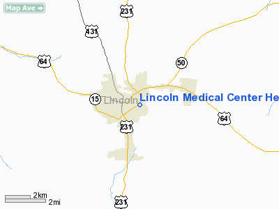
Lincoln Medical Center Heliport |
Location & QuickFacts
| FAA Information Effective: | 2008-09-25 |
| Airport Identifier: | 16TN |
| Airport Status: | Operational |
| Longitude/Latitude: | 086-33-19.5000W/35-09-01.0000N
-86.555417/35.150278 (Estimated) |
| Elevation: | 738 ft / 224.94 m (Estimated) |
| Land: | 0 acres |
| From nearest city: | 1 nautical miles E of Fayetteville, TN |
| Location: | Lincoln County, TN |
| Magnetic Variation: | 02W (2000) |
Owner & Manager
| Ownership: | Privately owned |
| Owner: | Lincoln Medical Center |
| Address: | 106 Medical Center Blvd
Fayetteville, TN 37334 |
| Phone number: | 931-438-1100 |
| Manager: | Gary Kendrick |
| Address: | Po Box 635
Fayetteville, TN 37334 |
Airport Operations and Facilities
| Airport Use: | Private |
| Wind indicator: | Yes |
| Segmented Circle: | No |
| Control Tower: | No |
| Lighting Schedule: | DUSK-DAWN |
| Sectional chart: | Atlanta |
| Region: | ASO - Southern |
| Boundary ARTCC: | ZME - Memphis |
| Tie-in FSS: | MKL - Jackson |
| FSS Toll Free: | 1-800-WX-BRIEF |
Runway Information
Helipad H1
| Dimension: | 75 x 75 ft / 22.9 x 22.9 m |
| Surface: | CONC, |
| |
Runway H1 |
Runway |
| Traffic Pattern: | Left | Left |
|
Radio Navigation Aids
| ID |
Type |
Name |
Ch |
Freq |
Var |
Dist |
| SYI | FAN MARKER | Bomar | | | 01W | 20.5 nm |
| TNY | NDB | Kelso | | 358.00 | 01W | 1.2 nm |
| BGF | NDB | Boiling Fork | | 263.00 | 02W | 24.0 nm |
| ULH | NDB | Burwi | | 332.00 | 03W | 24.2 nm |
| LUG | NDB | Verona | | 251.00 | 00W | 24.5 nm |
| GZS | NDB | Giles/dcmsnd | | 375.00 | 00E | 24.7 nm |
| CWH | NDB | Capshaw | | 350.00 | 01W | 25.2 nm |
| HUA | NDB | Redstone | | 287.00 | 00W | 27.9 nm |
| UOS | NDB | Sewanee | | 275.00 | 02E | 32.6 nm |
| LRT | NDB | Lawrenceburg | | 269.00 | 00E | 35.0 nm |
| PBC | NDB | Maury County | | 365.00 | 01W | 38.0 nm |
| APT | NDB | Jasper | | 382.00 | 02W | 48.1 nm |
| SWZ | NDB | Sewart | | 391.00 | 02W | 48.7 nm |
| CPP | NDB | Cole Spring | | 230.00 | 01W | 48.9 nm |
| FQW | NDB | Walter Hill | | 371.00 | 02W | 49.6 nm |
| UXM | VOR | Tullahoma Regional | | 109.65 | 03W | 20.5 nm |
| SYI | VOR/DME | Shelbyville | 027X | 109.00 | 01W | 25.4 nm |
| DCU | VOR/DME | Decatur | 075X | 112.80 | 01W | 35.6 nm |
| RQZ | VORTAC | Rocket | 059X | 112.20 | 02E | 21.6 nm |
| HSV | VOT | Huntsville | | 111.00 | | 14.7 nm |
Remarks
- (PRIVATE USE VFR ONLY) MEDICAL USE.
- PRVDD AREA IS MARKED; VFR PVT USE.
Images and information placed above are from
http://www.airport-data.com/airport/16TN/
We thank them for the data!
|
|


