 |
|
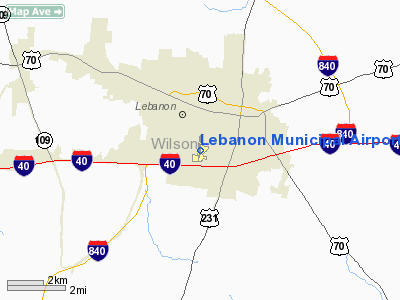
Location & QuickFacts
| FAA Information Effective: | 2008-09-25 |
| Airport Identifier: | M54 |
| Airport Status: | Operational |
| Longitude/Latitude: | 086-18-56.4855W/36-11-25.4804N
-86.315690/36.190411 (Estimated) |
| Elevation: | 588 ft / 179.22 m (Surveyed) |
| Land: | 256 acres |
| From nearest city: | 2 nautical miles SW of Lebanon, TN |
| Location: | Wilson County, TN |
| Magnetic Variation: | 02W (1995) |
Owner & Manager
| Ownership: | Publicly owned |
| Owner: | City Of Lebanon |
| Address: | 200 Castle Heights Ave North
Lebanon, TN 37087 |
| Phone number: | 615-443-2839 |
| Manager: | Myron Lasater |
| Address: | 760 Franklin Road
Lebanon, TN 37087 |
| Phone number: | 615-444-0031 |
Airport Operations and Facilities
| Airport Use: | Open to public |
| Wind indicator: | Yes |
| Segmented Circle: | Yes |
| Control Tower: | No |
| Lighting Schedule: | DUSK-DAWN |
| Beacon Color: | Clear-Green (lighted land airport) |
| Landing fee charge: | No |
| Sectional chart: | St Louis |
| Region: | ASO - Southern |
| Boundary ARTCC: | ZME - Memphis |
| Tie-in FSS: | BNA - Nashville |
| FSS on Airport: | No |
| FSS Toll Free: | 1-800-WX-BRIEF |
| NOTAMs Facility: | BNA (NOTAM-d service avaliable) |
| Federal Agreements: | N1 |
Airport Communications
| CTAF: | 122.725 |
| Unicom: | 122.725 |
Airport Services
| Fuel available: | 100LLA |
| Airframe Repair: | MAJOR |
| Power Plant Repair: | MAJOR |
| Bottled Oxygen: | NONE |
| Bulk Oxygen: | NONE |
Runway Information
Runway 01/19
| Dimension: | 5000 x 100 ft / 1524.0 x 30.5 m |
| Surface: | ASPH, Good Condition |
| Weight Limit: | Single wheel: 24000 lbs.
Dual wheel: 37000 lbs. |
| Edge Lights: | Medium |
| |
Runway 01 |
Runway 19 |
| Longitude: | 086-19-02.6909W | 086-18-55.7339W |
| Latitude: | 36-11-01.1454N | 36-11-50.2550N |
| Elevation: | 588.00 ft | 550.00 ft |
| Alignment: | 7 | 127 |
| Traffic Pattern: | Left | Left |
| Markings: | Non-precision instrument, Good Condition | Non-precision instrument, Good Condition |
| Displaced threshold: | 400.00 ft | 500.00 ft |
| VASI: | 2-light PAPI on left side
PAPI OTS INDEFLY. | 2-light PAPI on left side |
| Runway End Identifier: | Yes | Yes |
| Obstruction: | 75 ft trees, 1246.0 ft from runway, 109 ft left of centerline, 14:1 slope to clear
APCH SLOPE 21:1 TO DSPLCD THLD. | 15 ft road, 300.0 ft from runway, 6:1 slope to clear
APCH SLOPE 28:1 TO DSPLCD THLD. |
| Decleard distances: | Take off run available 5000.00 ft
Take off distance available 5000.00 ft
Actual stop distance available 4680.00 ft
Landing distance available 4527.00 ft
| Take off run available 5000.00 ft
Take off distance available 5000.00 ft
Actual stop distance available 4847.00 ft
Landing distance available 4527.00 ft
|
|
Runway 04/22
| Dimension: | 1801 x 150 ft / 548.9 x 45.7 m |
| Surface: | TURF, Good Condition |
| |
Runway 04 |
Runway 22 |
| Longitude: | 086-18-56.8600W | 086-18-40.9700W |
| Latitude: | 36-11-18.7200N | 36-11-31.0200N |
| Elevation: | 568.00 ft | 565.00 ft |
| Alignment: | 46 | 127 |
| Traffic Pattern: | Left | Left |
| Obstruction: | , 50:1 slope to clear | 56 ft trees, 654.0 ft from runway, 1 ft right of centerline, 8:1 slope to clear
APCH SLOPE 22:1 TO DSPLCD THLD. |
|
Radio Navigation Aids
| ID |
Type |
Name |
Ch |
Freq |
Var |
Dist |
| SYI | FAN MARKER | Bomar | | | 01W | 43.1 nm |
| JUE | NDB | Lebanon | | 414.00 | 02W | 0.1 nm |
| FQW | NDB | Walter Hill | | 371.00 | 02W | 14.0 nm |
| SWZ | NDB | Sewart | | 391.00 | 02W | 15.8 nm |
| VI | NDB | Opery | | 344.00 | 02W | 16.4 nm |
| LFB | NDB | Lafayette | | 245.00 | 02W | 23.1 nm |
| SKN | NDB | Hurricane | | 256.00 | 02W | 27.6 nm |
| PED | NDB | Needmore | | 221.00 | 01W | 35.8 nm |
| ON | NDB | Music | | 279.00 | 03W | 36.3 nm |
| HEM | NDB | Huchn | | 233.00 | 02W | 37.5 nm |
| RN | NDB | Warri | | 209.00 | 02W | 37.6 nm |
| ULH | NDB | Burwi | | 332.00 | 03W | 44.0 nm |
| LUG | NDB | Verona | | 251.00 | 00W | 47.9 nm |
| UXM | VOR | Tullahoma Regional | | 109.65 | 03W | 48.8 nm |
| SYI | VOR/DME | Shelbyville | 027X | 109.00 | 01W | 38.2 nm |
| BNA | VORTAC | Nashville | 088X | 114.10 | 02W | 18.2 nm |
| BWG | VORTAC | Bowling Green | 126X | 117.90 | 02E | 44.8 nm |
| MQY | VOT | Smyrna | | 110.20 | | 14.5 nm |
| BNA | VOT | Nashville Metropoln | | 108.60 | | 18.2 nm |
Remarks
- GCO AVBL ON FREQ 135.075 THRU BNA CLEARANCE DELIVERY.
- GCO AVBL ON FREQ 135.075 THRU BNA CLEARANCE DELIVERY.
- BIRD ACTIVITY ON & INVOF ARPT.
Images and information placed above are from
http://www.airport-data.com/airport/M54/
We thank them for the data!
| General Info
|
| Country |
United States
|
| State |
TENNESSEE
|
| FAA ID |
M54
|
| Latitude |
36-11-25.500N
|
| Longitude |
086-18-56.500W
|
| Elevation |
576 feet
|
| Near City |
LEBANON
|
We don't guarantee the information is fresh and accurate. The data may
be wrong or outdated.
For more up-to-date information please refer to other sources.
|
|


