 |
|
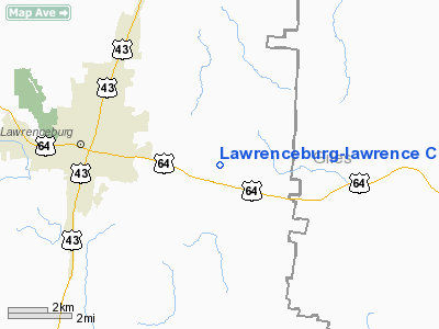
Lawrenceburg-lawrence County Airport |
Location & QuickFacts
| FAA Information Effective: | 2008-09-25 |
| Airport Identifier: | 2M2 |
| Airport Status: | Operational |
| Longitude/Latitude: | 087-15-28.5560W/35-14-03.4890N
-87.257932/35.234302 (Estimated) |
| Elevation: | 936 ft / 285.29 m (Surveyed) |
| Land: | 131 acres |
| From nearest city: | 3 nautical miles NE of Lawrenceburg, TN |
| Location: | Lawrence County, TN |
| Magnetic Variation: | 01W (1995) |
Owner & Manager
| Ownership: | Publicly owned |
| Owner: | City Of Lawrenceburg
AND COUNTY OF LAWRENCE |
| Address: | Po Box 590
Lawrenceburg, TN 38464 |
| Phone number: | 931-762-4459 |
| Manager: | Mr. Doris Venable |
| Address: | 4110 Airport Dr
Lawrenceburg, TN 38464 |
| Phone number: | 931-762-5133 |
Airport Operations and Facilities
| Airport Use: | Open to public |
| Wind indicator: | Yes |
| Segmented Circle: | Yes |
| Control Tower: | No |
| Lighting Schedule: | DUSK-DAWN |
| Beacon Color: | Clear-Green (lighted land airport) |
| Landing fee charge: | No |
| Sectional chart: | Atlanta |
| Region: | ASO - Southern |
| Boundary ARTCC: | ZME - Memphis |
| Tie-in FSS: | MKL - Jackson |
| FSS on Airport: | No |
| FSS Toll Free: | 1-800-WX-BRIEF |
| NOTAMs Facility: | MKL (NOTAM-d service avaliable) |
| Federal Agreements: | N1 |
Airport Communications
| CTAF: | 122.800 |
| Unicom: | 122.800 |
Airport Services
| Fuel available: | 100LLA |
| Bottled Oxygen: | NONE |
| Bulk Oxygen: | NONE |
Runway Information
Runway 17/35
| Dimension: | 5003 x 100 ft / 1524.9 x 30.5 m |
| Surface: | ASPH, Good Condition |
| Weight Limit: | Single wheel: 15000 lbs. |
| Edge Lights: | Medium |
| |
Runway 17 |
Runway 35 |
| Longitude: | 087-15-35.6210W | 087-15-21.5800W |
| Latitude: | 35-14-27.5480N | 35-13-39.4280N |
| Elevation: | 936.00 ft | 927.00 ft |
| Alignment: | 127 | 127 |
| Traffic Pattern: | Left | Left |
| Markings: | Non-precision instrument, Good Condition
RY MARKINGS FADED & PEELING. | Non-precision instrument, Good Condition
RY MARKINGS FADED & PEELING. |
| VASI: | 4-light PAPI on left side | 4-light PAPI on left side |
| Runway End Identifier: | Yes | Yes |
| Obstruction: | 75 ft trees, 1473.0 ft from runway, 63 ft left of centerline, 17:1 slope to clear | 39 ft pole, 897.0 ft from runway, 36 ft left of centerline, 18:1 slope to clear |
|
Radio Navigation Aids
| ID |
Type |
Name |
Ch |
Freq |
Var |
Dist |
| SYI | FAN MARKER | Bomar | | | 01W | 41.7 nm |
| LRT | NDB | Lawrenceburg | | 269.00 | 00E | 0.2 nm |
| GZS | NDB | Giles/dcmsnd | | 375.00 | 00E | 11.0 nm |
| JHG | NDB | Hohenwald | | 257.00 | 01W | 22.8 nm |
| PBC | NDB | Maury County | | 365.00 | 01W | 23.9 nm |
| LUG | NDB | Verona | | 251.00 | 00W | 27.2 nm |
| TNY | NDB | Kelso | | 358.00 | 01W | 35.7 nm |
| CWH | NDB | Capshaw | | 350.00 | 01W | 36.4 nm |
| HUA | NDB | Redstone | | 287.00 | 00W | 42.7 nm |
| HHY | NDB | Pinhook | | 346.00 | 01W | 46.5 nm |
| DCU | VOR/DME | Decatur | 075X | 112.80 | 01W | 38.6 nm |
| SYI | VOR/DME | Shelbyville | 027X | 109.00 | 01W | 44.7 nm |
| MSL | VORTAC | Muscle Shoals | 112X | 116.50 | 01E | 33.7 nm |
| GHM | VORTAC | Graham | 053X | 111.60 | 03E | 37.3 nm |
| RQZ | VORTAC | Rocket | 059X | 112.20 | 02E | 40.4 nm |
| HSV | VOT | Huntsville | | 111.00 | | 28.3 nm |
Remarks
- FOR AFT HRS SVC CONTACT 931-829-2652 OR 931-209-8294.
- GCO AVBL ON FREQ 121.725 THRU FLT SVCS.
Images and information placed above are from
http://www.airport-data.com/airport/2M2/
We thank them for the data!
| General Info
|
| Country |
United States
|
| State |
TENNESSEE
|
| FAA ID |
2M2
|
| Latitude |
35-14-03.489N
|
| Longitude |
087-15-28.556W
|
| Elevation |
936 feet
|
| Near City |
LAWRENCEBURG
|
We don't guarantee the information is fresh and accurate. The data may
be wrong or outdated.
For more up-to-date information please refer to other sources.
|
|


