 |
|
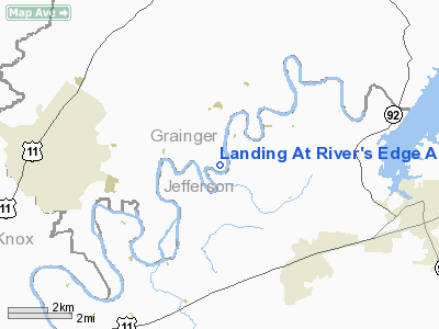
Landing At River's Edge Airport |
Location & QuickFacts
| FAA Information Effective: | 2008-09-25 |
| Airport Identifier: | 98TN |
| Airport Status: | Operational |
| Longitude/Latitude: | 083-36-15.0000W/36-08-33.0000N
-83.604167/36.142500 (Estimated) |
| Elevation: | 1019 ft / 310.59 m () |
| Land: | 0 acres |
| From nearest city: | 4 nautical miles S of Blaine, TN |
| Location: | Grainger County, TN |
| Magnetic Variation: | () |
Owner & Manager
| Ownership: | Privately owned |
| Owner: | Tailwater Properties Inc |
| Address: | 325 Alpine Mountain Way
Pigeon Forge, TN 37863 |
| Phone number: | 865-368-0165 |
| Manager: | Wayne Mitchell |
| Address: | 325 Alpine Mountain Way
Pigeon Forge, TN 37863 |
| Phone number: | 865-368-0165 |
Airport Operations and Facilities
| Airport Use: | Private |
| Wind indicator: | Yes |
| Control Tower: | No |
| Sectional chart: | Cincinnati |
| Region: | ASO - Southern |
| Boundary ARTCC: | ZTL - Atlanta |
| Tie-in FSS: | BNA - Nashville |
| FSS Toll Free: | 1-800-WX-BRIEF |
Airport Communications
Runway Information
Runway 14/32
| Dimension: | 3000 x 50 ft / 914.4 x 15.2 m |
| Surface: | ASPH, |
| |
Runway 14 |
Runway 32 |
| Traffic Pattern: | Left | Right |
|
Radio Navigation Aids
| ID |
Type |
Name |
Ch |
Freq |
Var |
Dist |
| JXT | NDB | Jefferson | | 346.00 | 04W | 6.5 nm |
| JAU | NDB | Jacksboro | | 204.00 | 03W | 29.4 nm |
| DYQ | NDB | Dulaney | | 263.00 | 04W | 34.7 nm |
| RVN | NDB | Rogersville | | 329.00 | 04W | 39.6 nm |
| LQV | NDB | Long Hollow | | 252.00 | 03W | 42.5 nm |
| BPO | NDB | Piney Grove | | 403.00 | 05W | 48.5 nm |
| VXV | VORTAC | Volunteer | 111X | 116.40 | 03W | 20.1 nm |
| SOT | VORTAC | Snowbird | 025X | 108.80 | 04W | 34.2 nm |
| TYS | VOT | Knoxville | | 112.00 | | 27.4 nm |
Remarks
- 679 FT LGTD TWR 5NM NE; 630 FT LGTD TWR 5 NM SE; 542 FT LGTD TWR 7 NM W.
- PRVDD VRF OPS AND PVT USE.
Images and information placed above are from
http://www.airport-data.com/airport/98TN/
We thank them for the data!
|
|


