 |
|
Location & QuickFacts
| FAA Information Effective: | 2008-09-25 |
| Airport Identifier: | TN10 |
| Airport Status: | Operational |
| Longitude/Latitude: | 083-46-43.6820W/36-20-20.2890N
-83.778801/36.338969 (Estimated) |
| Elevation: | 1066 ft / 324.92 m (Estimated) |
| Land: | 24 acres |
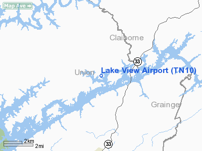
| From nearest city: | 2 nautical miles E of Sharps Chapel, TN |
| Location: | Union County, TN |
| Magnetic Variation: | 03W (1985) |
Owner & Manager
| Ownership: | Privately owned |
| Owner: | James Giles Realty Corp. |
| Address: | 503 Cherry Ave.
New Tazewell, TN 37825 |
| Phone number: | 423-626-5030 |
| Manager: | Donna Giles Bryant |
| Address: | 503 Cherry Ave.
New Tazewell, TN 37825 |
| Phone number: | 423-626-5030 |
Airport Operations and Facilities
| Airport Use: | Private |
| Wind indicator: | Yes |
| Segmented Circle: | No |
| Control Tower: | No |
| Landing fee charge: | No |
| Sectional chart: | Cincinnati |
| Region: | ASO - Southern |
| Boundary ARTCC: | ZTL - Atlanta |
| Tie-in FSS: | BNA - Nashville |
| FSS on Airport: | No |
| FSS Toll Free: | 1-800-WX-BRIEF |
Airport Services
| Airframe Repair: | NONE |
| Power Plant Repair: | NONE |
Runway Information
Runway E/W
| Dimension: | 2300 x 50 ft / 701.0 x 15.2 m |
| Surface: | TURF, |
| |
Runway E |
Runway W |
| Traffic Pattern: | Left | Left |
|
Radio Navigation Aids
| ID |
Type |
Name |
Ch |
Freq |
Var |
Dist |
| JAU | NDB | Jacksboro | | 204.00 | 03W | 18.5 nm |
| JXT | NDB | Jefferson | | 346.00 | 04W | 20.1 nm |
| BPO | NDB | Piney Grove | | 403.00 | 05W | 35.8 nm |
| LQV | NDB | Long Hollow | | 252.00 | 03W | 40.6 nm |
| RVN | NDB | Rogersville | | 329.00 | 04W | 43.8 nm |
| DYQ | NDB | Dulaney | | 263.00 | 04W | 44.8 nm |
| VXV | VORTAC | Volunteer | 111X | 116.40 | 03W | 26.7 nm |
| LOZ | VORTAC | London | 108X | 116.10 | 03W | 44.7 nm |
| SOT | VORTAC | Snowbird | 025X | 108.80 | 04W | 48.3 nm |
| TYS | VOT | Knoxville | | 112.00 | | 33.3 nm |
Remarks
Images and information placed above are from
http://www.airport-data.com/airport/TN10/
We thank them for the data!
| General Info
|
| Country |
United States
|
| State |
TENNESSEE
|
| FAA ID |
TN10
|
| Latitude |
36-20-20.289N
|
| Longitude |
083-46-43.682W
|
| Elevation |
1066 feet
|
| Near City |
SHARPS CHAPEL
|
We don't guarantee the information is fresh and accurate. The data may
be wrong or outdated.
For more up-to-date information please refer to other sources.
|
|


