 |
|
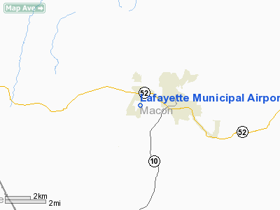
Location & QuickFacts
| FAA Information Effective: | 2008-09-25 |
| Airport Identifier: | 3M7 |
| Airport Status: | Operational |
| Longitude/Latitude: | 086-03-29.0000W/36-31-12.1000N
-86.058056/36.520028 (Estimated) |
| Elevation: | 969 ft / 295.35 m (Surveyed) |
| Land: | 91 acres |
| From nearest city: | 2 nautical miles W of Lafayette, TN |
| Location: | Macon County, TN |
| Magnetic Variation: | 02W (1990) |
Owner & Manager
| Ownership: | Publicly owned |
| Owner: | City Of Lafayette |
| Address: | City Hall
Lafayette, TN 37083 |
| Phone number: | 615-666-2194 |
| Manager: | Jesse Brawner |
| Address: | 1000 Airport Rd
Lafayette, TN 37083 |
| Phone number: | 615-666-6542 |
Airport Operations and Facilities
| Airport Use: | Open to public |
| Wind indicator: | Yes |
| Segmented Circle: | Yes |
| Control Tower: | No |
| Lighting Schedule: | DUSK-DAWN
ACTVT VASI RYS 01 & 19 - CTAF. |
| Beacon Color: | Clear-Green (lighted land airport) |
| Landing fee charge: | No |
| Sectional chart: | St Louis |
| Region: | ASO - Southern |
| Boundary ARTCC: | ZME - Memphis |
| Tie-in FSS: | BNA - Nashville |
| FSS on Airport: | No |
| FSS Toll Free: | 1-800-WX-BRIEF |
| NOTAMs Facility: | BNA (NOTAM-d service avaliable) |
| Federal Agreements: | NGY |
Airport Communications
| CTAF: | 122.800 |
| Unicom: | 122.800 |
Airport Services
| Fuel available: | 100LLA |
| Airframe Repair: | MINOR |
| Power Plant Repair: | MINOR |
| Bottled Oxygen: | NONE |
| Bulk Oxygen: | NONE |
Runway Information
Runway 01/19
| Dimension: | 5200 x 75 ft / 1585.0 x 22.9 m |
| Surface: | ASPH, |
| Weight Limit: | Single wheel: 21000 lbs.
Dual wheel: 31000 lbs. |
| Edge Lights: | Medium |
| |
Runway 01 |
Runway 19 |
| Longitude: | 086-03-32.4800W | 086-03-25.4700W |
| Latitude: | 36-30-46.5300N | 36-31-37.6500N |
| Elevation: | 969.00 ft | 945.00 ft |
| Alignment: | 6 | 127 |
| Traffic Pattern: | Left | Left |
| Markings: | Basic, Good Condition | Basic, Good Condition |
| Crossing Height: | 24.00 ft | 21.00 ft |
| Displaced threshold: | 200.00 ft | 0.00 ft |
| VASI: | 2-box on left side | 2-box on left side |
| Visual Glide Angle: | 3.50° | 3.00° |
| Runway End Identifier: | Yes | Yes |
| Obstruction: | 68 ft trees, 1512.0 ft from runway, 539 ft right of centerline, 19:1 slope to clear | 10 ft pline, 720.0 ft from runway, 50:1 slope to clear |
|
Radio Navigation Aids
| ID |
Type |
Name |
Ch |
Freq |
Var |
Dist |
| LFB | NDB | Lafayette | | 245.00 | 02W | 0.3 nm |
| JUE | NDB | Lebanon | | 414.00 | 02W | 23.3 nm |
| BVQ | NDB | Beaver Creek | | 260.00 | 02W | 30.0 nm |
| SKN | NDB | Hurricane | | 256.00 | 02W | 34.4 nm |
| VI | NDB | Opery | | 344.00 | 02W | 34.5 nm |
| FQW | NDB | Walter Hill | | 371.00 | 02W | 36.9 nm |
| SWZ | NDB | Sewart | | 391.00 | 02W | 39.2 nm |
| HEM | NDB | Huchn | | 233.00 | 02W | 39.3 nm |
| PED | NDB | Needmore | | 221.00 | 01W | 41.5 nm |
| ON | NDB | Music | | 279.00 | 03W | 45.4 nm |
| RN | NDB | Warri | | 209.00 | 02W | 48.3 nm |
| BWG | VORTAC | Bowling Green | 126X | 117.90 | 02E | 30.8 nm |
| BNA | VORTAC | Nashville | 088X | 114.10 | 02W | 38.1 nm |
| LVT | VORTAC | Livingston | 021X | 108.40 | 02W | 43.2 nm |
| MQY | VOT | Smyrna | | 110.20 | | 37.8 nm |
| BNA | VOT | Nashville Metropoln | | 108.60 | | 38.4 nm |
Remarks
Images and information placed above are from
http://www.airport-data.com/airport/3M7/
We thank them for the data!
| General Info
|
| Country |
United States
|
| State |
TENNESSEE
|
| FAA ID |
3M7
|
| Latitude |
36-31-06.150N
|
| Longitude |
086-03-29.811W
|
| Elevation |
970 feet
|
| Near City |
LAFAYETTE
|
We don't guarantee the information is fresh and accurate. The data may
be wrong or outdated.
For more up-to-date information please refer to other sources.
|
|


