 |
|
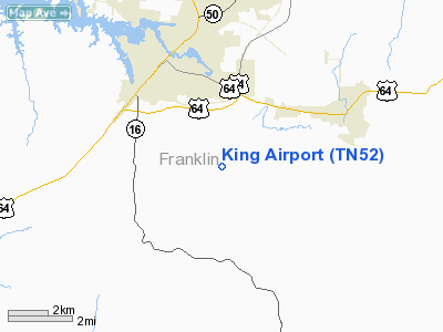
Location & QuickFacts
| FAA Information Effective: | 2008-09-25 |
| Airport Identifier: | TN52 |
| Airport Status: | Operational |
| Longitude/Latitude: | 086-04-51.9410W/35-08-17.3000N
-86.081095/35.138139 (Estimated) |
| Elevation: | 1050 ft / 320.04 m (Estimated) |
| Land: | 0 acres |
| From nearest city: | 3 nautical miles S of Winchester, TN |
| Location: | Franklin County, TN |
| Magnetic Variation: | 01W (1985) |
Owner & Manager
| Ownership: | Privately owned |
| Owner: | H. D. King, Jr. |
| Address: | 1667 Old Holders Cove Rd
Winchester, TN 37398 |
| Phone number: | 615-967-2733 |
| Manager: | H. D. King, Jr. |
| Address: | 1667 Old Holders Cove Rd
Winchester, TN 37398 |
| Phone number: | 615-967-2733 |
Airport Operations and Facilities
| Airport Use: | Private |
| Segmented Circle: | No |
| Control Tower: | No |
| Landing fee charge: | No |
| Sectional chart: | Atlanta |
| Region: | ASO - Southern |
| Boundary ARTCC: | ZME - Memphis |
| Tie-in FSS: | BNA - Nashville |
| FSS on Airport: | No |
| FSS Toll Free: | 1-800-WX-BRIEF |
Runway Information
Runway 17/35
| Dimension: | 1250 x 50 ft / 381.0 x 15.2 m |
| Surface: | TURF, |
| |
Runway 17 |
Runway 35 |
| Traffic Pattern: | Right | Left |
|
Radio Navigation Aids
| ID |
Type |
Name |
Ch |
Freq |
Var |
Dist |
| SYI | FAN MARKER | Bomar | | | 01W | 28.1 nm |
| BGF | NDB | Boiling Fork | | 263.00 | 02W | 2.5 nm |
| UOS | NDB | Sewanee | | 275.00 | 02E | 9.9 nm |
| ULH | NDB | Burwi | | 332.00 | 03W | 21.0 nm |
| TNY | NDB | Kelso | | 358.00 | 01W | 22.7 nm |
| APT | NDB | Jasper | | 382.00 | 02W | 24.9 nm |
| HUA | NDB | Redstone | | 287.00 | 00W | 39.9 nm |
| RN | NDB | Warri | | 209.00 | 02W | 40.1 nm |
| CWH | NDB | Capshaw | | 350.00 | 01W | 40.8 nm |
| LUG | NDB | Verona | | 251.00 | 00W | 41.8 nm |
| FTP | NDB | Fort Payne | | 426.00 | 01W | 42.2 nm |
| CQN | NDB | Daisy | | 341.00 | 02W | 45.4 nm |
| GZS | NDB | Giles/dcmsnd | | 375.00 | 00E | 48.0 nm |
| UXM | VOR | Tullahoma Regional | | 109.65 | 03W | 16.7 nm |
| SYI | VOR/DME | Shelbyville | 027X | 109.00 | 01W | 30.9 nm |
| RQZ | VORTAC | Rocket | 059X | 112.20 | 02E | 34.1 nm |
| GQO | VORTAC | Choo Choo | 105X | 115.80 | 01E | 46.9 nm |
| HSV | VOT | Huntsville | | 111.00 | | 35.3 nm |
Remarks
- VFR OPERATIONS/PRIVATE USE.OPERATIONS ARE CONDUCTED WEST OF THE RWY CENTERLINE AND CENTERLINE EXTENDED.
Images and information placed above are from
http://www.airport-data.com/airport/TN52/
We thank them for the data!
| General Info
|
| Country |
United States
|
| State |
TENNESSEE
|
| FAA ID |
TN52
|
| Latitude |
35-08-17.300N
|
| Longitude |
086-04-51.941W
|
| Elevation |
1050 feet
|
| Near City |
WINCHESTER
|
We don't guarantee the information is fresh and accurate. The data may
be wrong or outdated.
For more up-to-date information please refer to other sources.
|
|


