 |
|
Location & QuickFacts
| FAA Information Effective: | 2008-09-25 |
| Airport Identifier: | 22TN |
| Airport Status: | Operational |
| Longitude/Latitude: | 086-33-48.0000W/36-23-14.0000N
-86.563333/36.387222 (Estimated) |
| Elevation: | 500 ft / 152.40 m (Estimated) |
| Land: | 5 acres |
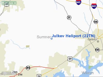
| From nearest city: | 7 nautical miles W of Gallatin, TN |
| Location: | Sumner County, TN |
| Magnetic Variation: | () |
Owner & Manager
| Ownership: | Privately owned |
| Owner: | Kevin Mccutcheon |
| Address: | 141 Upper Station Camp Creek Road
Gallatin, TN 37066 |
| Phone number: | 615-206-9179 |
| Manager: | Kevin Mccutcheon |
| Address: | 141 Upper Station Camp Creek Road
Gallatin, TN 37066 |
| Phone number: | 615-206-9179 |
Airport Operations and Facilities
| Airport Use: | Private |
| Wind indicator: | Yes |
| Control Tower: | No |
| Sectional chart: | St Louis |
| Region: | ASO - Southern |
| Boundary ARTCC: | ZME - Memphis |
| Tie-in FSS: | BNA - Nashville |
| FSS Toll Free: | 1-800-WX-BRIEF |
Runway Information
Helipad H1
| Dimension: | 60 x 35 ft / 18.3 x 10.7 m |
| Surface: | CONC, |
| |
Runway H1 |
Runway |
| Traffic Pattern: | Left | Left |
|
Radio Navigation Aids
| ID |
Type |
Name |
Ch |
Freq |
Var |
Dist |
| VI | NDB | Opery | | 344.00 | 02W | 11.8 nm |
| JUE | NDB | Lebanon | | 414.00 | 02W | 16.8 nm |
| PED | NDB | Needmore | | 221.00 | 01W | 19.3 nm |
| ON | NDB | Music | | 279.00 | 03W | 21.1 nm |
| LFB | NDB | Lafayette | | 245.00 | 02W | 25.5 nm |
| SWZ | NDB | Sewart | | 391.00 | 02W | 26.3 nm |
| FQW | NDB | Walter Hill | | 371.00 | 02W | 27.3 nm |
| SKN | NDB | Hurricane | | 256.00 | 02W | 43.9 nm |
| DMZ | NDB | Dickson | | 203.00 | 01W | 44.9 nm |
| FK | NDB | Airbe | | 273.00 | 01W | 46.1 nm |
| BVQ | NDB | Beaver Creek | | 260.00 | 02W | 46.4 nm |
| HIX | NDB | Honey Grove | | 356.00 | 01W | 47.7 nm |
| HXW | TACAN | Screaming Eagle | 096X | | 01W | 48.2 nm |
| CKV | VOR/DME | Clarksville | 043X | 110.60 | 01W | 43.4 nm |
| SYI | VOR/DME | Shelbyville | 027X | 109.00 | 01W | 50.0 nm |
| BNA | VORTAC | Nashville | 088X | 114.10 | 02W | 16.2 nm |
| BWG | VORTAC | Bowling Green | 126X | 117.90 | 02E | 33.1 nm |
| BNA | VOT | Nashville Metropoln | | 108.60 | | 16.7 nm |
| MQY | VOT | Smyrna | | 110.20 | | 23.0 nm |
Remarks
- PRVDD VFR OPNS; PVT USE; ALL APP & DEP FR 180 DEG TO 330 DEG; AREA IS MARKED; WIND INDICATOR IS MAINTAINED; INSTALL FIRE FIGHTING EQUIP.
Images and information placed above are from
http://www.airport-data.com/airport/22TN/
We thank them for the data!
|
|


