 |
|
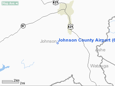
Location & QuickFacts
| FAA Information Effective: | 2008-09-25 |
| Airport Identifier: | 6A4 |
| Airport Status: | Operational |
| Longitude/Latitude: | 081-49-30.5000W/36-25-04.2000N
-81.825139/36.417833 (Estimated) |
| Elevation: | 2240 ft / 682.75 m (Estimated) |
| Land: | 80 acres |
| From nearest city: | 4 nautical miles S of Mountain City, TN |
| Location: | Johnson County, TN |
| Magnetic Variation: | 05W (1985) |
Owner & Manager
| Ownership: | Publicly owned |
| Owner: | Johnson County |
| Address: | Co Courthse; 222 W Main St
Mountain City, TN 37683 |
| Phone number: | 423-727-9696 |
| Manager: | J.r. Bob Johnson |
| Address: | 611 Airport Road
Mountain City, TN 37683 |
| Phone number: | 423-727-1223
AFTER HOURS 423-768-3882. |
Airport Operations and Facilities
| Airport Use: | Open to public |
| Wind indicator: | Yes |
| Segmented Circle: | Yes |
| Control Tower: | No |
| Landing fee charge: | No |
| Sectional chart: | Cincinnati |
| Region: | ASO - Southern |
| Boundary ARTCC: | ZTL - Atlanta |
| Tie-in FSS: | BNA - Nashville |
| FSS on Airport: | No |
| FSS Toll Free: | 1-800-WX-BRIEF |
| NOTAMs Facility: | BNA (NOTAM-d service avaliable) |
| Federal Agreements: | NGY |
Airport Communications
| CTAF: | 122.700 |
| Unicom: | 122.700 |
Airport Services
| Fuel available: | 100LLA |
| Airframe Repair: | MINOR |
| Power Plant Repair: | MINOR |
| Bottled Oxygen: | NONE |
| Bulk Oxygen: | NONE |
Runway Information
Runway 06/24
| Dimension: | 4498 x 75 ft / 1371.0 x 22.9 m |
| Surface: | ASPH, Good Condition |
| Weight Limit: | Dual wheel: 26000 lbs.
Dual tandem wheel: 37000 lbs. |
| |
Runway 06 |
Runway 24 |
| Longitude: | 081-49-53.8665W | 081-49-07.0981W |
| Latitude: | 36-24-52.5201N | 36-25-15.9599N |
| Elevation: | 2240.00 ft | 2240.00 ft |
| Traffic Pattern: | Right | Left |
| Markings: | Basic, Good Condition | Basic, Good Condition |
| Runway End Identifier: | No | No |
| Centerline Lights: | No | No |
| Touchdown Lights: | No | No |
| Obstruction: | 111 ft tree, 2050.0 ft from runway, 319 ft right of centerline, 16:1 slope to clear | 59 ft pline, 2300.0 ft from runway, 159 ft right of centerline, 35:1 slope to clear |
|
Radio Navigation Aids
| ID |
Type |
Name |
Ch |
Freq |
Var |
Dist |
| MRN | FAN MARKER | Lenoir | | | 03W | 38.6 nm |
| BAR | NDB | Hemlock | | 320.00 | 02W | 16.1 nm |
| VJ | NDB | Whine | | 236.00 | 05W | 19.9 nm |
| EZT | NDB | Elizabethton | | 275.00 | 02W | 22.4 nm |
| JU | NDB | Ashee | | 410.00 | 07W | 24.4 nm |
| BO | NDB | Booie | | 221.00 | 04W | 32.5 nm |
| UKF | NDB | Wilki | | 209.00 | 06W | 39.7 nm |
| MK | NDB | Suzze | | 335.00 | 06W | 41.2 nm |
| FIQ | NDB | Fiddlers | | 391.00 | 07W | 43.2 nm |
| HK | NDB | Tawba | | 332.00 | 06W | 45.6 nm |
| GZG | VOR/DME | Glade Spring | 039X | 110.20 | 02W | 27.4 nm |
| BZM | VOR/DME | Barretts Mountain | 045X | 110.80 | 06W | 43.5 nm |
| HMV | VORTAC | Holston Mountain | 093X | 114.60 | 04W | 14.8 nm |
| HKY | VOT | Hickory Regional | | 110.00 | | 45.8 nm |
Remarks
- MOUNTAINOUS TERRAIN; HIGH PEAKS ALL QUADRANTS.
- NIGHT OPNS NOT RECOMMENDED FOR TRANSIENT TFC DUE TO TERRAIN.
- BIRD & DEER ACTIVITY INVOF ARPT.
- FOR FBO SVCS CALL 423-727-1223.
- VFR OPERNS ONLY.
Images and information placed above are from
http://www.airport-data.com/airport/6A4/
We thank them for the data!
| General Info
|
| Country |
United States
|
| State |
TENNESSEE
|
| FAA ID |
6A4
|
| Latitude |
36-25-04.200N
|
| Longitude |
081-49-30.500W
|
| Elevation |
2240 feet
|
| Near City |
MOUNTAIN CITY
|
We don't guarantee the information is fresh and accurate. The data may
be wrong or outdated.
For more up-to-date information please refer to other sources.
|
|


