 |
|
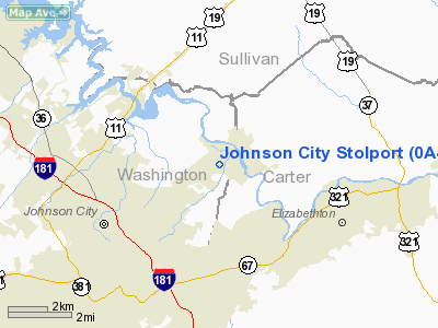
Johnson City Stolport Airport |
Location & QuickFacts
| FAA Information Effective: | 2008-09-25 |
| Airport Identifier: | 0A4 |
| Airport Status: | Operational |
| Longitude/Latitude: | 082-18-32.4940W/36-21-49.3800N
-82.309026/36.363717 (Estimated) |
| Elevation: | 1550 ft / 472.44 m (Estimated) |
| Land: | 45 acres |
| From nearest city: | 3 nautical miles NE of Johnson City, TN |
| Location: | Washington County, TN |
| Magnetic Variation: | 04W (1985) |
Owner & Manager
| Ownership: | Privately owned |
| Owner: | George W St John, Heirs |
| Address: | Rt 1 Box 122
Watauga, TN 37694 |
| Phone number: | 423-928-5841 |
| Manager: | Unknown |
| Address: | 3191 Hwy 400
Watauga, TN 37694 |
| Phone number: | 423-928-5841 |
Airport Operations and Facilities
| Airport Use: | Open to public |
| Wind indicator: | Yes |
| Segmented Circle: | No |
| Control Tower: | No |
| Landing fee charge: | No |
| Sectional chart: | Cincinnati |
| Region: | ASO - Southern |
| Boundary ARTCC: | ZTL - Atlanta |
| Tie-in FSS: | BNA - Nashville |
| FSS on Airport: | No |
| FSS Toll Free: | 1-800-WX-BRIEF |
| NOTAMs Facility: | BNA (NOTAM-d service avaliable) |
Airport Communications
| CTAF: | 122.800 |
| Unicom: | 122.800 |
Airport Services
| Bottled Oxygen: | NONE |
| Bulk Oxygen: | NONE |
Runway Information
Runway 04/22
| Dimension: | 3000 x 50 ft / 914.4 x 15.2 m |
| Surface: | ASPH, Poor Condition
PAVEMENT BADLY CRACKED. |
| Weight Limit: | Single wheel: 15000 lbs. |
| |
Runway 04 |
Runway 22 |
| Traffic Pattern: | Left | Left |
| Markings: | Numbers only, Poor Condition
04/22 MARKINGS BADLY FADED. | Numbers only, Poor Condition |
| Displaced threshold: | 800.00 ft | 0.00 ft |
| Runway End Identifier: | No | No |
| Centerline Lights: | No | No |
| Touchdown Lights: | No | No |
| Obstruction: | 68 ft trees, 230.0 ft from runway, 54 ft right of centerline
APCH RATIO 15:1 TO DSPLCD THLD. ROAD CROSSES APCH PATH. | 43 ft trees, 900.0 ft from runway, 165 ft right of centerline, 50:1 slope to clear |
|
Radio Navigation Aids
| ID |
Type |
Name |
Ch |
Freq |
Var |
Dist |
| MRN | FAN MARKER | Lenoir | | | 03W | 47.6 nm |
| EZT | NDB | Elizabethton | | 275.00 | 02W | 3.4 nm |
| BO | NDB | Booie | | 221.00 | 04W | 9.3 nm |
| JJO | NDB | Mountain City | | 396.00 | 04W | 23.7 nm |
| BAR | NDB | Hemlock | | 320.00 | 02W | 24.3 nm |
| VJ | NDB | Whine | | 236.00 | 05W | 28.2 nm |
| RVN | NDB | Rogersville | | 329.00 | 04W | 28.4 nm |
| DYQ | NDB | Dulaney | | 263.00 | 04W | 31.3 nm |
| LQV | NDB | Long Hollow | | 252.00 | 03W | 42.3 nm |
| JU | NDB | Ashee | | 410.00 | 07W | 47.9 nm |
| GZG | VOR/DME | Glade Spring | 039X | 110.20 | 02W | 29.9 nm |
| HMV | VORTAC | Holston Mountain | 093X | 114.60 | 04W | 9.7 nm |
| SOT | VORTAC | Snowbird | 025X | 108.80 | 04W | 49.9 nm |
Remarks
- RECOMMENDED PATTERN TKOF RWY 04 LAND RWY 22.
Images and information placed above are from
http://www.airport-data.com/airport/0A4/
We thank them for the data!
| General Info
|
| Country |
United States
|
| State |
TENNESSEE
|
| FAA ID |
0A4
|
| Latitude |
36-21-49.380N
|
| Longitude |
082-18-32.494W
|
| Elevation |
1550 feet
|
| Near City |
JOHNSON CITY
|
We don't guarantee the information is fresh and accurate. The data may
be wrong or outdated.
For more up-to-date information please refer to other sources.
|
|


