 |
|
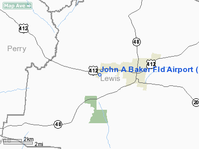
Location & QuickFacts
| FAA Information Effective: | 2008-09-25 |
| Airport Identifier: | 0M3 |
| Airport Status: | Operational |
| Longitude/Latitude: | 087-35-50.3650W/35-32-45.5000N
-87.597324/35.545972 (Estimated) |
| Elevation: | 972 ft / 296.27 m (Surveyed) |
| Land: | 116 acres |
| From nearest city: | 2 nautical miles W of Hohenwald, TN |
| Location: | Lewis County, TN |
| Magnetic Variation: | 01W (2000) |
Owner & Manager
| Ownership: | Publicly owned |
| Owner: | Lewis County |
| Address: | County Courthouse
Hohenwald, TN 38462 |
| Phone number: | 931-796-3378 |
| Manager: | Lewis County |
| Address: | 1192 West Main St
Hohenwald, TN 38462 |
Airport Operations and Facilities
| Airport Use: | Open to public |
| Wind indicator: | Yes |
| Segmented Circle: | No |
| Control Tower: | No |
| Lighting Schedule: | DUSK-DAWN |
| Beacon Color: | Clear-Green (lighted land airport) |
| Landing fee charge: | No |
| Sectional chart: | Atlanta |
| Region: | ASO - Southern |
| Boundary ARTCC: | ZME - Memphis |
| Tie-in FSS: | MKL - Jackson |
| FSS on Airport: | No |
| FSS Toll Free: | 1-800-WX-BRIEF |
| NOTAMs Facility: | MKL (NOTAM-d service avaliable) |
| Federal Agreements: | 1 |
Airport Communications
| CTAF: | 122.800 |
| Unicom: | 122.800 |
Airport Services
| Airframe Repair: | NONE |
| Power Plant Repair: | NONE |
| Bottled Oxygen: | NONE |
| Bulk Oxygen: | NONE |
Runway Information
Runway 02/20
| Dimension: | 4000 x 75 ft / 1219.2 x 22.9 m |
| Surface: | ASPH, Good Condition |
| Weight Limit: | Single wheel: 8000 lbs.
Dual wheel: 12000 lbs. |
| Edge Lights: | Medium
ACTVT MIRL RY 02/20 - CTAF. |
| |
Runway 02 |
Runway 20 |
| Longitude: | 087-35-57.7100W | 087-35-43.0200W |
| Latitude: | 35-32-26.6500N | 35-33-04.3500N |
| Elevation: | 949.00 ft | 968.00 ft |
| Alignment: | 18 | 127 |
| Traffic Pattern: | Left | Left |
| Markings: | Basic, Good Condition
RY 02/20 MARKINGS FADED AND PEELING | Basic, Good Condition |
| Crossing Height: | 24.00 ft | 23.00 ft |
| Displaced threshold: | 0.00 ft | 500.00 ft |
| VASI: | 2-box SAVASI on left side
RY 02 VASI OTS INDEFLY. | 2-box SAVASI on left side
RY 20 VASI OTS INDEFLY. |
| Visual Glide Angle: | 3.50° | 3.50° |
| Obstruction: | 74 ft trees, 1932.0 ft from runway, 2 ft right of centerline, 23:1 slope to clear | 31 ft trees, 336.0 ft from runway, 95 ft right of centerline, 4:1 slope to clear
APCH RATIO 20:1 TO DSPLCD THLD. |
|
Radio Navigation Aids
| ID |
Type |
Name |
Ch |
Freq |
Var |
Dist |
| JHG | NDB | Hohenwald | | 257.00 | 01W | 5.3 nm |
| LRT | NDB | Lawrenceburg | | 269.00 | 00E | 24.9 nm |
| PBC | NDB | Maury County | | 365.00 | 01W | 25.0 nm |
| HHY | NDB | Pinhook | | 346.00 | 01W | 34.5 nm |
| AEY | NDB | Waverly | | 329.00 | 00E | 35.0 nm |
| GZS | NDB | Giles/dcmsnd | | 375.00 | 00E | 35.5 nm |
| DMZ | NDB | Dickson | | 203.00 | 01W | 35.9 nm |
| LUG | NDB | Verona | | 251.00 | 00W | 38.6 nm |
| SZY | NDB | Sibley | | 386.00 | 01E | 48.7 nm |
| JKS | VOR/DME | Jacks Creek | 031X | 109.40 | 02E | 37.4 nm |
| GHM | VORTAC | Graham | 053X | 111.60 | 03E | 18.7 nm |
Remarks
Images and information placed above are from
http://www.airport-data.com/airport/0M3/
We thank them for the data!
| General Info
|
| Country |
United States
|
| State |
TENNESSEE
|
| FAA ID |
0M3
|
| Latitude |
35-32-45.500N
|
| Longitude |
087-35-50.365W
|
| Elevation |
972 feet
|
| Near City |
HOHENWALD
|
We don't guarantee the information is fresh and accurate. The data may
be wrong or outdated.
For more up-to-date information please refer to other sources.
|
|


