 |
|
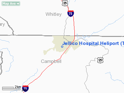
Jellico Hospital Heliport |
Location & QuickFacts
| FAA Information Effective: | 2008-09-25 |
| Airport Identifier: | TN40 |
| Airport Status: | Operational |
| Longitude/Latitude: | 084-07-47.0000W/36-34-26.0000N
-84.129722/36.573889 (Estimated) |
| Elevation: | 1080 ft / 329.18 m (Estimated) |
| Land: | 3 acres |
| From nearest city: | 0 nautical miles N of Jellico, TN |
| Location: | Campbell County, TN |
| Magnetic Variation: | 04W (1995) |
Owner & Manager
| Ownership: | Privately owned |
| Owner: | Jellico Community Hospital |
| Address: | 188 Hospital Lane
Jellico, TN 37762 |
| Phone number: | 423-784-7252 |
| Manager: | Gerald Hammon |
| Address: | 188 Hospital Lane
Jellico, TN 37762 |
| Phone number: | 423-784-7252 |
Airport Operations and Facilities
| Airport Use: | Private |
| Wind indicator: | Yes |
| Segmented Circle: | No |
| Control Tower: | No |
| Lighting Schedule: | DUSK-DAWN |
| Sectional chart: | Cincinnati |
| Region: | ASO - Southern |
| Boundary ARTCC: | ZID - Indianapolis |
| Tie-in FSS: | BNA - Nashville |
| FSS Toll Free: | 1-800-WX-BRIEF |
Runway Information
Helipad H1
| Dimension: | 40 x 40 ft / 12.2 x 12.2 m |
| Surface: | CONC, |
| |
Runway H1 |
Runway |
| Traffic Pattern: | Left | Left |
|
Radio Navigation Aids
| ID |
Type |
Name |
Ch |
Freq |
Var |
Dist |
| JAU | NDB | Jacksboro | | 204.00 | 03W | 14.3 nm |
| BPO | NDB | Piney Grove | | 403.00 | 05W | 16.8 nm |
| CDX | NDB | Cumberland River | | 388.00 | 05E | 36.7 nm |
| EKQ | NDB | Elk Spring | | 290.00 | 03W | 38.8 nm |
| JXT | NDB | Jefferson | | 346.00 | 04W | 42.2 nm |
| LOZ | VORTAC | London | 108X | 116.10 | 03W | 27.6 nm |
| VXV | VORTAC | Volunteer | 111X | 116.40 | 03W | 41.8 nm |
| TYS | VOT | Knoxville | | 112.00 | | 46.2 nm |
Remarks
- PRVDD VFR, PVT USE, APCH/DEP IN AREA FROM 270 TO 060 DEGS, AREA IS MKD, WIND INDICATOR MAINTAINED.
Images and information placed above are from
http://www.airport-data.com/airport/TN40/
We thank them for the data!
| General Info
|
| Country |
United States
|
| State |
TENNESSEE
|
| FAA ID |
TN40
|
| Latitude |
36-34-26.000N
|
| Longitude |
084-07-47.000W
|
| Elevation |
1080 feet
|
| Near City |
JELLICO
|
We don't guarantee the information is fresh and accurate. The data may
be wrong or outdated.
For more up-to-date information please refer to other sources.
|
|


