 |
|
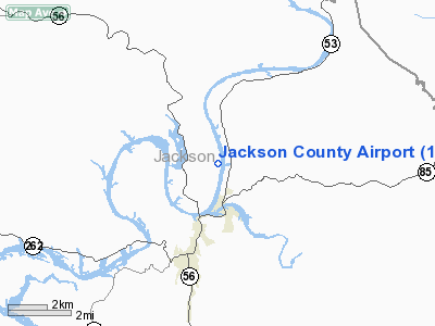
Location & QuickFacts
| FAA Information Effective: | 2008-09-25 |
| Airport Identifier: | 1A7 |
| Airport Status: | Operational |
| Longitude/Latitude: | 085-38-29.9140W/36-23-50.2130N
-85.641643/36.397281 (Estimated) |
| Elevation: | 515 ft / 156.97 m (Surveyed) |
| Land: | 65 acres |
| From nearest city: | 3 nautical miles NE of Gainesboro, TN |
| Location: | Jackson County, TN |
| Magnetic Variation: | 02W (1985) |
Owner & Manager
| Ownership: | Publicly owned |
| Owner: | Jackson County |
| Address: | Po Box 617
Gainesboro, TN 38562 |
| Phone number: | 931-268-9888 |
| Manager: | Jim Young |
| Address: | 153 Ward Lane
Gainesboro, TN 38562
AIRPORT PHYSICAL ADDRESS IS 860 BIG BOTTOM ROAD GAINESBORO, TN 38562 |
| Phone number: | 931-268-9643 |
Airport Operations and Facilities
| Airport Use: | Open to public |
| Wind indicator: | Yes |
| Segmented Circle: | Yes |
| Control Tower: | No |
| Landing fee charge: | No |
| Sectional chart: | St Louis |
| Region: | ASO - Southern |
| Boundary ARTCC: | ZME - Memphis |
| Tie-in FSS: | BNA - Nashville |
| FSS on Airport: | No |
| FSS Toll Free: | 1-800-WX-BRIEF |
| NOTAMs Facility: | BNA (NOTAM-d service avaliable) |
| Federal Agreements: | NY1 |
Airport Communications
Airport Services
| Airframe Repair: | NONE |
| Power Plant Repair: | NONE |
| Bottled Oxygen: | NONE |
| Bulk Oxygen: | NONE |
Runway Information
Runway 18/36
| Dimension: | 3500 x 75 ft / 1066.8 x 22.9 m |
| Surface: | ASPH, Good Condition |
| Weight Limit: | Single wheel: 21000 lbs.
Dual wheel: 31000 lbs. |
| |
Runway 18 |
Runway 36 |
| Traffic Pattern: | Left | Left |
| Markings: | Basic, Good Condition | Basic, Good Condition |
| Runway End Identifier: | No | No |
| Centerline Lights: | No | No |
| Touchdown Lights: | No | No |
| Obstruction: | 30 ft trees, 705.0 ft from runway, 18:1 slope to clear | , 50:1 slope to clear |
|
Radio Navigation Aids
| ID |
Type |
Name |
Ch |
Freq |
Var |
Dist |
| LFB | NDB | Lafayette | | 245.00 | 02W | 21.5 nm |
| HEM | NDB | Huchn | | 233.00 | 02W | 24.8 nm |
| SKN | NDB | Hurricane | | 256.00 | 02W | 26.1 nm |
| JUE | NDB | Lebanon | | 414.00 | 02W | 34.8 nm |
| RN | NDB | Warri | | 209.00 | 02W | 39.2 nm |
| BVQ | NDB | Beaver Creek | | 260.00 | 02W | 41.3 nm |
| FQW | NDB | Walter Hill | | 371.00 | 02W | 44.0 nm |
| EKQ | NDB | Elk Spring | | 290.00 | 03W | 47.0 nm |
| SWZ | NDB | Sewart | | 391.00 | 02W | 47.9 nm |
| LVT | VORTAC | Livingston | 021X | 108.40 | 02W | 25.6 nm |
| HCH | VORTAC | Hinch Mountain | 123X | 117.60 | 02W | 49.1 nm |
| MQY | VOT | Smyrna | | 110.20 | | 48.1 nm |
Remarks
- HIGH TERRAIN ALL QUADS.
- VFR OPERNS ONLY
Images and information placed above are from
http://www.airport-data.com/airport/1A7/
We thank them for the data!
| General Info
|
| Country |
United States
|
| State |
TENNESSEE
|
| FAA ID |
1A7
|
| Latitude |
36-23-50.213N
|
| Longitude |
085-38-29.914W
|
| Elevation |
515 feet
|
| Near City |
GAINESBORO
|
We don't guarantee the information is fresh and accurate. The data may
be wrong or outdated.
For more up-to-date information please refer to other sources.
|
|


